From yesterday the talk of the town has been possible Cyclone towards Tamil Nadu. While weather bloggers have been keeping an eye on weather models for a possible disturbance to evolve the Flash Alerts by Television media from yesterday afternoon has created a frenzy. The dry spell and poor NEM last year has added to the anxiety of people creating a lot of expectations from this development.

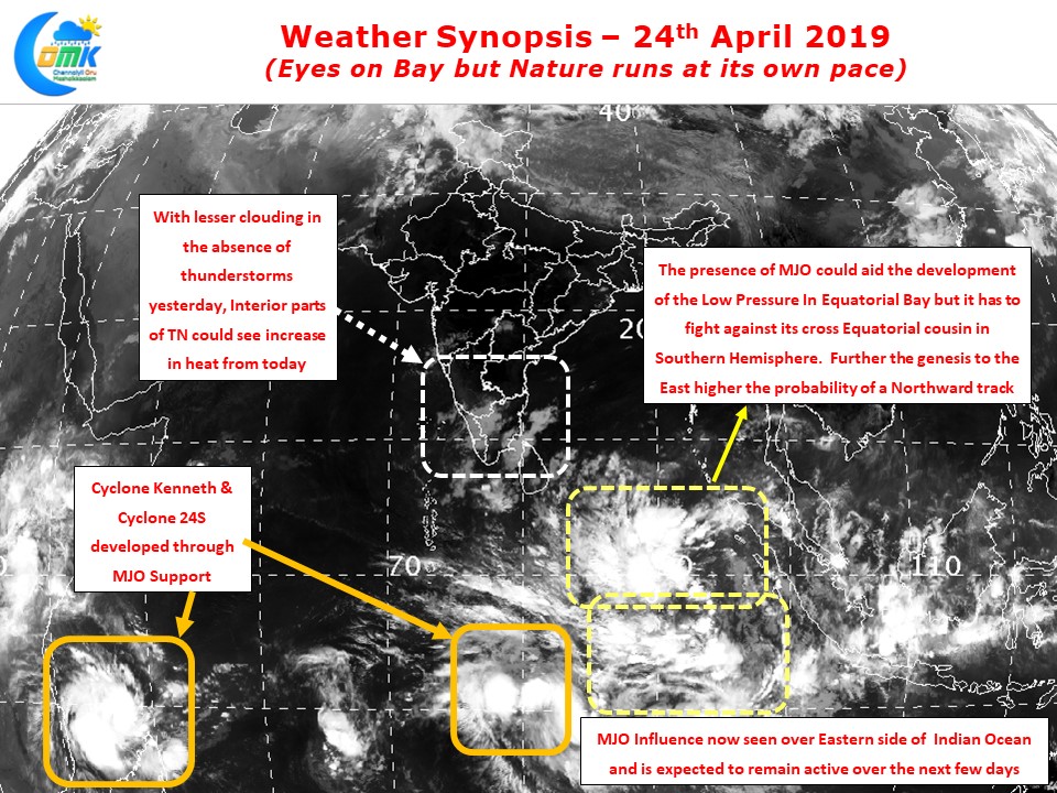
But what we must not forget is Nature’s clock runs at its own pace and direction. Seasonality or what is called as Climatology by Meteorologists cannot be ignored by weather watchers at all. A few days back in our post dated 18th April we had mentioned about the possibility of a Pre Monsoon disturbance evolving in the Equatorial waters. Currently in addition to two Cyclones to the South of Equator a broad area of disturbance is prevailing either side of Equator providing an opportunity for two more disturbances to evolve.
The role of Equatorial Rossby wave is clearly seen in this development along with the movement of MJO from West to East. Currently OLR Maps indicate MJO influence in the Eastern side of Indian Ocean which should help the pulse to the North of Equator to develop into an organized disturbance.

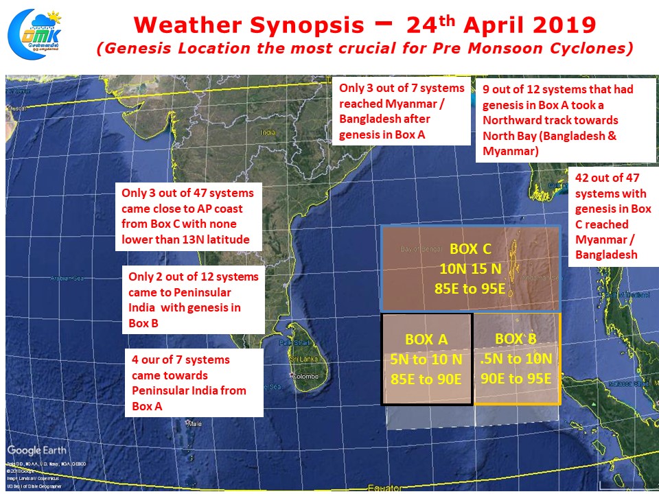
But the caveat in the entire thing is more than any place North Indian Ocean is known as the graveyard for Global Weather Models as far as Tropical Cyclones are concerned. While over time the accuracy levels have improved many fold, the key factor here is accuracy improves drastically after the genesis of the disturbance. The map here clearly indicates how the probability of movement towards Peninsular India changes dramatically if the genesis of the Low Pressure Area shifts a couple of degrees longitude to the East.
Our advice from COMK is to hold your horses and wait for the genesis to happen. It would be prudent to keep expectations under control.


