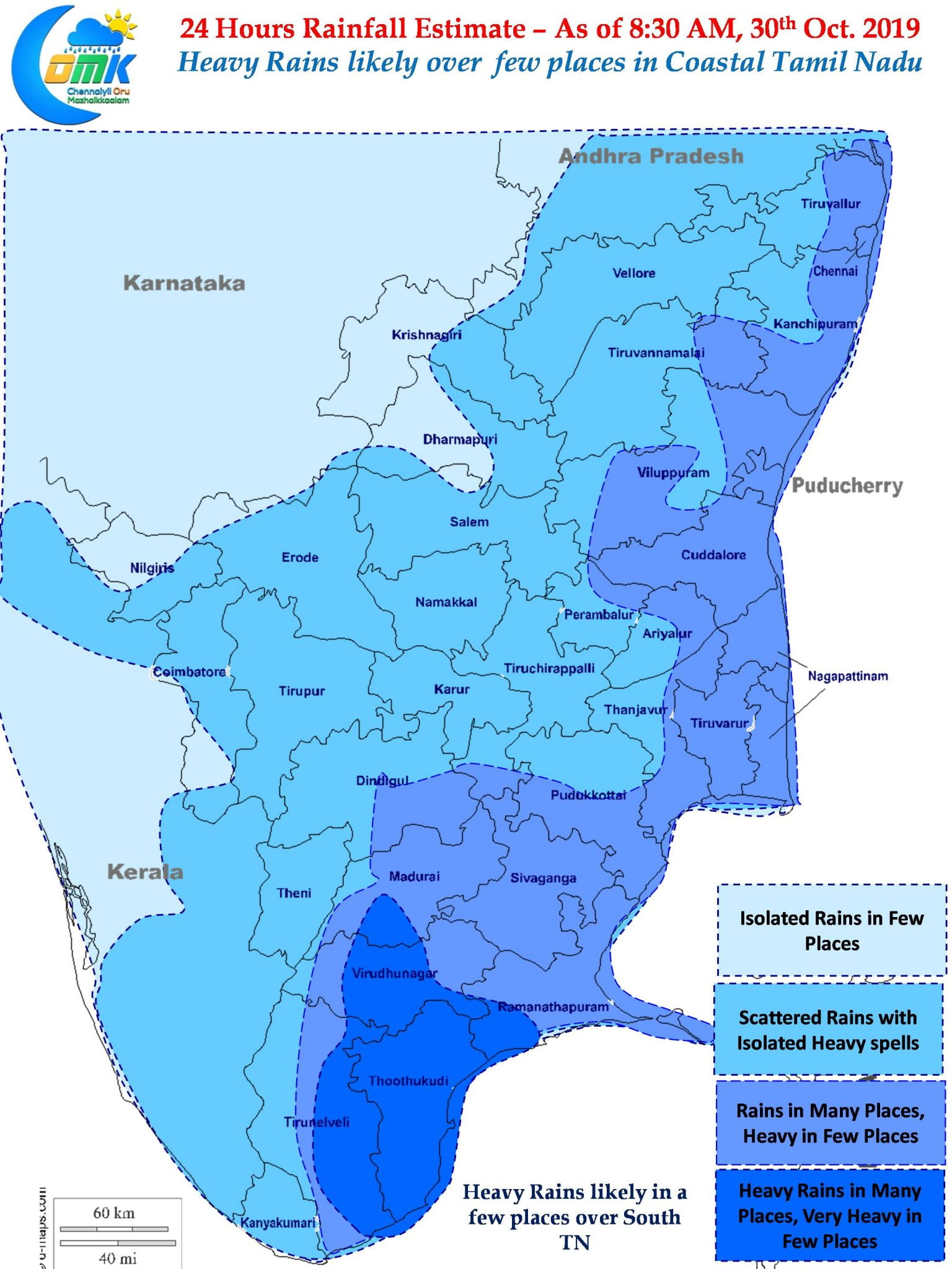
Northeast Monsoon picked up pace yesterday as many parts of the Tamil Nadu saw good rains return with the improved Easterlies aided by the Low Pressure Area over Comorin Sea. Parts of Chennai recorded multiple spells of rains since yesterday morning with very intense spell of rain lashing the city during the early morning hours of Tuesday.

Over the Arabian Sea Super Cyclonic Storm Kyarr continues to maintain extreme intensity under favorable Oceanic and atmospheric conditions. It is expected to remain in peak intensity until later today afternoon post which we are likely to see a gradual reduction in intensity as it moves in a general Westward direction.

In conditions indicating a perfect Northeast Monsoon day spells of rains are likely to continue right through the day along the coastal areas interspersed with spells of heavy rains as well. Weather models indicate lower level Easterlies to clock nearly 30 km/h all the way from South AP Coast to South TN Coast. This would mean thunderstorms from the Sea will move inland without any hindrances. Consequent to the friction created by land mass places about 20 – 40 kms from the coast may see heavy thunderstorms as these bands move from East to West.

While coastal areas are likely to record good rains with heavy rains in a few places, due to the location of the Low Pressure Area in the Comorin Sea area parts of South Tamil Nadu could see heavy to very heavy rains in a few places. In particular parts of Kanyakumar, Tirunelveli and Thootukudi district could see intense spell of rains later in the day.
As far as Chennai goes on and off spells of rains will continue through the day with heavy spells later in the afternoon and possibly later tonight during the wee hours of Wednesday


