
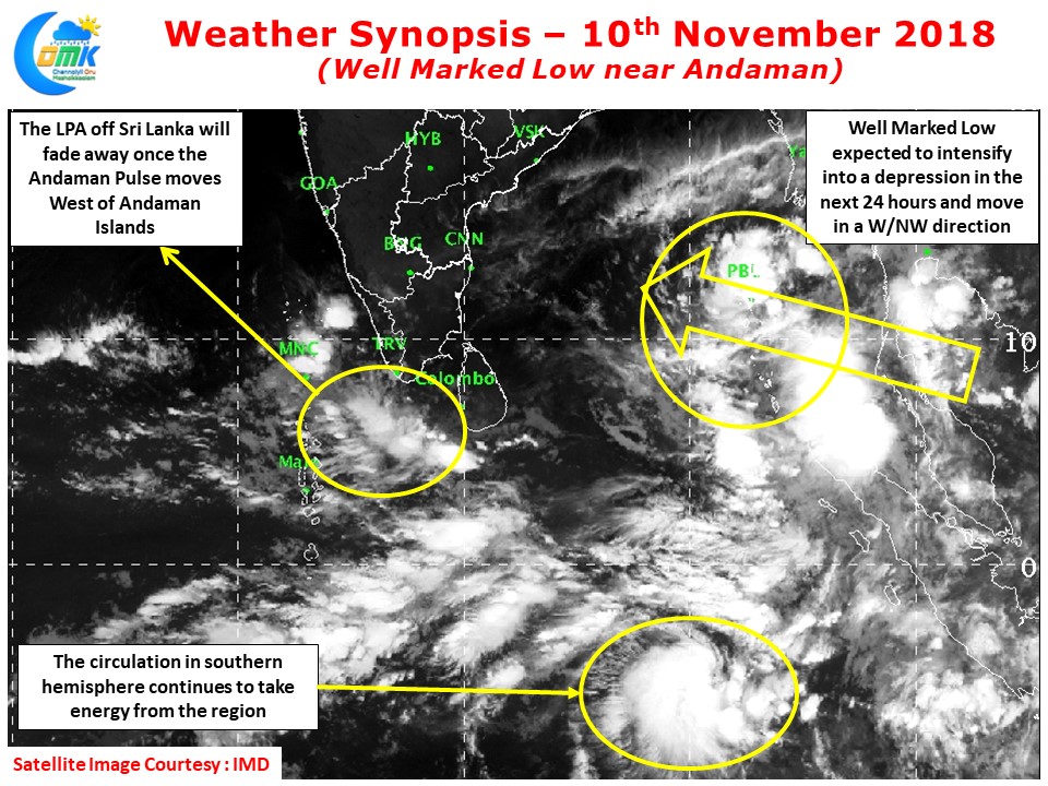
As expected the pulse from Gulf of Thailand has moved into the Andaman Sea and now lies as a well marked low straddling the Andaman Islands. It is expected to become a depression over the next 24 hours or so under favorable conditions. The circulation that was lingering around Sri Lanka intensified into a Low Pressure Area once again yesterday but is unlikely to improve / influence any further.
The satellite images continue to show the Southern Hemisphere cousin taking a lot of energy from the region. When the Andaman pulse moves slightly away it could break itself free from its counter circulation and provide for better intensification conditions.
The Bay waters around Andanam are fairly warm and conducive for the development of the disturbance. While most models estimate a bout of rapid intensification after 72 hours or so it could happen much earlier to it. This bout of rapid intensification will also possibily coincide with a slow movement / stall scenario as the system tries to align itself firmly with one of two ridges (Indo China / Indo Arabian). Depending on the intensification we could possibly see a NW or a W/NW movement from now on for the next 48 hours or so.
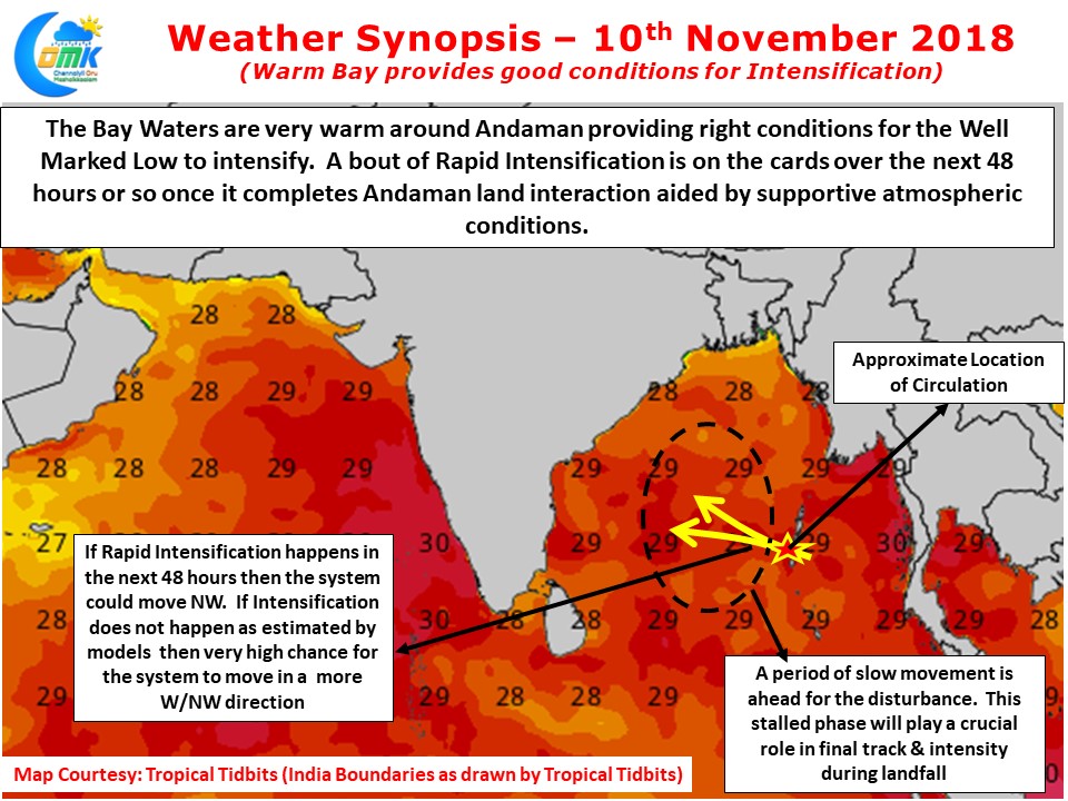
The atmospheric conditions are also conducive to the West of Andaman Islands in the form of very low / moderate wind shear which should develop the disturbance further. During this period of slow movement how much North the system climbs will decide whether it would move as a sheared system in a a W/SW movement towards the TN coast or with the structure intact like Vardah.
A real time observation of the system is possibly the best way forward over the next 24 hours to understand if it is inline with what models are estimating