
During Southwest Monsoon period Weather in Tamil Nadu is closely linked with the dynamics prevailing over the West Coast. And this relationship primarily works as inverse, as the rains increase over West Coast weather in Tamil Nadu tends to get more drier.
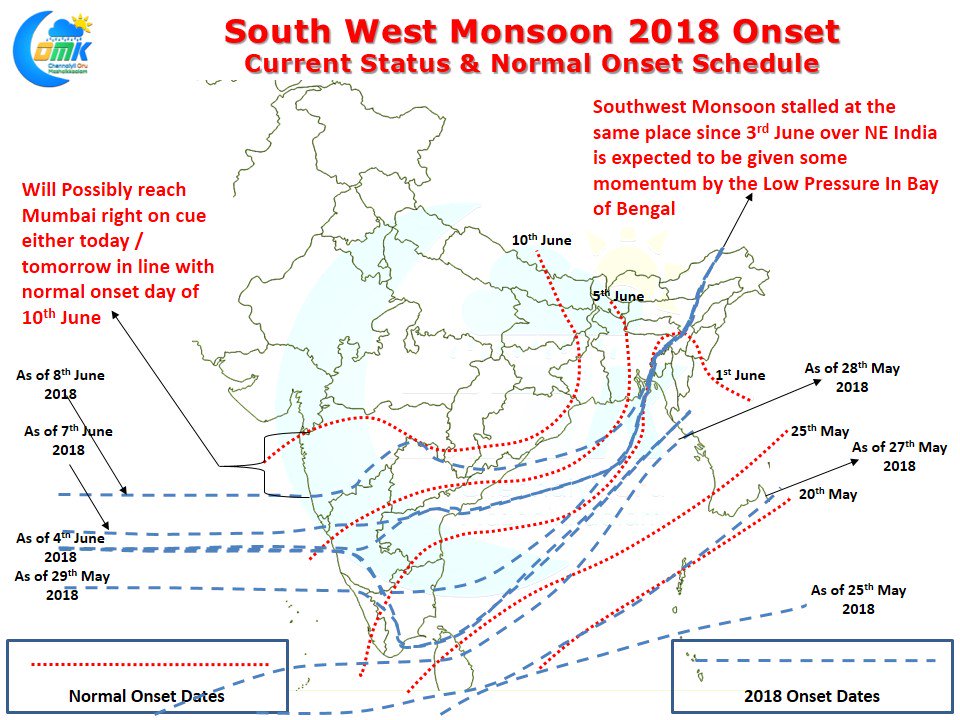
A couple of days back we had explained how during active monsoon days the thunderstorms slow down over most of Tamil Nadu due to increasing Westerlies and a more stable atmospheric conditions. After stalling for couple of days Southwest Monsoon has started moving in the West Coast making its entry into Maharashtra yesterday. The normal onset monsoon onset date for Mumbai is 10th June and right on cue Monsoon is expected to check in over the Megapolis this weekend.
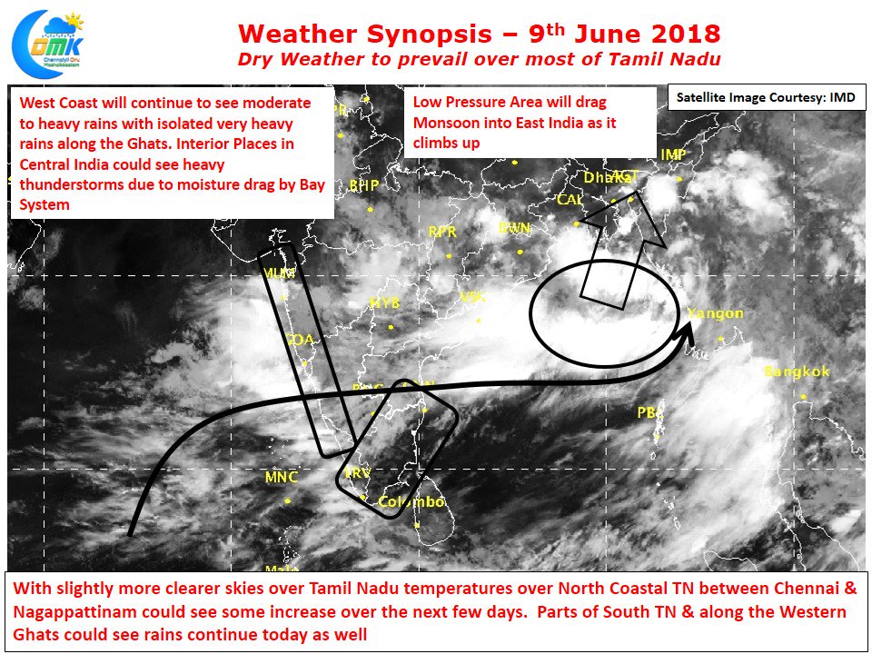
On the other side of the Indian sub continent Monsoon has been stationary for nearly a week now which under the influence of the Low Pressure that has formed in Head Bay could start to move finally in the next few days. Places around Mumbai has been getting some rains early in the morning with heavy spells in a few areas. Most of West Coast is under spell of rains with moderate to heavy rains seen in some of the ghat areas of Karnataka which could augur well for the catchment areas of Cauvery. Parts of extreme South TN around Kanyakumari district and the places along the Western Ghats will continue to see moderate rains continue. As slightly more clearer skies are likely to happen today temperatures could see a slight increase over North Coastal TN. Models are consistent about the absence of sea breeze over the next few days this will ensure the temperatures will take its own sweet time to come down and the evenings in places like Chennai are likely to be fairly hot with late peaking of temperatures unlike say the month of April / early May when temperatures peak around late morning.