
In continuing with the trend for the last couple of days yesterday saw another day of weak thunderstorm activity in Tamil Nadu with extremely isolated rains over the state. Parts of delta districts & western Tamil Nadu around Coimbatore, Salem & Nilgiris district recorded some light to moderate rains. With pseudo Northeast Monsoon type weather conditions prevailing parts of Chennai recorded light showers thanks to some moisture incursion from the Easterlies.
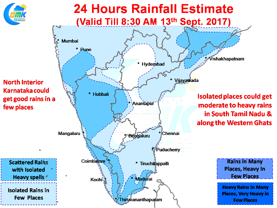
With Easterlies / Southerlies still prevailing over large parts of Tamil Nadu the convective thunderstorm activity is expected to remain weak for the next couple of days. Today is going to be no exception with places along the Western Ghats & a few places in South Tamil Nadu & delta areas possibly getting light to moderate rains. North Tamil Nadu will remain relatively dry with not much thunderstorm activity expected in the interiors. The coastal areas could see light spell of early morning rains due to Easterlies these could be light spell of rains at best.
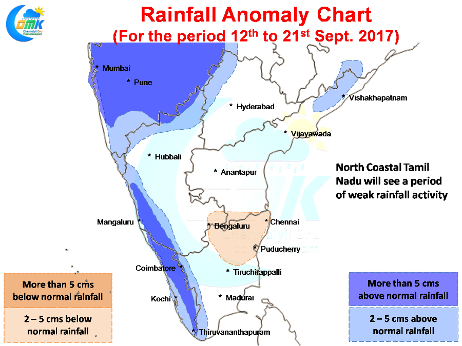
In the larger context the next week to 10 days is going to be a relatively quiet period for most of Tamil Nadu with possibly the exception of the Western Ghats & Kanyakumari district. North Tamil Nadu including the coastal areas could see subdued rainfall activity thanks to monsoon dynamics picking up in the West Coast due to the UAC which is likely to persist until Thursday. Further to that a weak cyclonic circulation is likely to evolve around Central India keeping the dynamics running while Bay gets ready to host what could possibly the last Monsoon Tropical Disturbance of 2017.
Powered by WPeMatico