
As we get closer to the last week of May the most talked about phrase among weather watchers of the Indian Sub Continent is Monsoon Onset. Would it be on time over Kerala? How active would the onset spell be? Will it cover the entire country without any stall scenario? For the agrarian community of India though the biggest question is would I get enough rains to cultivate my crops.
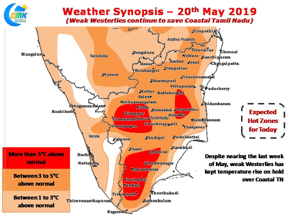
Before we try to look into some of the questions a quick update on the temperature front over TN. The sub par summer conditions for most days over the coastal places like Chennai are indicative of the weak conditions prevailing for monsoon dynamics to evolve. The Westerlies have not strengthened enough allowing sea breeze to sneak in during late afternoon bringing respite to the coastal places. Today will be no different with Coastal places seeing near normal temperatures while Interior places seeing slightly above normal day time temperatures.
Its now pretty much confirmed the monsoon onset dynamics is running behind schedule as indicated by the likely MOK (Monsoon Onset over Kerala) date of 6th June by IMD. But a look at the slightly larger picture gives a bigger worry not only in terms of Monsoon onset but the performance of Monsoon during the first half of the season.

As by now most of our followers would know the performance of ISMR (Indian Summer Monsoon Rains) and NEM is closely linked with how favorable MJO works out over Indian Ocean. While most weather enthusiasts were hoping for a helping hand from MJO during the Onset Phase of Monsoon, it appears MJO might trigger a possible disturbance over Arabian Sea. With West to movement there is a possibility this disturbance could head towards Oman thereby impacting the flow of Cross Equatorial Westerlies into Indian West coast impacting monsoon dynamics.
What follows subsequently is a worry which hopefully will fade away considering there is a lot of time still left. Long term Weather Models indicate a slow movement of MJO over Maritime Continent & West Pacific which will bring the suppressed phase over Indian Sub Continent at the most critical phase when it is likely to cover across the country. This would mean most of the 2nd fortnight & the first fortnight of July may see subdued phase of Monsoon which could put further pressure on the Reservoirs of West Coast which are already at the fag end of their water cycle.