As we get into the last 10 days of October a sense of anticipation sets into the weather bloggers and a sense of expectation for the people of Tamil Nadu. According to IMD the normal onset date for NorthEast monsoon is 20th October with a deviation of +/- 7 days. At times in our exuberance we tend to become anxious as we get to the second fortnight of October.
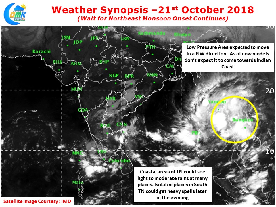
During the first week of October when we had a phase of Easterlies partially triggered by the two circulations one of them evolved into Cyclone Titli disturbing the wind pattern and stopping the Easterlies strengthening. In a similar situation we now have a Low Pressure Area over the Gulf of Thailand freedom l region which may emerge into Andaman sea area and increase in intensity. Models don’t estimate this to move towards the Indian coast. Instead it could possibly prevent the Easterly surge to move in from Indo China region heralding the monsoon onset.
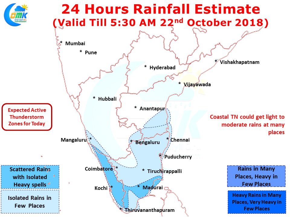
In the meanwhile due to the cyclonic circulation prevailing over Southwest Bay area we are likely to see rains over many places in Coastal Tamil Nadu. In particular few places in South Tamil Nadu could see heavy spells of rains later in the evening. In the absence of strong Easterlies the Thunderstorms will possibly not penetrate enough Inland to give widespread heavy rains in the state.


