
Very Severe Cyclone Vardah now lies 300 kms to the East of Chennai and has been slowly making progress towards Chennai all the while continuing its organization and intensifying all the while. In what could turn out to be a very watchful night contrary to initial model estimates Very Severe Cyclone Vardah is not yet showing any signs of weakening. With Wind Shear slowing down closer to coast things are certainly looking far more dangerous to Chennai than how things were today morning.

Very Severe Cyclone Vardah has been taking a steady West track with occasional North & South drifts as one can see from the JTWC track so far. Yesterday the models were estimating Vardah to peak today afternoon but real time observations indicate Very Severe Cyclone Vardah has continued to slowly intensify till today evening. This bout of intensification is showing up in the JTWC estimates of the system. In the latest update JTWC expects the system to make landfall as a 60 knots strong cyclone with almost all areas of Chennai likely to be under strong winds in excess of 100 km/h
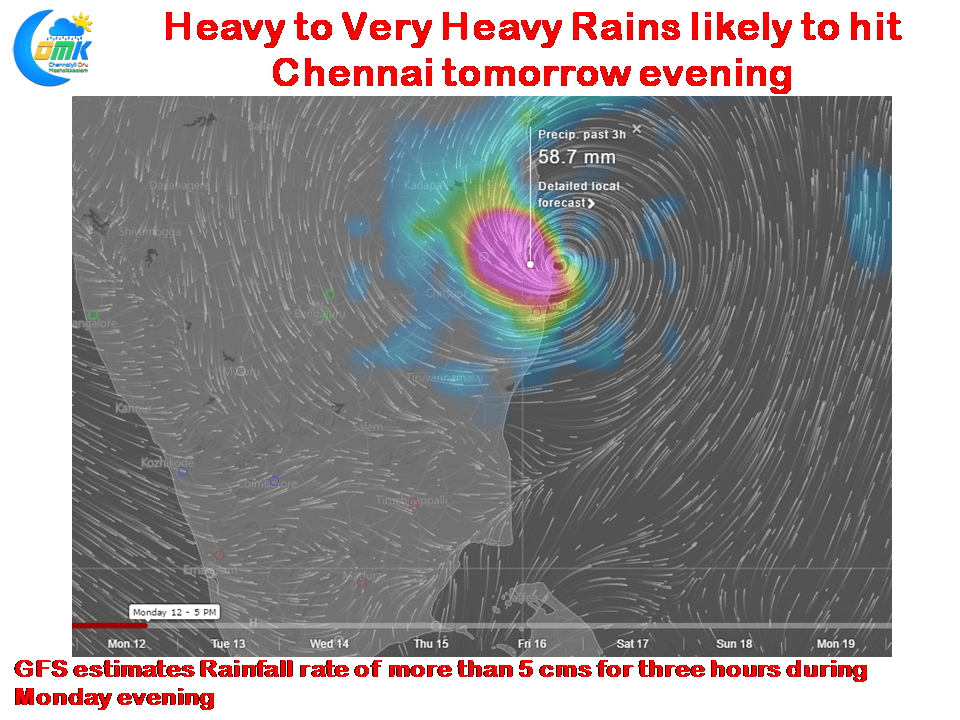
Additionally models have been indicating possibly Very Severe Cyclone Vardah to not only notch up the winds but also dump heavy rains as well at the time of landfall around evening tomorrow. GFS estimating Chennai and surrounding areas to get as high as 6 cms of rainfall in the 3 hours coinciding with the landfall moment.
As things stand Very Severe Cyclone Vardah is likely to make landfall as a strong Tropical Cyclone within 25 kms either side of Chennai in less than 24 hours from now.
Powered by WPeMatico