The last few days saw Tamil Nadu come under an intense spell of heat under dry weather. Places like Madurai, Coonoor, Nagapattinam, Karaikal recorded highest temperatures during September. The IMD observatory at Chennai Meenambakkam equalled 39.2°C the highest temperature during September. The dry weather for the past one month is well captured by this daily rainfall chart. But the good news is வெப்பம் will now gradually give way to veppasalanam thunderstorms. The midnight rains over parts of Chennai was a precursor to what is in store for the next few days.
A look at the satellite image shows the influence of the developing circulation over North Andaman Sea. It also shows Southwest Monsoon is all set to withdraw as well with only back to back lows from South China sea holding the dynamics. Once the current circulation which is expected to become an LPA in the next 48 hours completes its lifecycle we can see a quick retreat of Southwest Monsoon from North and Central India.
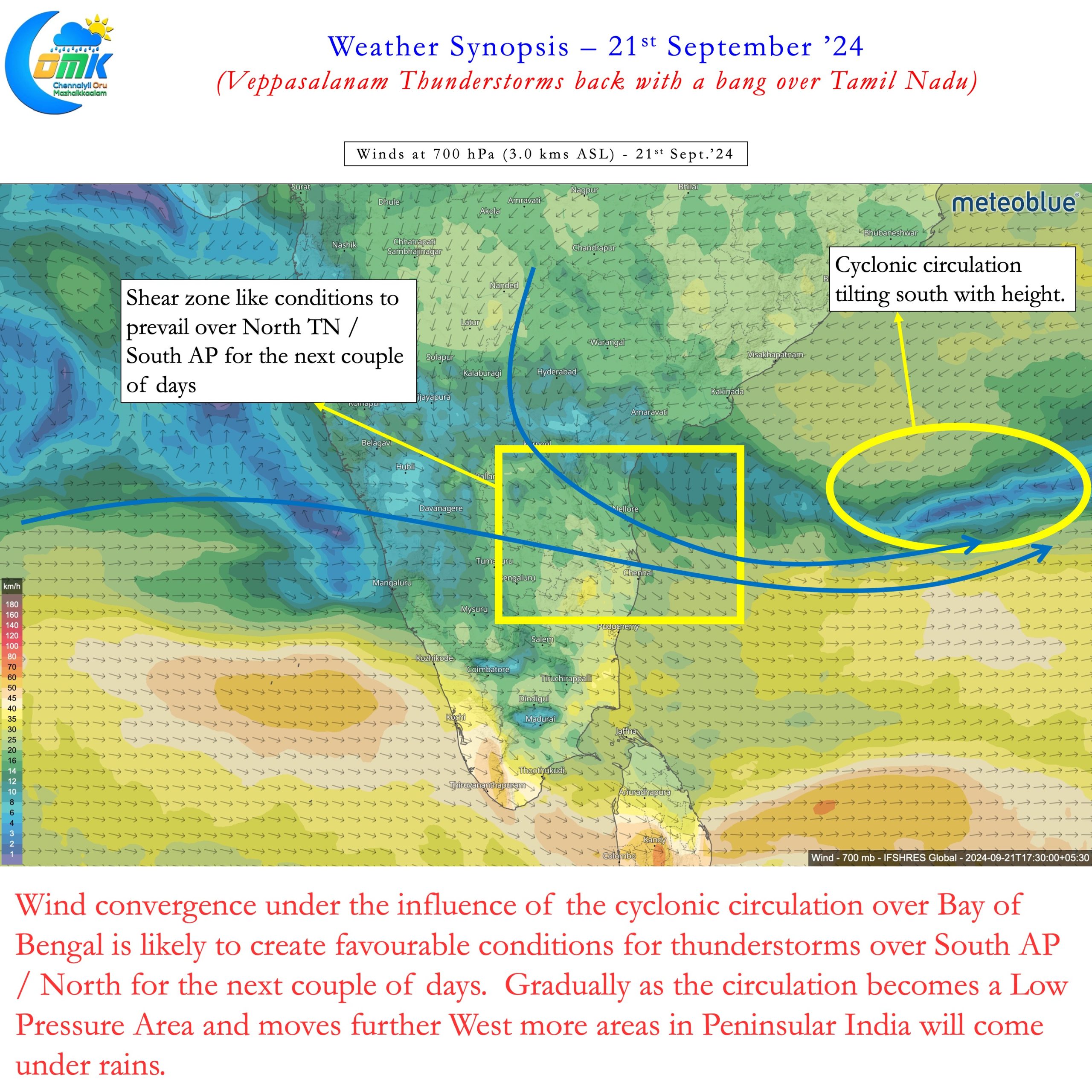
A developing cyclonic circulation over Bay is likely to set wind convergence over South AP and North TN. This is likely to bring thunderstorms over the region almost on a daily basis for the next couple of days. While there could be rains for most parts of TN Chennai and suburbs possibly may be the biggest beneficiary of this spell of thunderstorms. With the cyclonic circulation expected to move slowly across Bay this period may bring a much needed spell of rains. Along with rains there will a much needed relief from the heat for the city and suburbs.


As the circulation moves WNW starting from tomorrow more places in Tamil Nadu may see thunderstorms. The areas that may miss out from Veppasalanam Thunderstorms during the next few days may be South TN and parts of West TN. Even those areas will gradually start seeing transition thunderstorms from later next week. As September gives way to October we can possibly see transition thunderstorms in full flow over the state. That could finally bring curtains as well to the excessive heat over the state for the past few days.
In the meanwhile there is a very high chance today few places over North Coastal TN and adjoining South Coastal AP may see intense late night thunderstorms. The ECMWF extreme precipitation index also indicate a high probability for anomalous rainfall off the coast. This could also spill over to a few places along the coast bringing these intense thunderstorms. The stretch between Mahabalipuram and Sriharikota may be vulnerable to this burst of intense late night storms. There is a good chance few places in this stretch may accumulate up to 15 cms by middle of next week.
Thunderstorms during the month of September almost always peaks during midnight hours. This spell also is likely to follow similar pattern. As far as monsoon rains for Peninsular West Coast goes there is nothing major on the cards going by sub seasonal models. Towards the end of next week we can possibly see transition thunderstorms slowly start happening along the Peninsular West coast and adjoining areas.
All in all a welcome return of rains for Chennai and suburbs. Relief for rest of Tamil Nadu not very far away. Veppasalanam thunderstorms are back with a bang.

