
Yesterday saw thunderstorm activity start once again over Tamil Nadu after a few days of dull and boring weather. Parts of Madurai, Dharmapuri, Perambalur, Dindigul, Virudhunagar & Tiruvannamalai districts saw moderate thunderstorm activity in the evening. In particular parts of Virudhunagar district saw near stationary storms for more than couple of hours providing good rains over the area. In a pattern that symbolizes thunderstorm activity during the later months of Southwest Monsoon some of the thunderstorms are still persisting over parts of Dharmapuri district as this post is being typed.
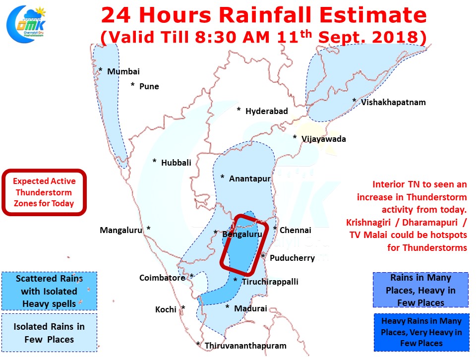
Today we could see an uptick in thunderstorm activity over Tamil Nadu with most parts of the state having some chance of thunderstorms in the evening. We will possibly see two clearly distinct types of thunderstorm activity, early afternoon sea breeze / low level convergence triggered thunderstorm activity in a few areas along the coast while later in the evening wind instability induced thunderstorms interplay with convective process after day time radiation.
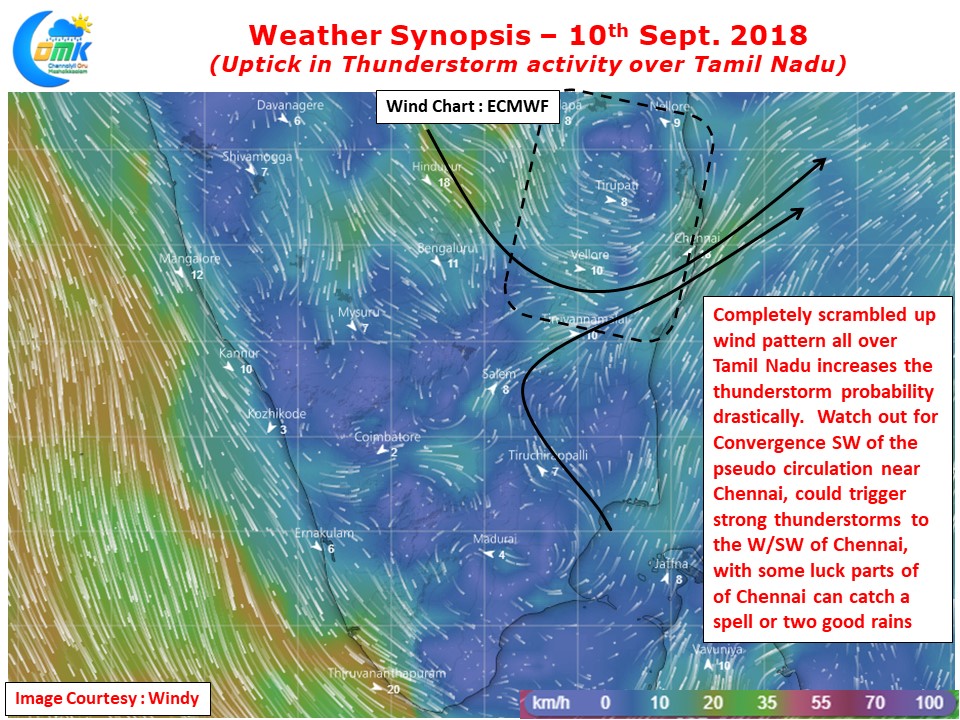
Once again areas around Virudhunagar / Madurai / Dindigul could be hotspot for thunderstorm activity in South TN while Dharmapuri / Tiruvannamalai / Vellore / Krishnagiri districts could see increased thunderstorm activity over North Interior TN. A strong convergence created by a pseudo circulation to the W/NW of Chennai is likely to trigger thunderstorms in these places. What could be interesting is in case the winds are favorable and steering ends up better than what models estimate few parts of Chennai could catch a spell or two of good rains from the thunderstorms forming to the W/SW of Chennai.