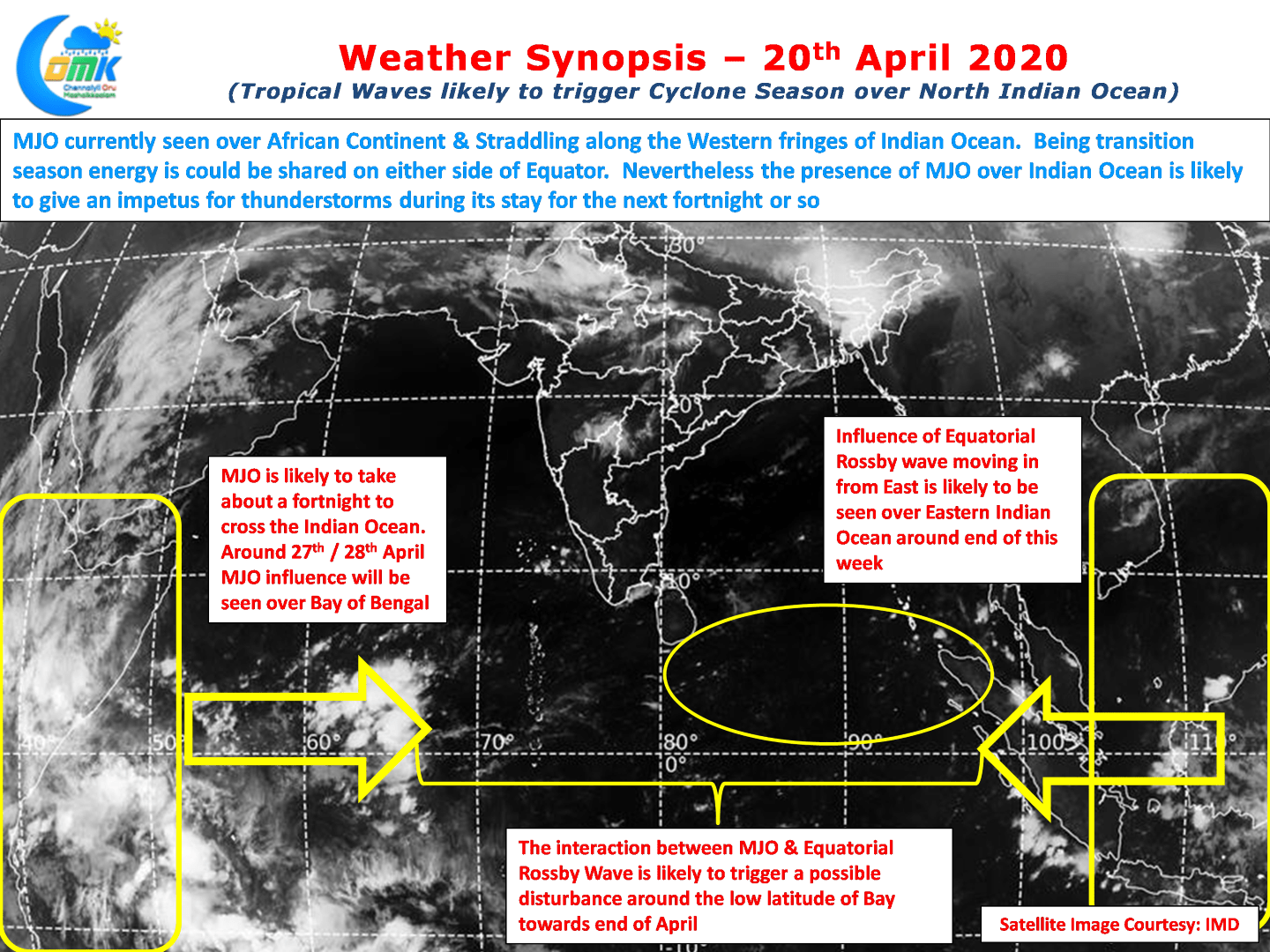
The North Indian Ocean (Arabian Sea + Bay of Bengal) typically sees two cyclonic seasons in a calendar year. Pre Monsoon & Post Monsoon Season. The Pre Monsoon Season that happens during April & May typically also sees higher instances of Intensifying Cyclones. If one were to put it as a statistic nearly every second tropical disturbance that develops during the months of April & May ends up becoming a severe Cyclonic Storm. Last year saw Fani one of the strongest cyclones to hit Odisha after 1999 Super Cyclone happen late April.

Though April & May are broadly considered Pre Monsoon Cyclone season for North Indian Ocean, the actual season pretty much starts around the last week of April. The last week of April & 1st Week of May has seen more than half of the formed disturbances intensify into Severe Cyclonic Storms indicating the potential for intensification during this period. Over the years these two weeks have thrown up some very intense cyclones including the 1990 AP Super Cyclone.

Warm seas along with the entry of ITCZ over Northern Hemisphere typically creates conducive conditions for Cyclones to intensify. But more often than not the trigger typically comes from the movement of tropical waves as they traverse across Indian Ocean. Looking at these charts it appears MJO is currently over African Sea straddling the western fringes of Indian Ocean. Weather models indicate MJO to traverse across Indian Ocean over the next fortnight or so. Around end of April Equatorial Rossby wave is expected to move into Indian Ocean from the Eastern side. The interplay between MJO & ER could throw up a possible disturbance having genesis around Equatorial waters of Bay.

But the key point about pre monsoon cyclones is their affinity towards North Bay. Almost always cyclones formed during this period tend to move in a Northerly track with a gradual eastward shift taking a NE recurve under the influence of Sub Tropical Westerly Trough. Though time to time we may end up getting lucky with a Roanu type of cyclone that moved along the TN coast dumping unseasonal rains during May 2016 as it climbed North.
Irrespective of where a potential disturbance may take genesis & end up it is an interesting time for weather watchers as the traversing MJO is likely to give a lot of impetus to the Pre Monsoon thunderstorms as well making it an interesting fortnight or so of weather watching.


