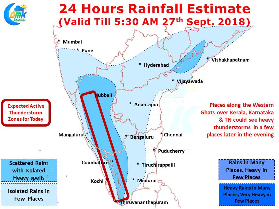
Peninsular India continues to see daily thunderstorms with yesterday being no different. While places in West Interior TN and South TN enjoyed moderate thunderstorms the highlight yesterday was some intense thunderstorms over parts of North Interior Karnataka, the area which has been so far reeling under a deficit monsoon. Like last year once again the thunderstorms to the downstream of KRS dam is contributing to increased inflow into Mettur Dam.
One of the key reasons for the thunderstorms to bloom over the past few days is the drastic weakening of the Westerlies and the prevalence of pseudo Easterlies at lower levels over Peninsular India. This weakening of westerlies has allowed surface level Easterlies penetrate to longer distances over the East Coast in the form of Sea Breeze keeping temperatures under check. While Interior areas tend to normally be hotter than coast due to this condition overall temperatures remain slightly below normal over most parts of Tamil Nadu.
Today also we are likely to see another day of heavy thunderstorm activity over Peninsular India with places along the Western Ghats likely to be the hot spot for thunderstorm activity. Parts of Kerala & Karnataka is likely to see heavy thunderstorms in isolated places while in the case of Tamil Nadu places in Madurai, Dindigul, Theni, Nilgiris, Coimbatore & Tiruppur districts could see moderate thunderstorm activity during the evening.


