
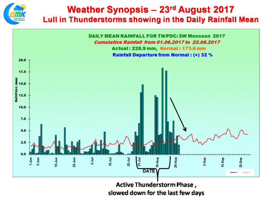
The last few days have seen a lull in the thunderstorms over Tamil Nadu as briefly the West Coast picked up on the monsoon dynamics under the influence of the Low Pressure that moved across the Central Indian region. This lull is indeed visible in the daily mean rainfall chart of Tamil Nadu & Pondy as well. Yesterday also was mostly a quiet day with some of the interiors around Vellore / Krishnagiri districts picking up some activity but overall it was mostly subdued once again.
 With high clouds dominating the skyscape over coastal areas Chennai and surrounding areas had a pretty much dry day. Pondicherry and Cuddalore got some light rains with both the places recording 12 & 11 mm respectively. Vrinchipuram ISRO & Kanchipuram ISRO recorded 4 mm each among the IMD AWS / ARG Network summing up the situation yesterday.
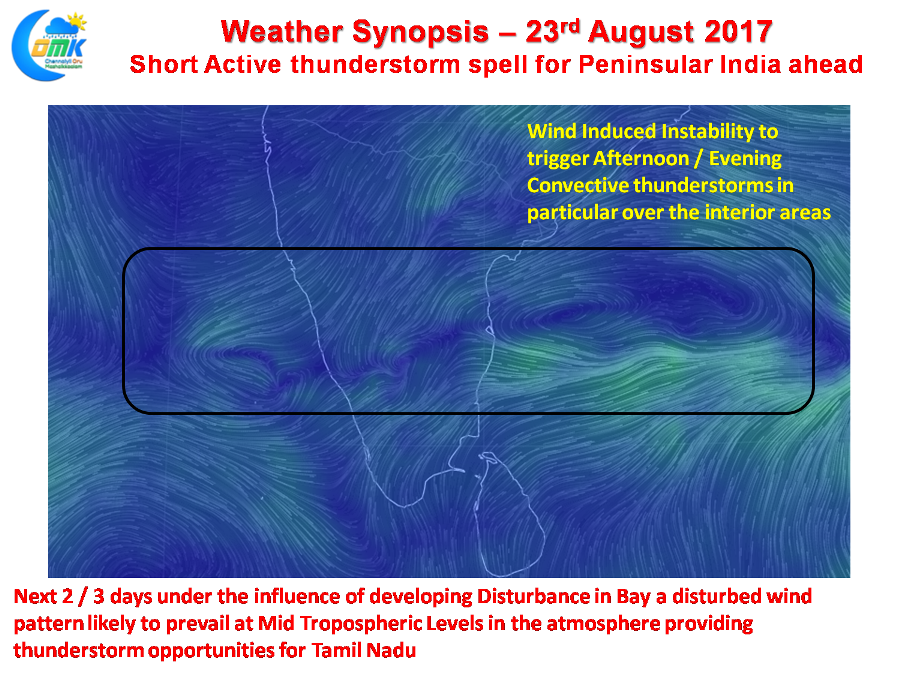 Things though look good for the next 2 / 3 days as a scrambled wind pattern is likely to evolve in the atmosphere in particular around Mid Tropospheric Levels which is likely to create necessary instability to trigger late evening convective thunderstorms. As it happens mostly the interior areas are likely to benefit more thanks to the absence of sea breeze allowing longer hours of heat radiation. This could be a short phase until the evolving disturbance in Bay descends to surface level becoming an organized Low Pressure Area bringing back monsoon dynamics once again into play.
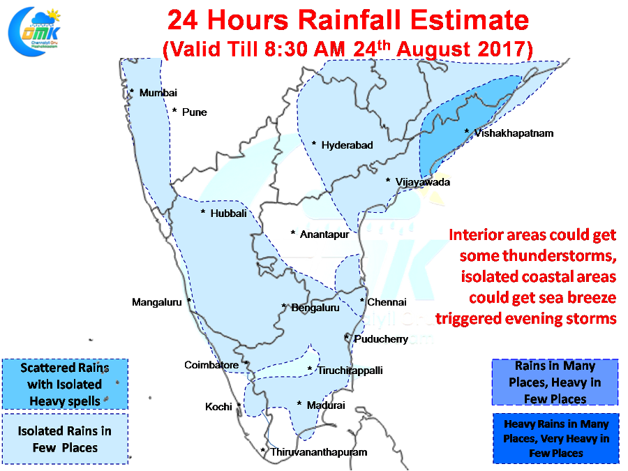
Things change for the good from today with couple of developments, one already mentioned above, while the second one is the slowing down of Westerlies allowing for a more robust sea breeze front that is likely to once again trigger some thunderstorms over the coastal areas. In particular this could be a good development in South TN where thunderstorm activity has pretty much come to a stand still.
Similarly North Coastal TN also could benefit from sea breeze inducing / giving impetus to some of the thunderstorms moving in from the interiors providing rainfall opportunities in a few places. There is a slight possibility of some disturbed wind activity as indicated by models slightly to the West of Chennai which could shake up things if it translates into reality.
Powered by WPeMatico