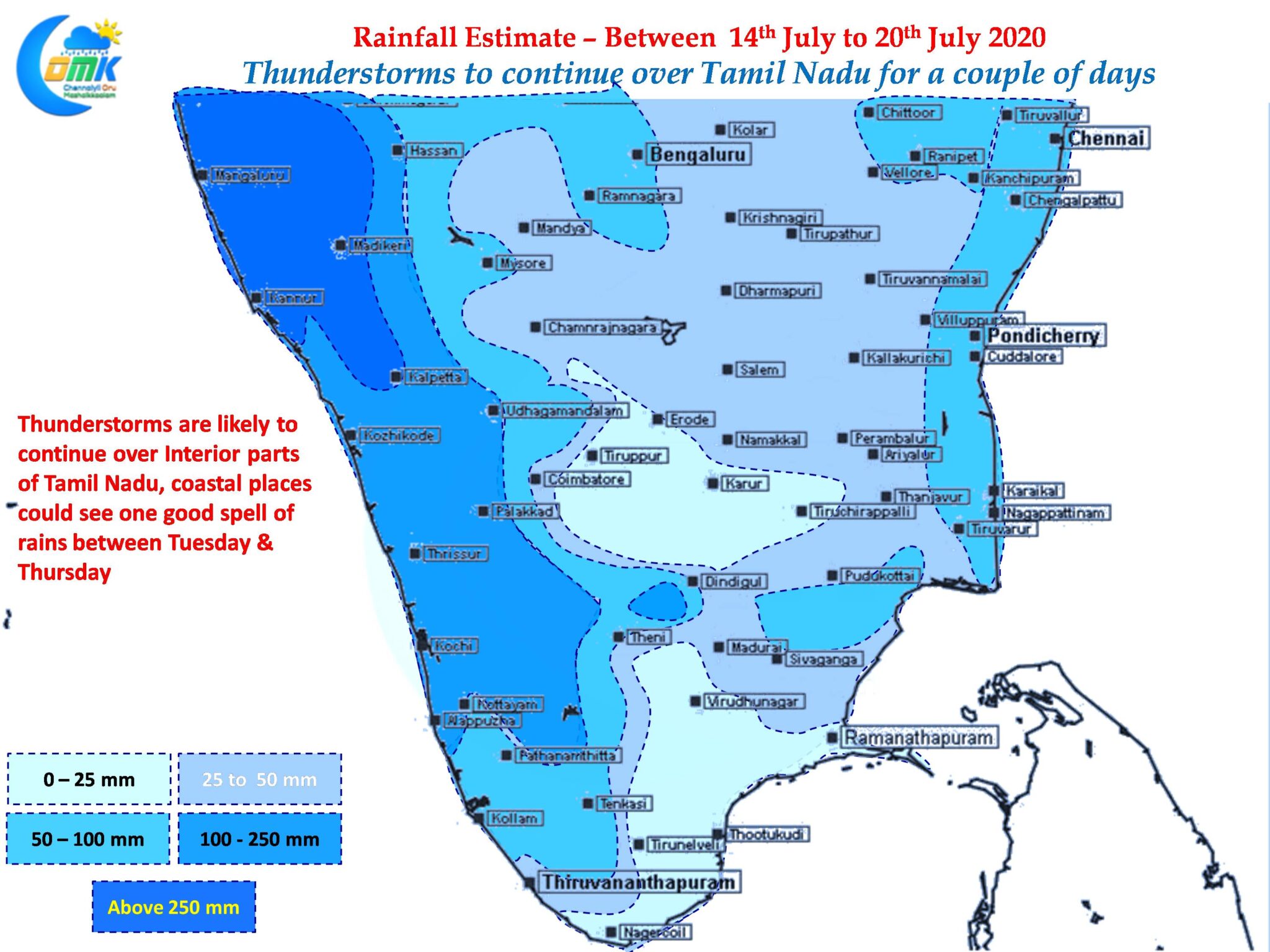
The last week has been very good as far as thunderstorms go over Tamil Nadu. With monsoon remaining weak a lot of places enjoyed a very good spell of thunderstorms bringing much needed rains to the farming community. As always Break in Monsoon period typically means heavy rains over Northeast India which has been the case this time around too with flooding seen over the states of Assam, Arunachal Pradesh, Sikkim etc

But it appears Monsoon may soon try to get back on track on the back of an expected southward shift of the Monsoon trough in a couple of days time. This period would also mean chance for thunderstorms over TN is likely to persist for the next couple of days. As always the case with monsoon dynamics a lot of factors come into play as things keep going through ebbs & flows.

On the one hand while the presence of an upper air cyclonic circulation over AP & Odisha coast is likely to help the trigger of thunderstorms over East Coast the same circulation is also likely to create conducive conditions for the Monsoon trough to climb down from the foothills of Himalayas. All of these are interlinked as always.

In the meanwhile wind convergence is likely to trigger thunderstorms over South Coastal AP & adjoining parts of Tamil Nadu with the stretch between Nellore & Pondy looking good for a spell or two of decent rains between today & Thursday post with we could see some reduction in thunderstorm activity as west coast tries to pick up pace once again.
As mentioned earlier the Monsoon Ebbs & Flows & along with it the prospects of thunderstorms for Chennai Peaks & Troughs


