For some of the weather bloggers the complex phenomenon of Veppa Salanam Thunderstorms is a sort of holy grail. Trying to identify patterns that could provide some insights into how these thunderstorms could evolve and likely impact areas possibly gives more sleepless nights than even some of the strongest cyclones seen in recent times overy Bay of Bengal. Pre Monsoon / Break in Monsoon / Retreating Monsoon you can see thunderstorms in different forms from early April to middle of October but the common theme is the complex nature & the unpredictability in them.
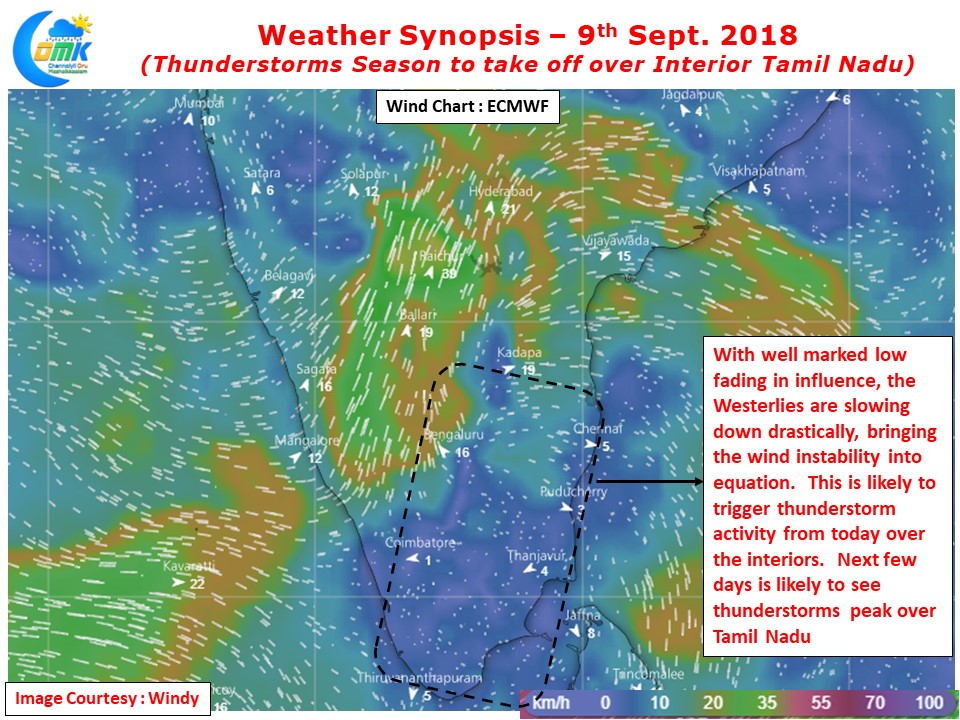
Look little deeper one can find an underlying common cause that binds them all “Wind Instability”. Thunderstorms peak when the winds slow down be it Easterlies during Pre Monsoon or Westerlies during Break in Monsoon or Withdrawal periods. Weather Models indicate a drastic slowing down of Westerlies from today as the well marked low over Central India fades in influence and becomes a non entity soon. Over the next few days one can see wind induced instabilities in all forms, scrambled winds ./ convergence / discontinuity, and shapes. All of it leading to the obvious result, Fasten your Seat Belts as the Thunderstorms Season over Tamil Nadu is all set for a take off once again.
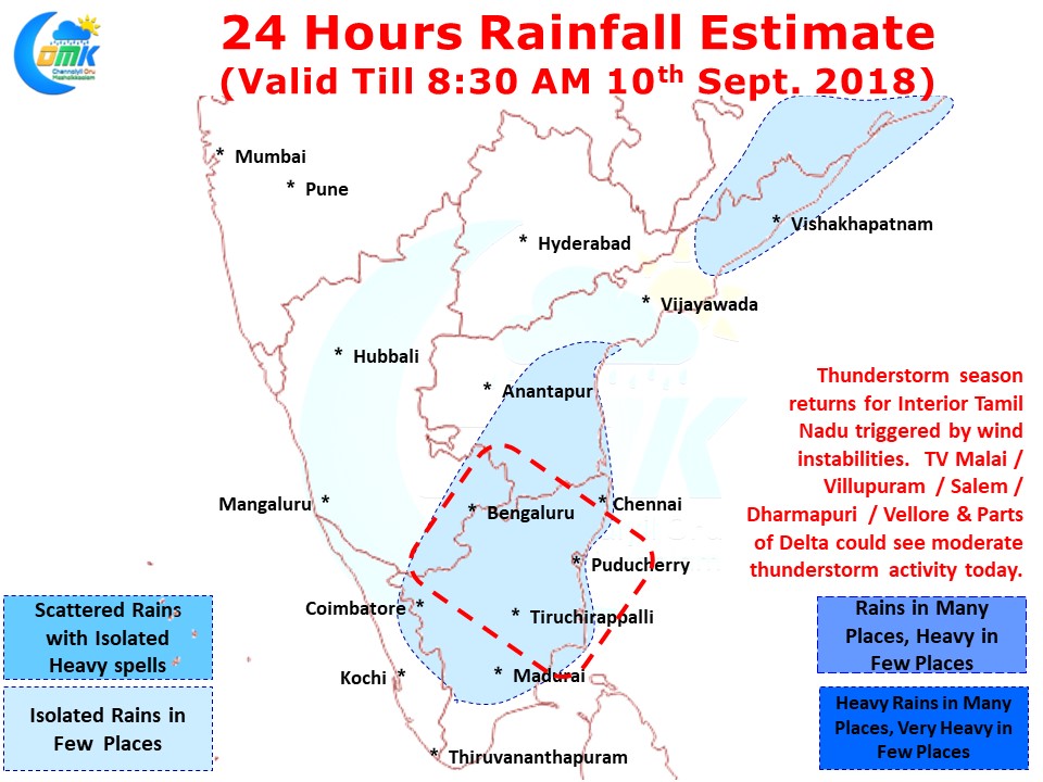
Today we could see some moderate thunderstorm activity over parts of Salem / TV Malai, Villupuram / Cuddalore and Delta districts with possibly isolated places getting heavy spells of rains as thunderstorms move slowly. Please keep in mind the day will remain fairly hot across the state which will do its bit of work in thunderstorm development. While few coastal areas will see late evening thunderstorms triggered through low level convergence the bulk of the thunderstorms will form in the interiors only after sun down and slowly wind their way towards the coast. Chennai could be on the fringe of the thunderstorm activity though if wind pattern shifts slightly to the North we could catch a spell or two of decent rains


