
Thunderstorms have well and truly parked over Interior Tamil Nadu for most of this week. Last Sunday we saw the first batch of thunderstorms form as Monsoon weakened and the Monsoon trough started to push back towards the Himalayas. Each day we have seen many parts of the state getting good rains from evening / late night thunderstorms.
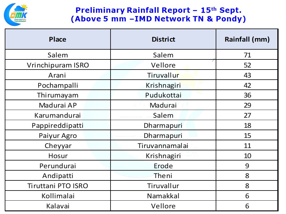
Yesterday’s highlight has to be Salem getting 71 mm rains from thunderstorms that started around 10 PM. Similarly Vellore district got very good rains from thunderstorms that moved in from South Interior Karnataka. Earlier in the day parts of South TN got very good rains around Pudukottai, Sivagangai, Madurai & Dindigul districts. Madurai AP recorded 29 mm rains during this spell of evening rains.
Today once again we can see wind instabilities stretching all the way from South Andhra Pradesh to parts of South Tamil Nadu near Dindigul / Madurai areas. Additionally isolated pockets are also seeing strong lower level convergence too improving the possibility of thunderstorms. Given the large scale wind instability seen in the weather models it may not be a surprise if today could be one of the best days of thunderstorms in interior Tamil Nadu from the current spell.
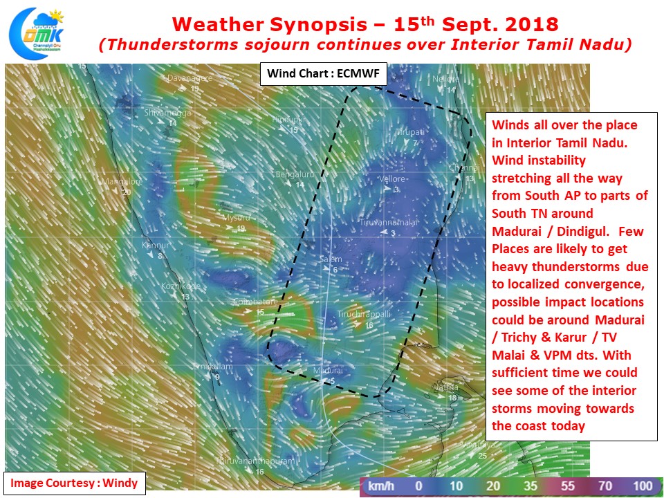
This time of the year thunderstorms are known to be strong in the interiors while coastal areas tend to miss out. The only time they score is on days when very heavy thunderstorms in the interiors create enough momentum of their own and cross the coast. Those coastal places that come under this movement end up getting a dumping deluge in a couple of hours of thunderstorm activity. Places like Chennai will have to wait for that D Day with models estimating another early thunderstorm activity today hopefully we will have sufficient time for a mature storm to reach the coast.