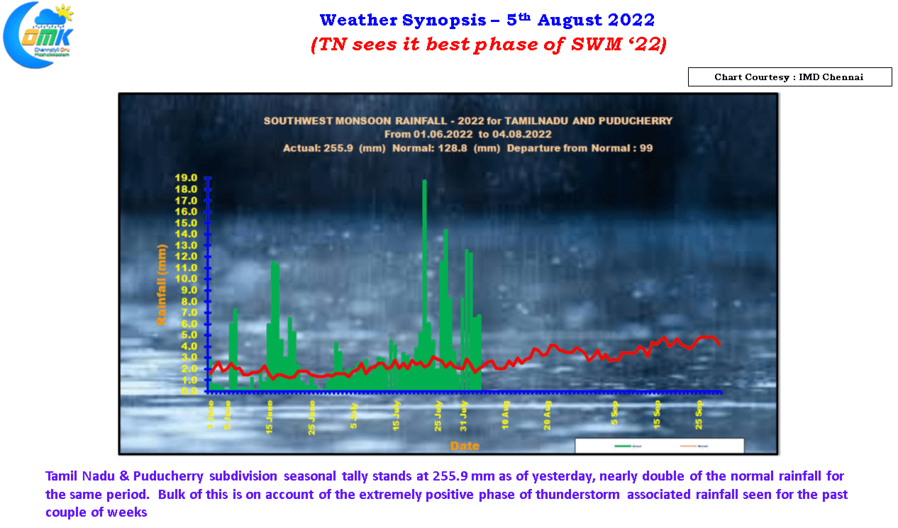
For the past few days even though citizens of Chennai may feel aggrieved has been very good for Tamil Nadu in terms of rains associated with thunderstorms. With the seasonal tally standing nearly twice the normal rainfall so far we are in line for another positive southwest monsoon performace in sync with how the past few years have been for the leeward areas of Tamil Nadu.
But we all know the monsoon dynamics behave like a pendulum oscillating between active and suppressed phases during which time core & leeward areas benefit accordingly. Though the past few 3 / 4 days have seen rains pick up over the West coast the expected development of a fresh Low Pressure area in West Central Bay areas over the next 48 hours or so will give fresh impetus to monsoon dynamics.


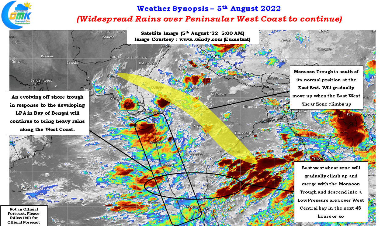
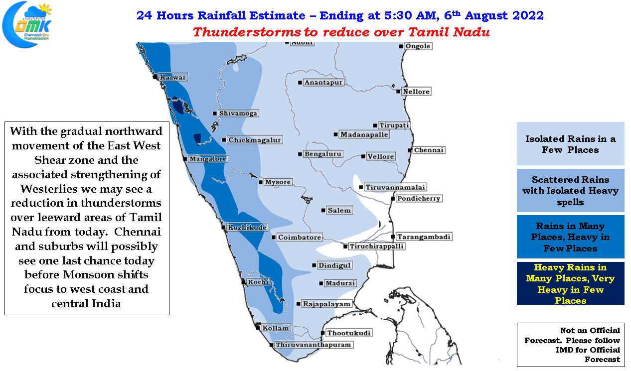
With monsoon dynamics picking up we can expect a reduction in thunderstorm activity over Tamil Nadu on account of the streamling of westerlies and the absence of any wind induced instability over the leeward area and Eastern Ghats to trigger convective thunderstorms during the evening and night hours. The East west shear zone currently seen close to Chennai latitude is expected to further climb up and merge with the monsoon trough and possibly descend into an LPA by weekend. This development is expected to see a response along the Peninsular West Coast in the form of an off shore trough which will increase the rainfall activity over West Coast and along the Western Ghats.
While Chennai missed out mostly on thundertorms for the past week or so due to unfavorable wind pattern today possibly represents the last and best chance as the East West Shear Zone climbs above our latitude bringing Westerlies. A small window of about 12 hours or so may be available during the evening / late night hours when the Westerlies are perfectly balanced to bring the remnant moisture from the interiors to be triggered as thunderstorms due to coastal convergence without shearing off the convection. Fingers Crossed.

