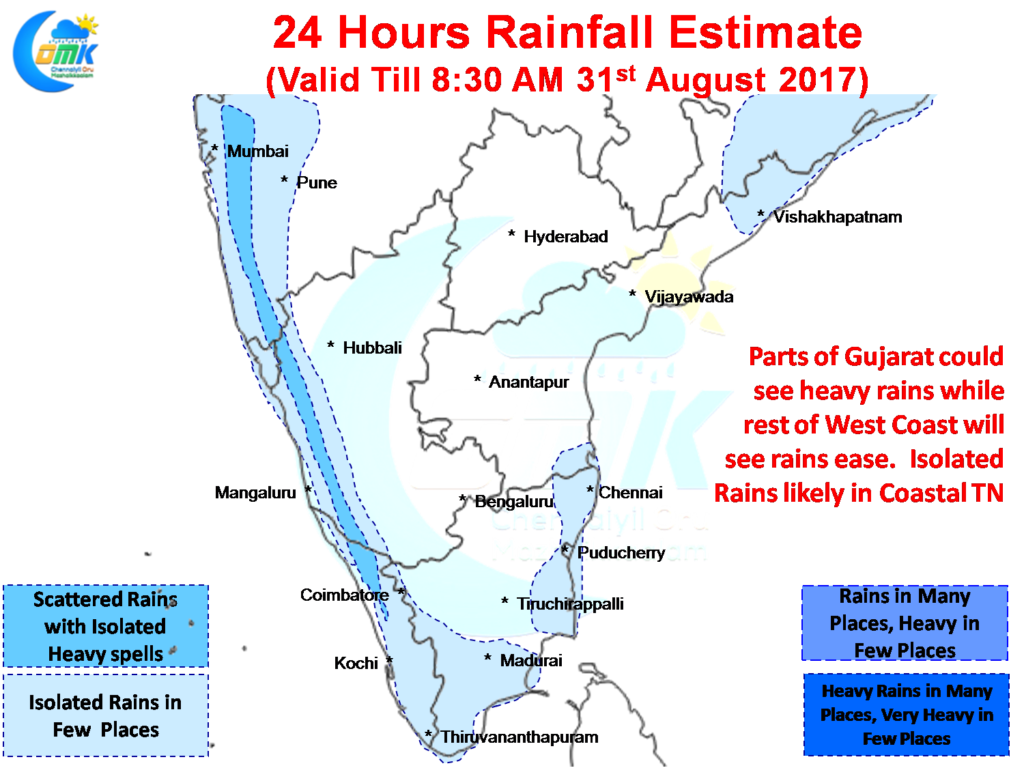
The last few days rains in Tamil Nadu have been centered around the Western Ghats along with the West Coast under active monsoon conditions aided by the Monsoon Low Pressure now expected to become a Depression and provide some heavy spells of rains over parts of Gujarat in the next day or two. Mumbai which came to a standstill yesterday as some very intense spells of rains lashed the metropolis over major part of the day should see some respite as the heaviest rain bands have now moved well North of the city.
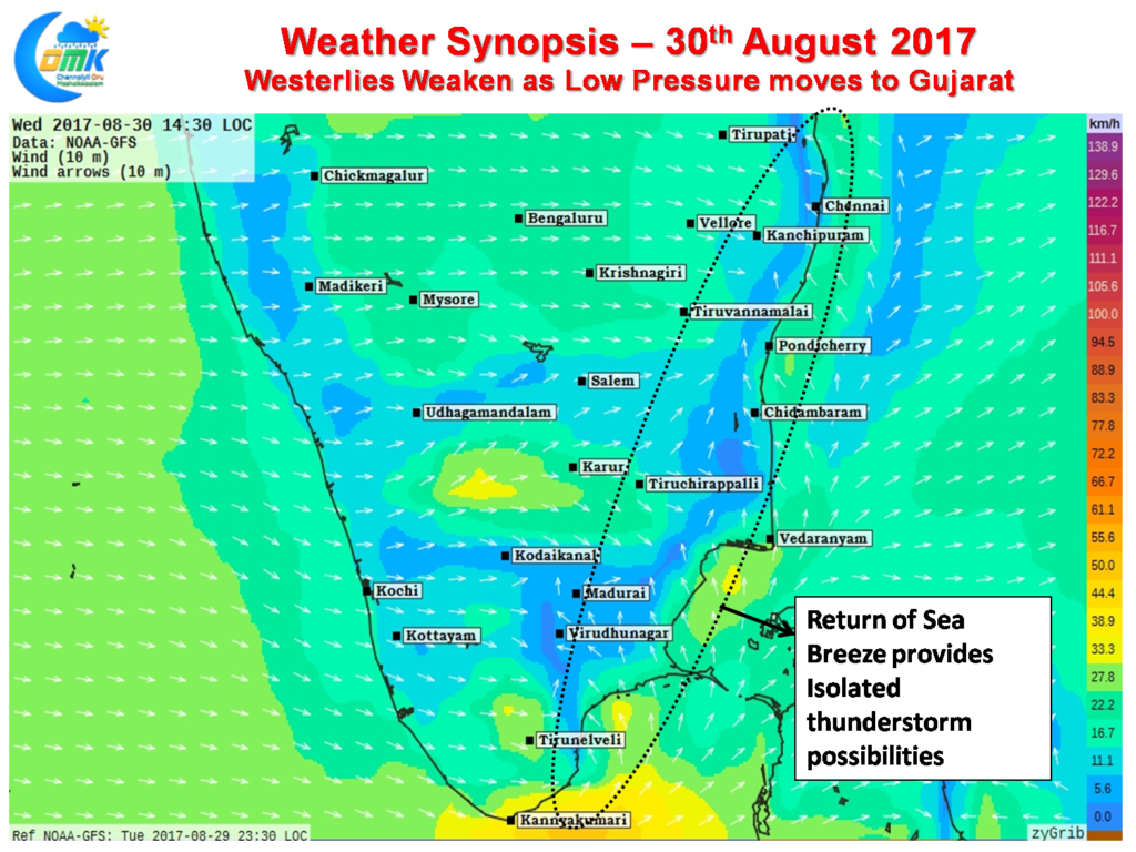
Consequent to the Low Pressure the Westerlies were fairly strong over Peninsular India which played a role in the subdued thunderstorm activity over the East Coast in particular over parts of Tamil Nadu. Not only where the upper level winds were strong not allowing thunderstorms to intensify at the lower level the absence of sea breeze removed one factor from the instability equation to trigger thunderstorms.
From today models are indicating the Westerlies to weaken providing a window for sea breeze to come back into the Thunderstorm equation. This is likely to play a very crucial role in the return of the thunderstorms over Coastal Tamil Nadu in particular over the South TN Region.
As mentioned in our opening lines the rains are likely to slow down in most parts of the West Coast with the exception of Gujarat where significant rains are expected for the next 24 to 48 hours. As the Monsoon Low completes its life cycle the rains will slow down over West Coast without the support of active Off Shore Trough.
In the meanwhile thunderstorms are expected to stage a return back to Tamil Nadu with isolated rains expected today with one or two places in the coast benefiting from the sea breeze penetration providing added instability. Things are expected to pick up gradually from tomorrow both in terms of the spread of the thunderstorm activity and also the intensity with weekend expected to provide some good rainfall opportunities to quite a few places in the state.
Powered by WPeMatico


