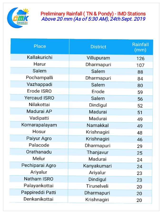
The Veppasalanam Express has been running non stop over South India with Monday seeing another active day of Thunderstorms over many parts of Tamil Nadu, Karnataka and AP. Chennai received early morning showers indicative of the upcoming Northeast Monsoon with places closer to the coast enjoying heavier spells.

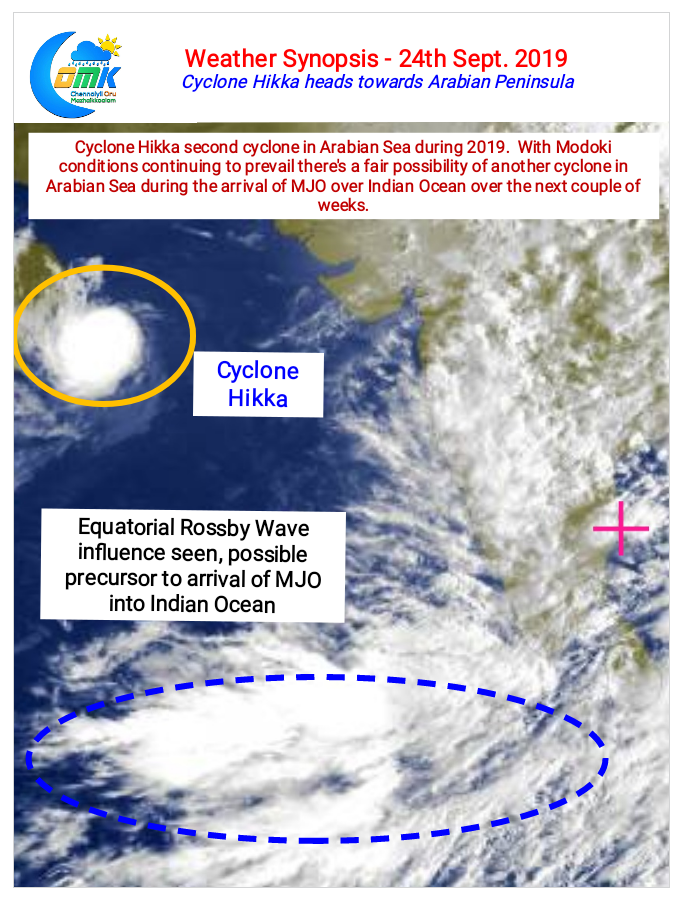
Interior areas of South India though has been enjoying a fabulous few days of Thunderstorms with many places once again recording centuries in Tamil Nadu & South Interior Karnataka. In the meanwhile Cyclone Hikka has been continuing on its Westward journey towards the Arabian Peninsula. Weather models indicate it to lose intensity as it nears the Arabian Peninsula though it is expected to give heavy rains to the region. Cyclone Hikka becomes the third cyclone of the year over North Indian Ocean with Fani & Vayu being the earlier two.

With Arabian Sea already hosting two cyclones and a firm probability of one more before the onset of Northeast Monsoon 2019 it confirms the Modoki state currently prevailing over Pacific Ocean. Satellite image indicates the influence of Equatorial Rossby Wave which is a precursor to the arrival of MJO over North Indian Ocean. The arrival of MJO will probably trigger the next cyclone which could hasten the seasonal wind change and withdrawal of Southwest Monsoon subsequently.

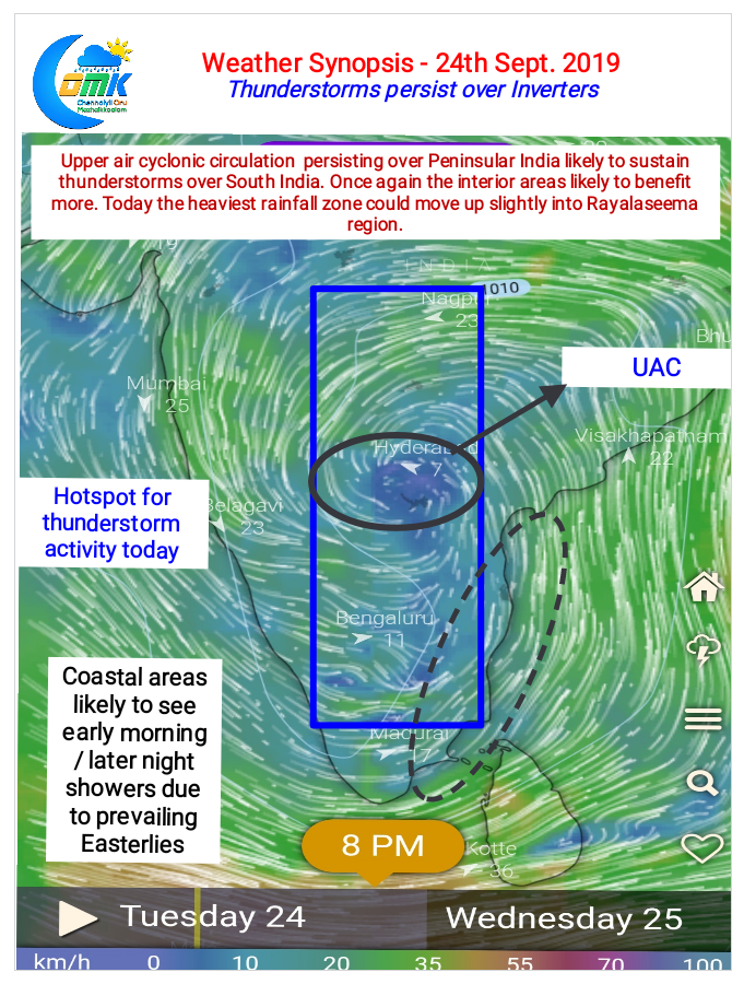
The Upper Air Cyclonic Circulation that’s been driving the Veppasalanam Express over South India now if straddling over Peninsular India and is expected to move into West Coast though it may not descend into a surface level circulation. Thunderstorms are likely to persist as Westerlies will remain weak with models indicating another Circulation to develop in Bay later this week. The never ending train of circulation is an indication of changing wind patterns as we are at the cusp of seasonal wind shift from West to East.


