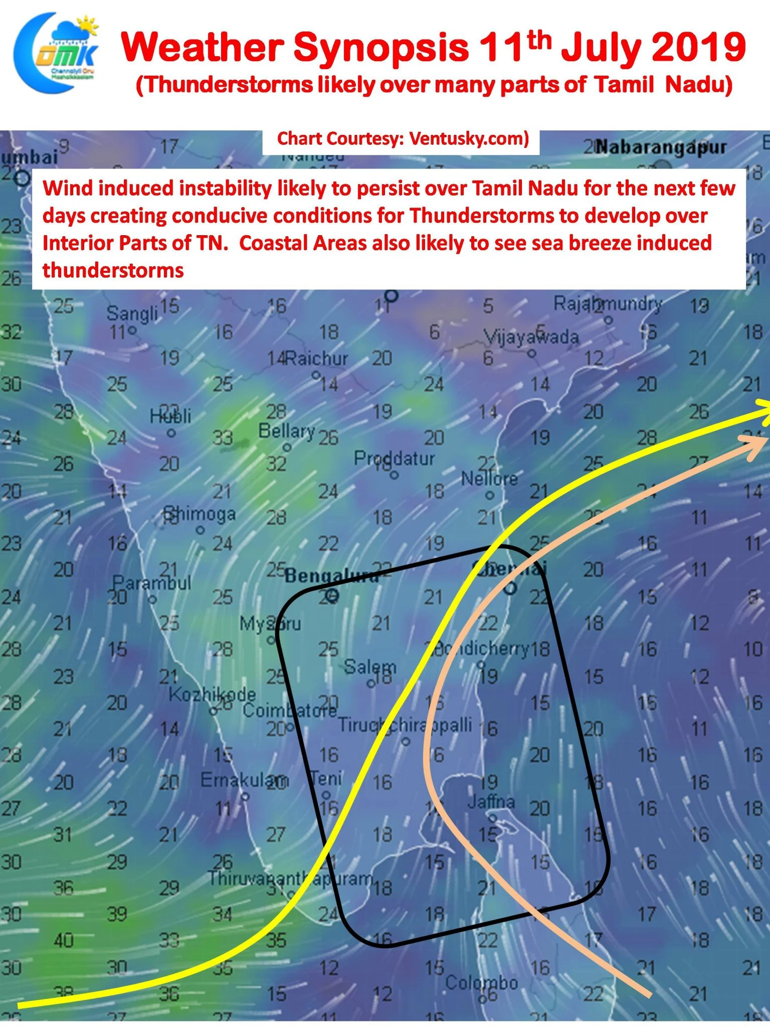
Yesterday saw isolated thunderstorms continue over a few places of Tamil Nadu & Pondicherry. The IMD observatory at Pondicherry recorded 17 mm from the evening rains yesterday in addition to the 31 mm recorded on Tuesday. Salem district also received moderate rains with the IMD observatory recording 26mm from the evening spells.
With the Well Marked Low straddling Bihar & Uttar Pradesh persisting the region sees the threat of Flooding Rains linger today as well. The Gangetic Plains across both the states are likely to receive moderate to heavy rains at many places in particular over Eastern UP & adjoining parts of Bihar.

Today morning saw light drizzle in a few parts of Chennai through the remnant stratiform clouds moving in from the interior areas. While there is always a threat such morning cloudiness could play spoilsport for thunderstorm prospects later in the evening the consensus is the skies will clear off for a proper convective process to happen across interior Tamil Nadu.

Additionally the wind charts indicate a zone of instability over South & Central TN primarily from the meeting of Westerlies & Southerlies at the Mid Tropospheric Levels. These two factors likely to create conducive conditions for thunderstorms today. A pseudo circulation at Mid levels is likely to persist over the Bay area for the next few days that is going to be a key component in the thunderstorm equation for Tamil Nadu over the next few days. With westerly winds slowing down the thunderstorms will be able to intensify better and will move slowly providing good rains along the way
As usual the prospects for Chennai will depend on the origin locations of the interior thunderstorms & the steering winds. with models indicating steering to be from the W/SW chance for Chennai is good for a spell or two of moderate thunderstorm activity around evening / late night


