The last couple of days have seen an uptick of thunderstorms over Tamil Nadu. Yesterday saw parts of Salem, Vellore, Tiruvallur, Kanchipuram districts get moderate rains in the evening. While Chennai and suburbs did not get major spells the IMD Observatory at Chennai Airport recorded 2 mm of rains. Parts of Rayalaseema region recorded moderate thunderstorms too with Tirupati recording good late night rains. With the Well Marked Low Pressure fading away and the next low pressure not due to influence weather until possibly weekend this intervening phase is likely to improve the dynamics for thunderstorms over Tamil Nadu.
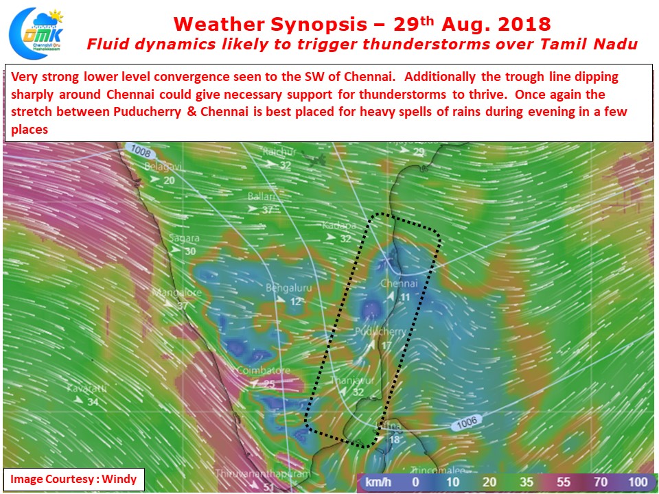
The slowing down of Westerlies straight away provides an opportunity for improved lower level convergence across the coastal areas. This lower level convergence at times triggers thunderstorms of its own in the form of sea breeze induced thunderstorms. In some cases it provides for remnant instability waiting to interplay with the incoming Westerly induced thunderstorms getting the storms to intensify close to the coast. Today Weather Models indicate a strong lower level convergence to the Southwest of Chennai bringing the region under the attack of evening thunderstorms. The sea breeze front is likely to be strong and also climb in altitude today making it conducive for some overhead thunderstorms developments along the coast.
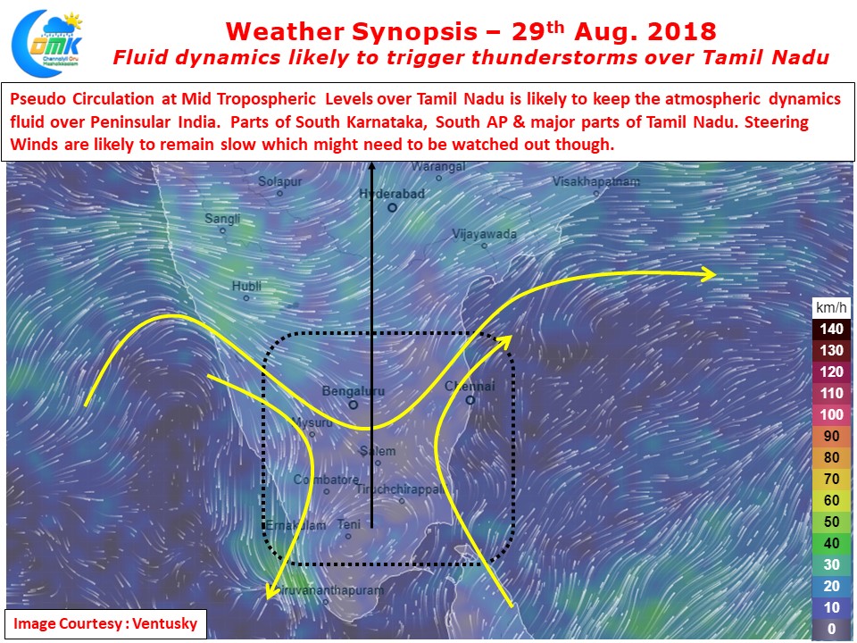
Additionally there exists a pseudo circulation over Southern Tamil Nadu that is likely to create unstable atmospheric conditions for thunderstorms to develop in the interior parts of Tamil Nadu, Karnataka & Rayalaseema region. With weak steering winds some of these thunderstorms over Tamil Nadu could move slowly. This could mean under right conditions a few places could see very heavy spells of rains get dumped later in the day. Some of the districts that could fall in line of such isolated heavy spells of rains are Salem, Karur, Namakkal, Tiruchirappalli, Ariyalur, Perambalur, Cuddalore, Villupuram & Tiruvannamalai. Among the coastal stretch it appears once again the hotspot today is likely to be Puducherry to Chennai. Yesterday saw heavy rains near Madurantagam / Chengalpattu / Mahabalipuram, today possibly this hotspot could move up slightly.


