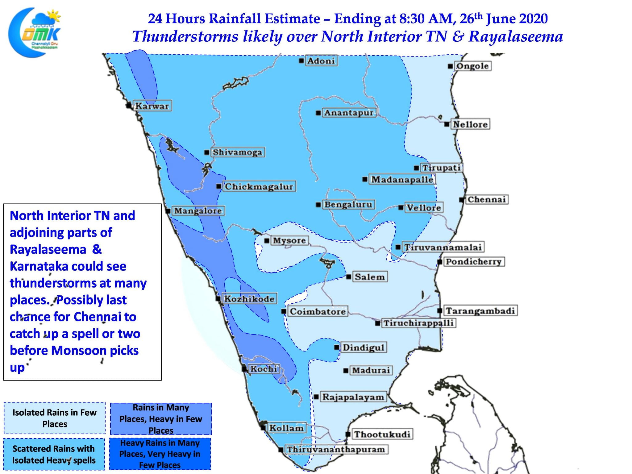
Yesterday once again many places in Tamil Nadu witnessed intense thunderstorms under the influence of a shear zone running over Peninsular India associated with the remnant upper air cyclonic circulation. While Hosur, Denkanikottai, Kallakurichi, Perambalu, Madurai & Trichy recorded between 4 to 7 cms of rainfall Natham in Didigul district recorded 19 cms of rains bulk of it falling in couple of hours.

Today the wind instability has shifted slightly to the North & Northwest with weather models indicating the zone of convergence over parts of Andhra Pradesh, Telengana & Karnataka. This could bring good rains over many places in these states. Along with this models also indicate strengthening of Westerlies which could bring back rains to West Coast.
With the zone of instability shifting further up parts of North Interior Tamil Nadu adjoining Rayalaseema & Karnataka could see moderate thunderstorm activity. Unlike the past few days Chennai is thankfully out of weak steering zone from today giving us one last chance until weekend to catch up a spell of thunderstorms before Monsoon picks up.

Over the past few days there has been a requests from our followers in Andhra Pradesh to include inferences for Rayalseema & South AP region as well in our daily updates. Taking this into account we are revising the 24 hour Rainfall estimate maps from today to incorporate these areas as well.


