
After a few days yesterday saw a relatively quiet day on the thunderstorm front as the wind instability triggering thunderstorms was less pronounced due to the Circulation off Sri Lanka becoming more pronounced. Even temperatures stayed low yesterday across most of Tamil Nadu as remnant clouding from the late night thunderstorms had an effect on temperatures.
Today though Satellite images indicate clearer skies over Tamil Nadu improving the chance of thunderstorms in the state. The larger picture though shows interesting development happening in the Equatorial waters where the Indian Ocean is boiling at 31 / 32 degrees.
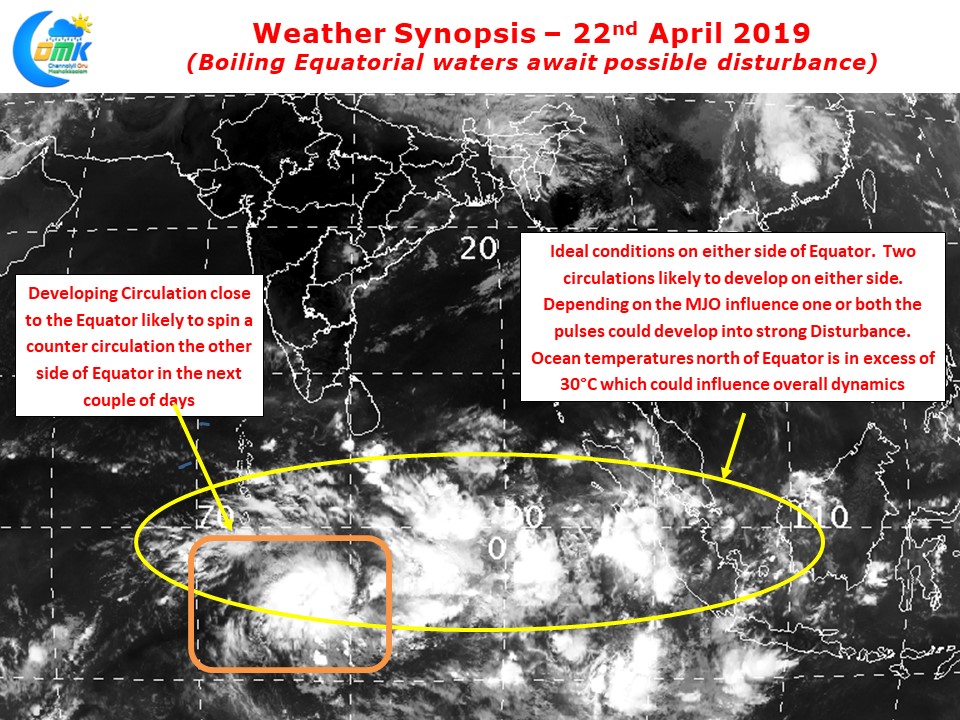
As we explained a few days back the Equatorial Rossby Wave has triggered an active zone of convection along the Equator with a circulation developing as well in the Southern Hemisphere too. This circulation could trigger a counter circulation north of Equator over the next couple of days. Whether it would benefit from the MJO pulse and the hot waters in Bay to develop into an organized disturbance needs to be seen.
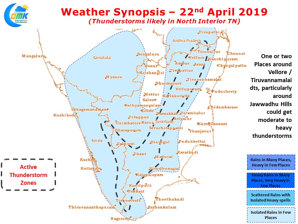
In the meanwhile today the thunderstorms could return with parts of North Interior Tamil Nadu likely to benefit from the convergence of Northerlies & Easterlies. In particular places around Jawwadhu Hills in Vellore & Tiruvannamalai district could see isolated places get moderate to heavy thunderstorms. Temperatures are likely to increase in rest of the state due to clearer skies.