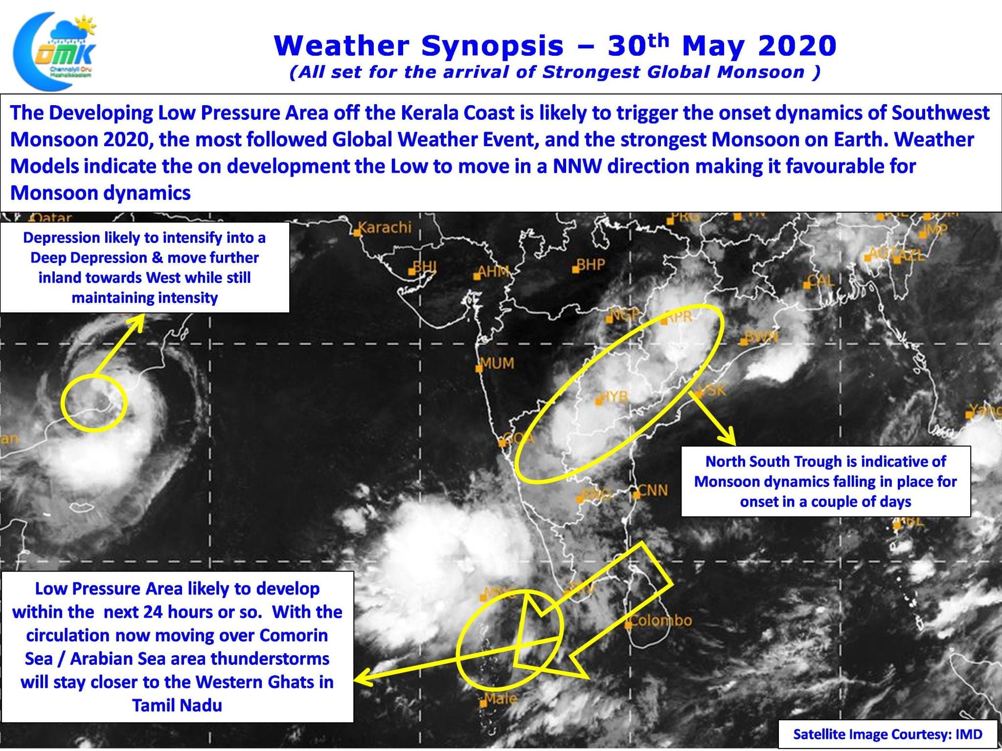
On Wednesday & Thursday large parts of Tamil Nadu saw thunderstorms under the influence of an elongated Upper Air Cyclonic Circulation that was stretching from off Tamil Nadu coast to Comorin Sea. Weather models were consistent on this circulation moving over to Arabian Sea and subsequently descending into a Low Pressure triggering monsoon dynamics for the onset of Southwest Monsoon, the strongest among all Global Monsoons.

The circulation has now moved to Arabian Sea and is likely to become a Low Pressure Area in the next 24 hours or so while the other disturbance over the Arabian Peninsula is now lying as a depression straddling the Oman Coast and is likely to intensify into a Deep Depression while it continues to move west further inland. Weather Models expect the Low Pressure to move in a NNW direction creating conducive conditions for the monsoon dynamics to pick up.

Because of the circulation moving into Arabian Sea thunderstorms over Tamil Nadu will move further west closer to the Ghats as rest of the state is likely to come under a more stable wind pattern created by the circulation. One or two places in in South Tamil Nadu and a few places in West Interior TN could see moderate to intense thunderstorms later in the evening.

There is a faint chance of some isolated thunderstorms over North TN it remains to be seen which of the place gets lucky, nevertheless as the circulation deepens and climbs up the latitude in a couple of days there could be possible spell of rains in North TN including Chennai before monsoon dynamics completely establishes itself.


