
Last night saw heavy thunderstorms lash over southern suburbs of Chennai while most parts of the city recorded light to moderate rains late in the evening. As a matter of fact yesterday was possibly one of the best days of thunderstorms for Coastal Tamil Nadu with rainbands right from Delta districts all the way to Chennai and also the adjoining parts of South Andhra Pradesh up to Nellore latitude.
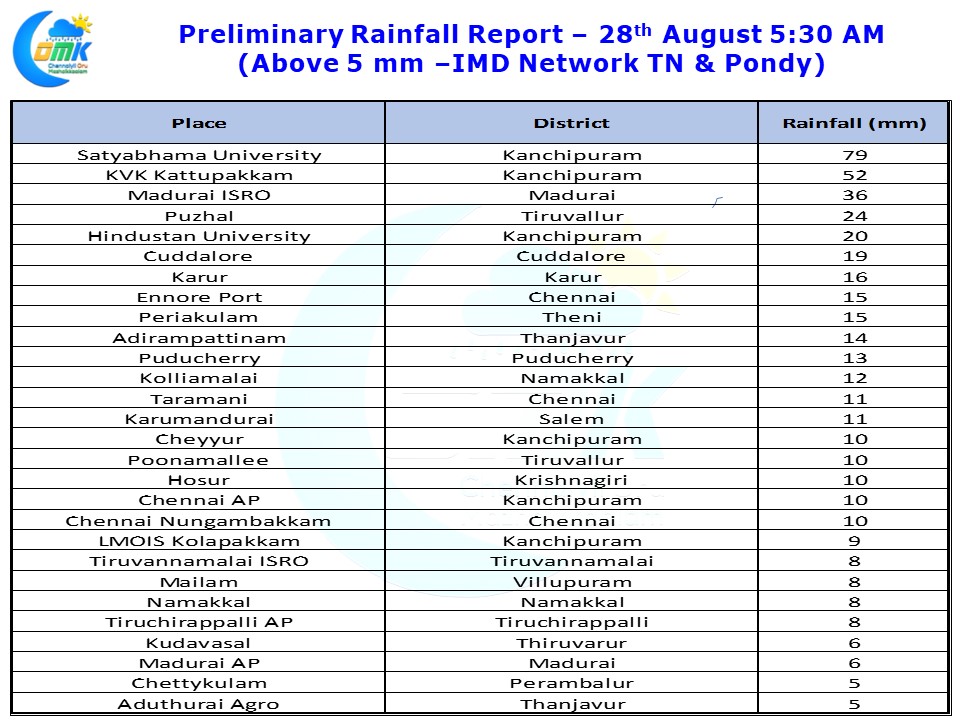
Satyabhama University recorded nearly 8 cms of rains of which 7 cms fell in one hour between 9:30 & 10:30 PM. Similarly KVK Kattupakkam near Kattankulathur south of Tambaram recorded about 5 cms until 5:30 today morning. Both the IMD observatories in Airport & Nungambakkam recorded identical 10 mm for the same period.
Yesterday was a clear instance of how on day of cloudy skies also thunderstorms could happen if there were favorable factors prevailing in the atmosphere. As we mentioned in our post yesterday there was a convergence of winds at Mid Tropospheric Levels which created the platform for the thunderstorms. Add to it despite the presence of a well marked low in the Indian subcontinent the prevailing westerlies at 3 kms ASL were not very strong to act as a negative factor.
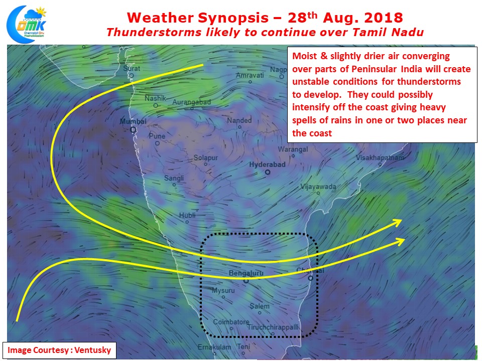
Similar conditions exist today too though its slightly less marked compared to yesterday. Nevertheless the chance for thunderstorms to continue today also over Tamil Nadu is high. Numerical Models indicate thunderstorms to intensify off the coast which could mean a few places along the coast could see spells of heavy rains as the interior thunderstorms find its way towards the sea. Satyabhama University benefited from one such spell yesterday. The stretch between Puducherry & Chennai once again is favorably placed for these intensifying thunderstorms.