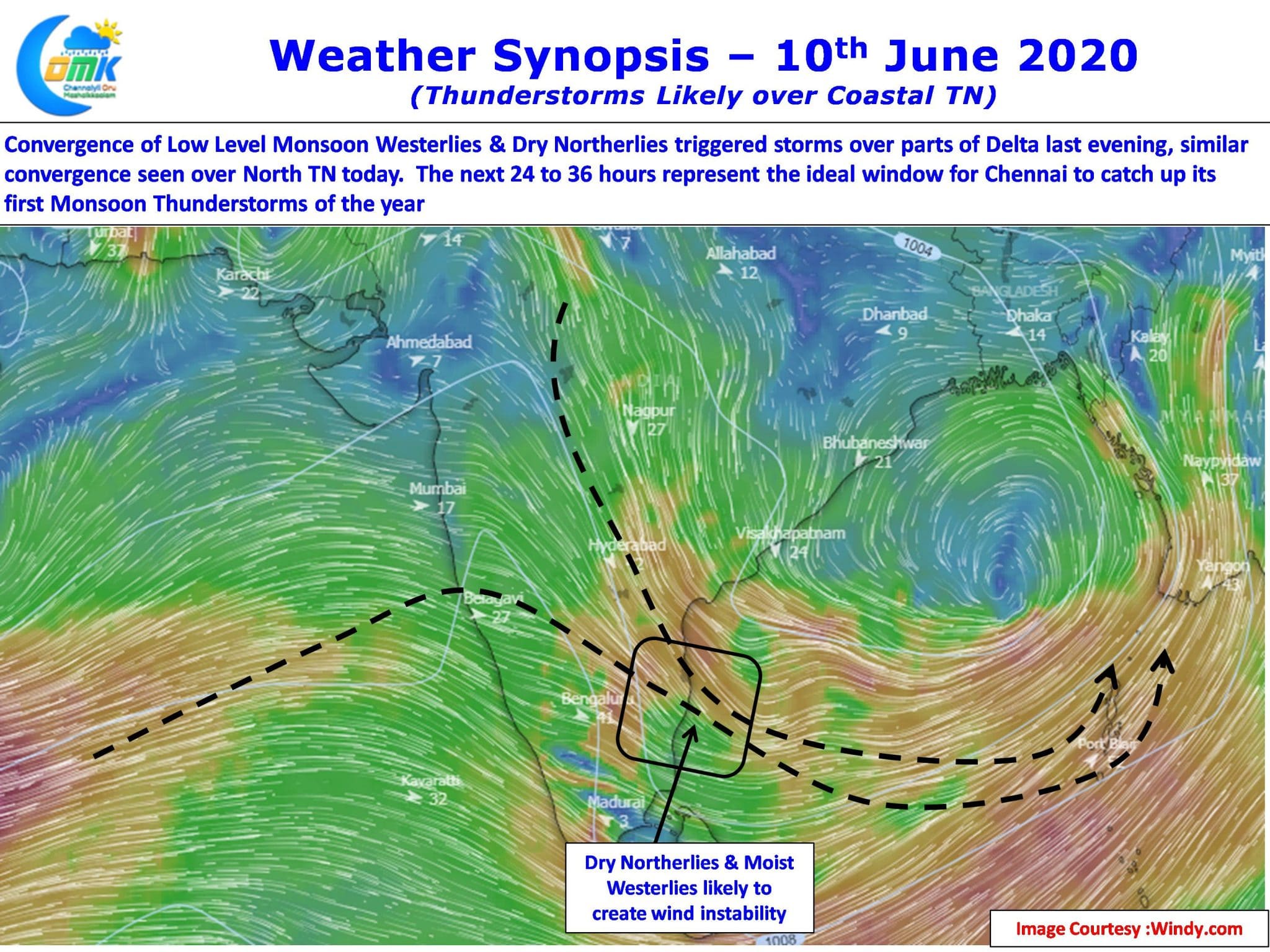
Yesterday IMD confirmed the first Monsoon Low of the season over central parts of Bay of Bengal. Influenced by the Low Pressure wind convergence triggered thunderstorms over parts of Delta yesterday in the evening with places like Karaikal, Nagappattinam getting moderate rains.

With Low Pressure expected to move in a WNW direction and intensify into a Well Marked Low over the next 48 hours or so. As the Low deepens it is likely to create a drag of monsoon winds over Peninsular India thereby giving an impetus to the Somali Jet, the driver of monsoon surge, increasing its strength.

In the meanwhile the low will also create a zone of wind convergence and associated instabilities to trigger thunderstorms over parts of Tamil Nadu. These thunderstorms normally happen during the early life cycle of a low pressure until it deepens. With westerlies oscillating around 20 knots and the Low Pressure bringing the Dry Northerlies over the East Coast of Peninsular India it provides the right environment for coastal places like Chennai to see thunderstorms.

The next 24 to 36 hours represent the ideal window for Chennai & Suburbs to catch up with the first monsoon thunderstorms of the season post which things will skew towards a strong monsoon surge. There is fairly high confidence & consistency among models for Chennai and suburbs to catch one good spell today with isolated places likely to see moderate to intense spell of rains later in the day.


