Last couple of days saw Monsoon surge over the West Coast of India with many places recording heavy rains. While Konkan coast along Maharashtra saw heavy rains on Wednesday, Thursday saw Karnataka coast record good rains with places in Kodagu district also recording moderate to heavy rains in the Cauvery catchment areas.

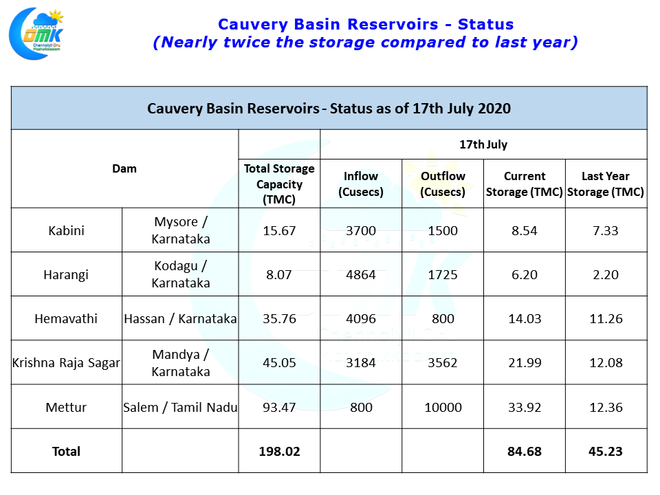
Though its ironical that we are now into the second half of July and still the smallest dam in the Cauvery Basin, Harangi with just 8 TMC of storage is not yet full while Kabini the one to normally fill first is just above half way mark in terms of available storage. But there is no reason to worry yet if one goes by the status as of mid July last year. The overall storage in the Cauvery Basin is still nearly twice the storage that was available at same time last year.

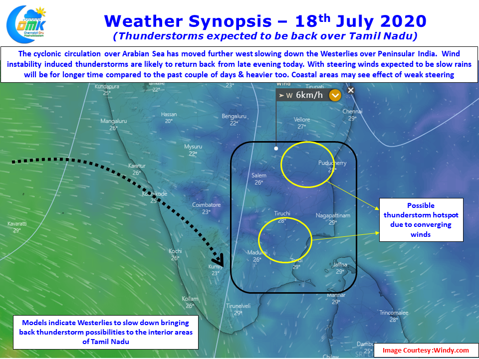
While monsoon is expected to weaken again one should not forget the role of thunderstorms over South Interior Karnataka & adjoining parts of Tamil Nadu in providing good inflows into Cauvery between KRS & Stanley Reservoir. Additionally for the rivers like Palar, Pennaiyar these thunderstorms are the biggest source of inflows unlike its siblings like Cauvery, Tamiraparani & Vaigai. With Westerly winds slowing down once again thunderstorms are expected back over Tamil Nadu.

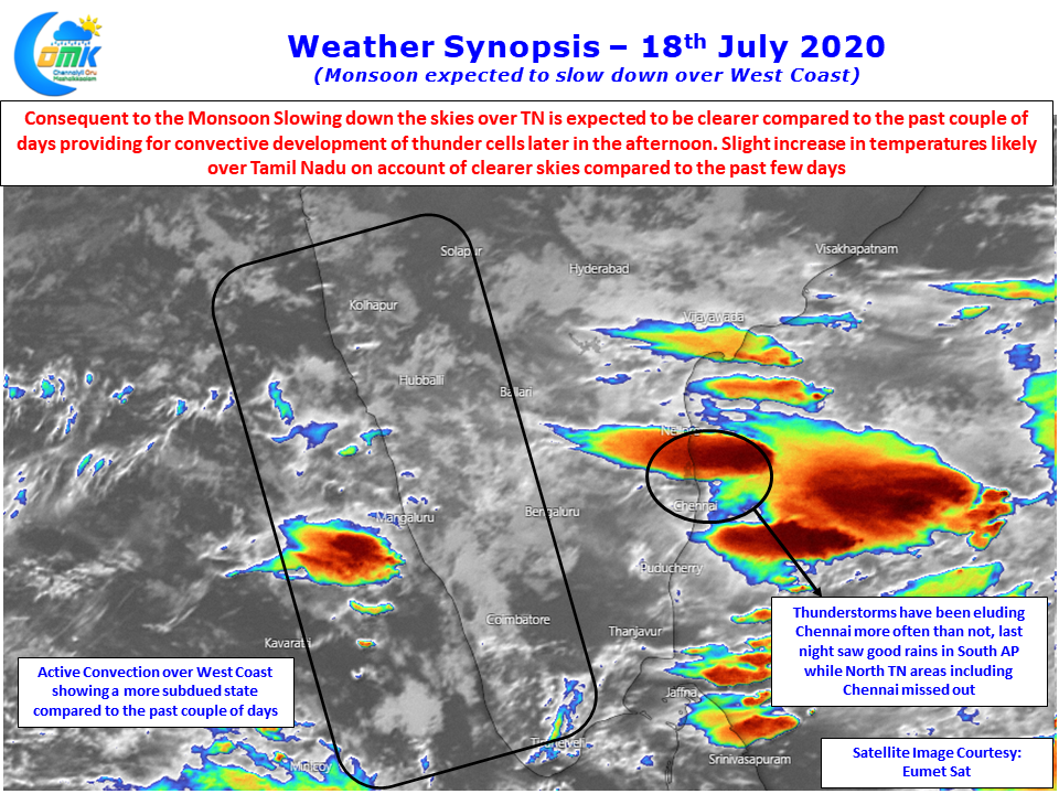
Today fairly widespread thunderstorms are indicated by weather models with isolated heavy spell of rains likely due to poor steering winds. Unlike the past couple of days when thunderstorms whizzed past coastal places like Chennai. As has been the case for the past couple of days, last night also saw thunderstorms over South AP bringing good rains over places like Nellore while North TN saw isolated showers around Ponneri & Gummidipoondi but Chennai pretty much was a spectator.

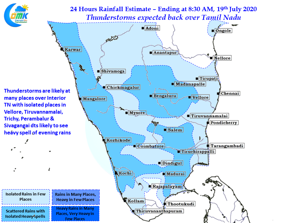
With slightly more clearer skies expected today over Tamil Nadu consequent to the absence of wide spread active convection over West Coast convective development of thunder cells can be expected over the interior areas of North TN like Vellore, Tiruvannamalai. Similarly one or two places in Trichy, Karur, Perambalur & Sivagangai districts could also see late afternoon thunderstorms with intense spells at times.
Coastal places like Chennai will possibly get some sea breeze induced thunderstorms if westerlies weaken well by today otherwise they may happen tomorrow. Some places though may get benefited from the interior storms moving to the coast.


