As Indian Subcontinent slowly heads towards the final phase of this year’s Southwest Monsoon there will be an increase in thunderstorm activity as wind pattern starts becoming erratic in cue to the seasonal change for the upcoming Northeast Monsoon.

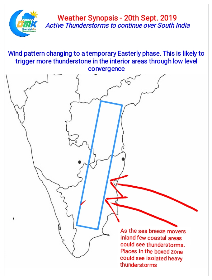
The upcoming few days will give a preview of the Easterly regime as a developing Low Pressure Area off Maharashtra coast is likely to create a pseudo Easterly wind pattern. The immediate impact of this slight alteration in the wind pattern would be the shift of lower level wind convergence zones. Unlike being closer to the coast for the past few days the next few days would see the convergence zone shift further to the West over the interior areas taking the Thunderstorms zone along with it.

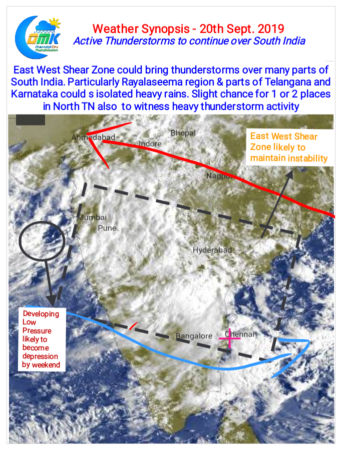
On a slightly larger scale the persistence of an East West Shear Zone over Peninsular India is likely to keep Thunderstorms rolling in the region. With one circulation on the verge of becoming a low in Arabian Sea another Circulation could soon form in the Eastern side of the East West Shear Zone. Models expect this Circulation also to descend into a low pressure in the coming week. Once this system completes its life cycle we may see some firm shift towards Monsoon Withdrawal.
Today once again parts of Rayalaseema along with adjoining areas of Telangana & Karnataka could see Thunderstorms while one or two places in the region could see heavy spells of rains. One or two places in North TN also could see heavy spells of rains later in the night.


