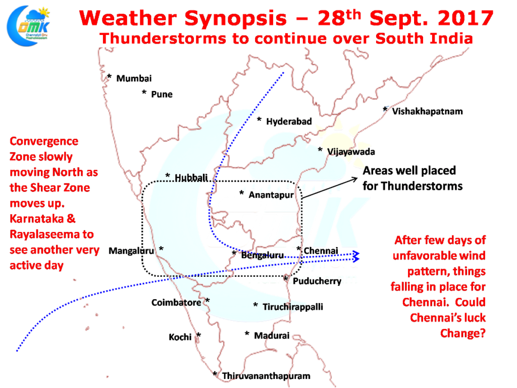
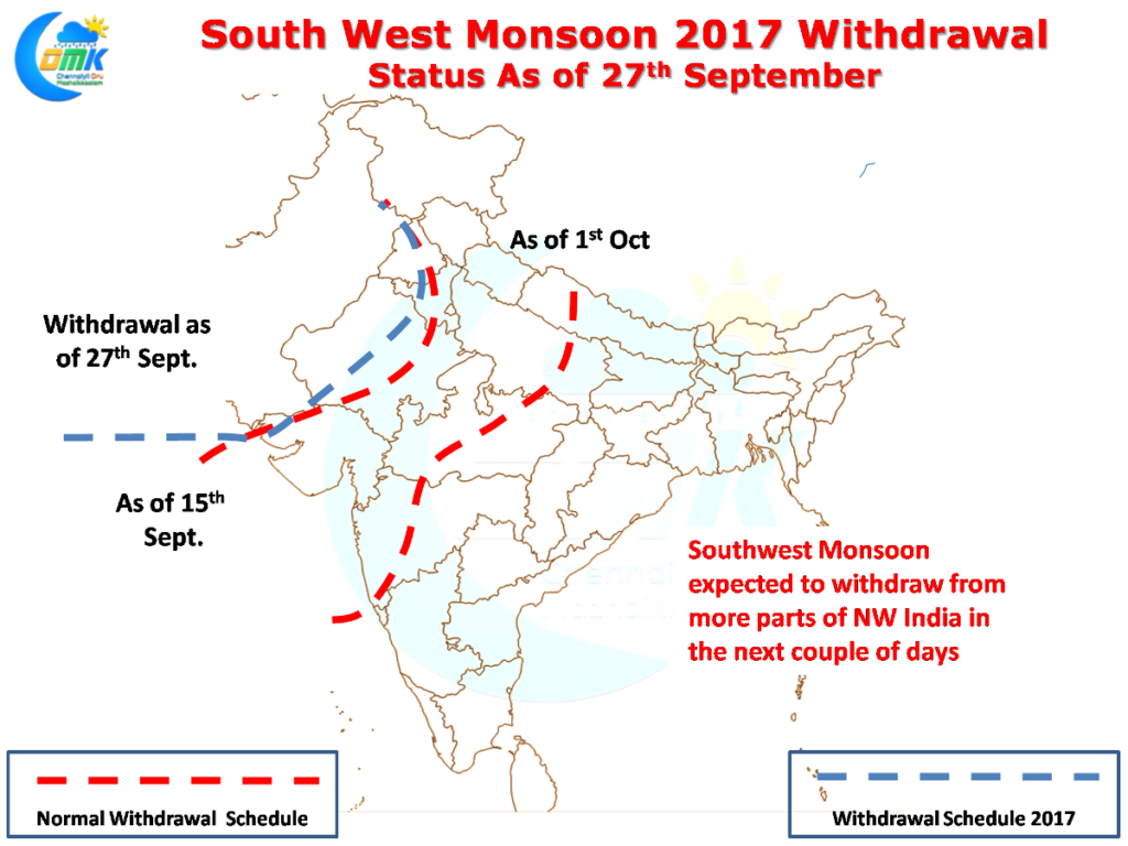
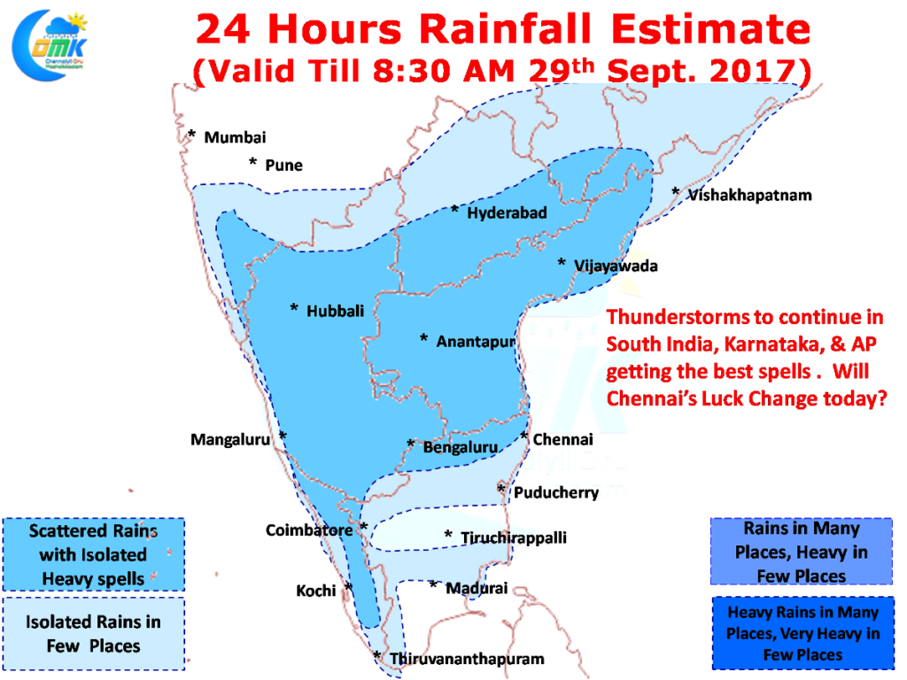
Thunderstorms continued to flex its muscles over many parts of South India in particular over Interior Karnataka & South Andhra Pradesh recording moderate to heavy rains in many places. Southwest Monsoon 2017 has started to bid adieu to the Indian Sub Continent with IMD officially announcing the start of the withdrawal process yesterday with parts of Punjab, Haryana, Kutch & Rajasthan seeing monsoon withdraw. Further withdrawal over NW India is expected in the next couple of days
While most of South India especially North of 10N latitude continued to enjoy decent bit of thunderstorm activity Chennai was mostly left to see from afar thanks to unfavorable wind pattern prevailing under the influence of the Upper Air Cyclonic Circulation in Bay of Bengal. But since late evening yesterday things have got better for Chennai with more Westerly slant to the winds than Northerly slant making the prospects of some thunderstorm activity over Chennai better.
 Over the last few days if one observes the convergence zone it has been slowly moving up in sync with the East West Shear Zone which has been climbing up the latitude after starting around 10 N around the weekend. Today once again the convergence zone is over South Interior Karnataka, Andhra Pradesh and parts of North Tamil Nadu.
While models do not show much rainfall prospects for Chennai if one were to look at the wind charts Chennai is falling bang in the middle of the zone were the Northerlies & Westerlies converge with the trough line passing very close to Chennai later in the day. Will Chennai’s luck change today? We think Chennai is due a good thunderstorm activity and between today & tomorrow represents our best chance before September winds down.
Powered by WPeMatico


