When it Rains it Pours goes the saying. This is almost always applicable to Chennai & suburbs. Though the city area once again missed out the southern suburbs of Chennai received the heaviest spell of this year’s Northeast Monsoon season as many private weather stations recorded triple digit rainfall scores around the southern suburbs & OMR areas.

Not only did Chennai suburbs recorded good rains entire coastal region all the way from Chennai to Delta recorded very good rains as for indicating the active monsoon conditions that is slowly falling in place. Cuddalore & Pondicherry have recorded good rains for the second consecutive day with the streak likely to continue as things stand.

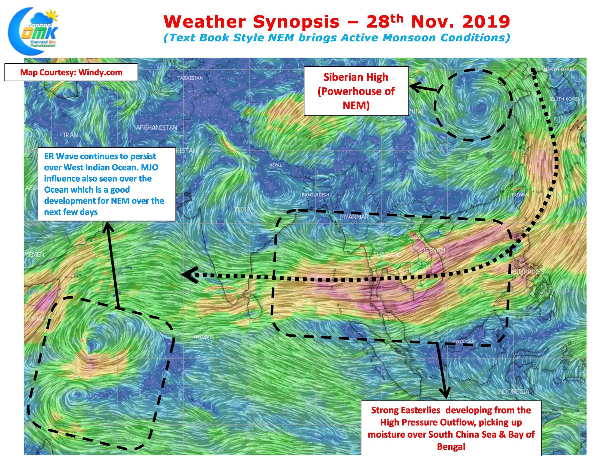
The wind charts indicate the text book style Northeast Monsoon conditions that is prevailing now. A strong Siberian High thats pushing the outflow winds onto South Asia via South East Asia. Good conditions over South China Sea & Bay of Bengal that is giving lot of moisture over South China Sea & Bay of Bengal. This has brought in active monsoon conditions over Tamil Nadu and is likely to persist over the next few days giving some much needed rains to the coastal stretch between Chennai & Delta that is still under deficit so far.

Today once again conditions are conducive for widespread rains over most parts of Coastal Tamil Nadu. As is the pattern during NEM the rains will peak after midnight over the coasts and the remnant moisture will travel interiors to give day time thunderstorms to these places. Weather models indicate an uptick in rainfall pattern tomorrow which will bring possibly the best spell of this year’s NEM for the next few days.
As things stand we request our followers not to look beyond 48 hours and enjoy the spell of rains that is on the way. We are still on course to end the season on a high so nothing to worry yet.


