It has been about 5 weeks since SWM made its entry over the Indian Main Land. During this period Monsoon has not been so kind to southern parts of Peninsular India. Down south in Kerala only 4 districts fall under normal category according to IMD classification. Even among these 4 districts Mahe (administratively under Pondicherry) is the only district that has a positive anomaly. The key Cauvery catchment districts like Wayanad, Hassan and Kodagu are at -40%, -46% and -16% respectively. The cumulative inflows into Cauvery Basin dam as on date is at 35.7 TMC. This is certainly way better than the 10.6 TMC received last year.
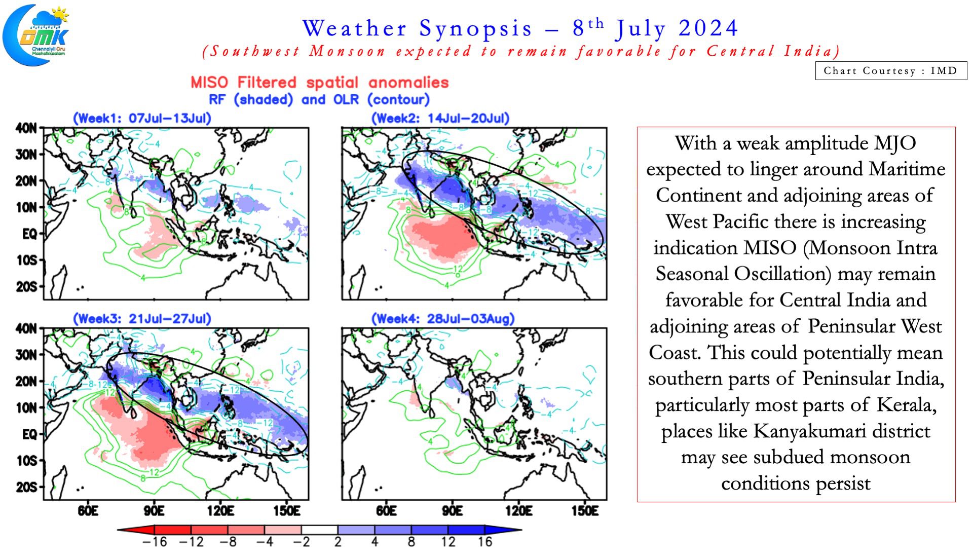
As an earlier post few days back highlighted Cauvery has been suffering early season pangs more often than not recently. The worry of early season pangs may not be much of a worry if the sub seasonal outlooks are positive. With seasonal outlooks based on July IC coming in indications are July may also remain weak for Cauvery basin. The sub seasonal ensemble forecasts, possibly influenced by the unfavourable MISO also reiterate that. Monsoon Intra-seasonal Oscillation (MISO) seem to once again favour Central India. SWM as we know is driven by circulations or LPAs’ that form over Bay and move into IGP and Central India.


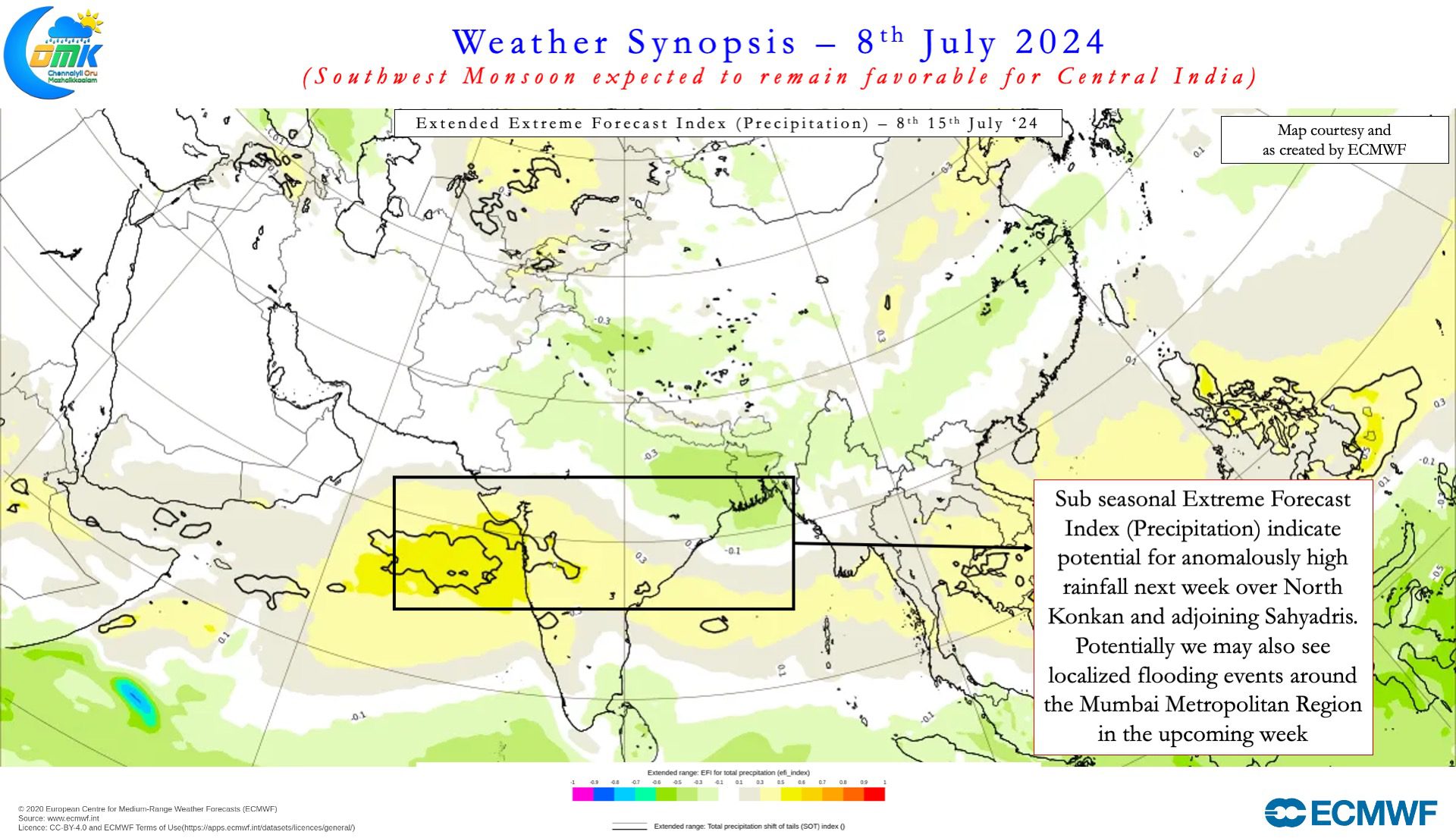
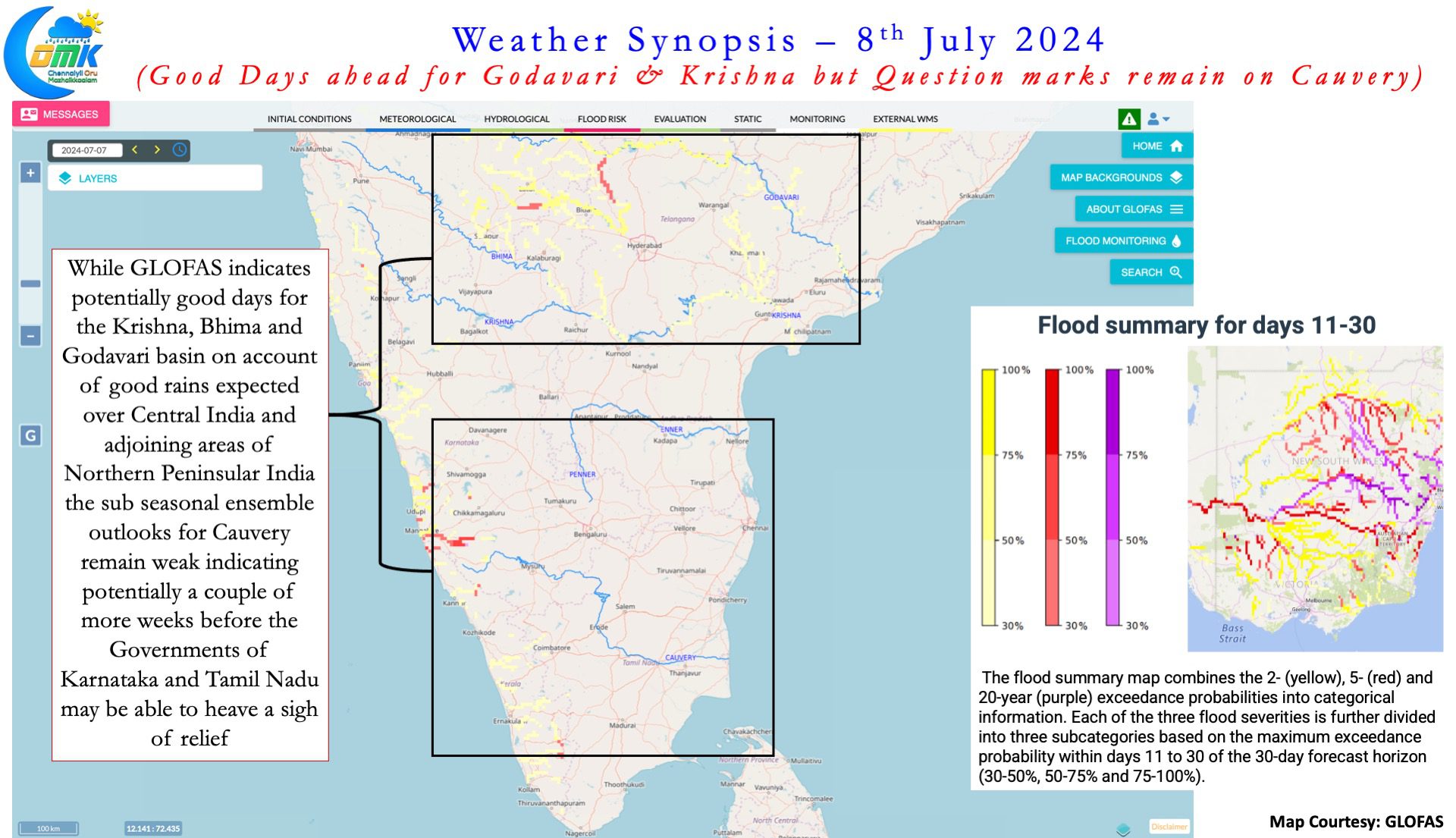
With MJO continuing to struggle against base state transition dynamics it has continued to remain weak around East Indian Ocean and Maritime Continent areas. This in turn will possibly push regular pulses into Bay of Bengal that may move towards Central India. As things stand over the next couple of weeks though there could be multiple pulses they may not favour southern parts of Peninsular India. Sub seasonal precipitation forecasts indicate active SWM over Central India and adjoining areas of Peninsular India due to this. Additionally GLOFAS,a very good tool to look at medium and long term flood scenarios also seem to indicate the same. It shows high probability for near normal inflows into Godavari, Bhima, Krishna in the 11 – 30 day time period. In the same context no / weak signal over the Cauvery Basin potentially mean lower than normal inflows.
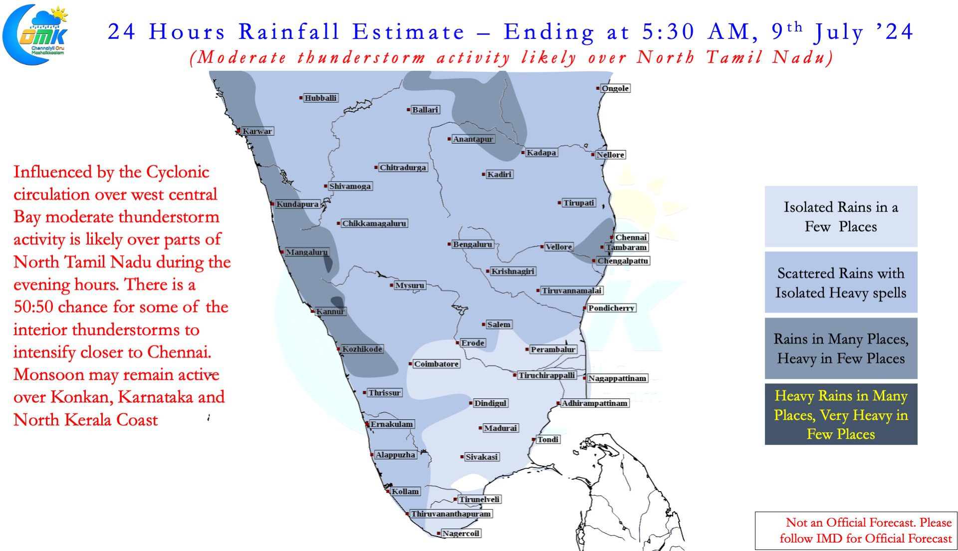
On the thunderstorm front over the next 3 or 4 days leeward areas of Tamil Nadu can look forward to late evening rains. With the cyclonic circulation seen over West Central Bay wind convergence may favour North Tamil Nadu and South AP. Both the IMD observatories in Chennai has recorded 35 cms already since the start of SWM. As a matter of fact Palayamkottai and Coimbatore AP are the only two IMD stations in the state to have a negative anomaly in the state. With another 2 or 3 days of thunderstorm activity expected there is a good chance both the observatories in Chennai may reach 400 mm before mid July.

