
The last week or two has seen Monsoon remain relatively quiet over South India with even the Ghats slowly seeing reduced rainfall numbers. Talacauvery, a place which is associated with the performance of Southwest Monsoon recorded 0 mm for the first time this season for 24 hours ending today morning.

Though Tamil Nadu has been seeing fairly active thunderstorms over the last couple of days most of North TN in particular the coastal districts of Kanchipuram, Chengalpattu, Tiruvallur & Chennai have been relatively dry with not much activity seen. Unlike the proper Break in Monsoon period which favors thunderstorms for Tamil Nadu the current phase of suppressed atmospheric conditions is due to unfavorable phase of Monsoon oscillation.
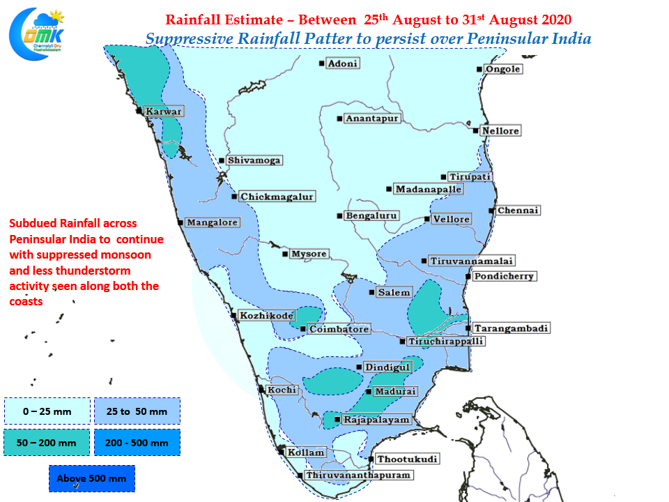
Bay has been churning back to back lows though it has not meant any uptick in rainfall over the west coast of South India. These low typically form in North Bay travel along the trough giving good rains to parts of East India, Central India & Subsequently the dry arid desert areas of Rajasthan & Kutch. IMD’s long range forecast indicates the suppressed state of affairs is likely to continue until month end with September promising a bounty with the return of favorable MISO. Till then we have to sit tight and wait for our turn
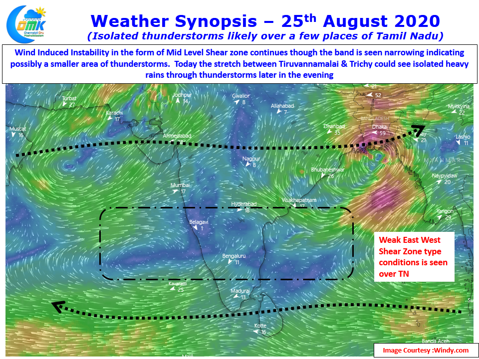
In the meanwhile today also parts of Tamil Nadu could see thunderstorms on account of the East West Shear Type conditions that is prevailing over the southern parts of Peninsular India. While it has weakened considerably compared to couple of days it is still likely to bring isolated heavy rains to parts of North TN between Tiruvannamalai & Trichy stretch.