
Last evening saw scattered thunderstorms over parts of Central & South TN while North TN saw isolated thunderstorms in a few places. In an indication of strengthening Westerlies parts of Chennai saw a batch of fast moving thunderstorms dumping high intensity rains for a short while before heading for the coast. At the COMK AWS in Anna Nagar 5.6 mm of rains was recorded though the entire spell lasted only 7 minutes in all. Northern suburbs of Chennai though recorded better spell of rains as thunderstorms went in a NE direction along the western suburbs of the city
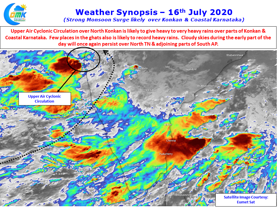
An upper air cyclonic circulation over the Konkan coast along with an East West Shear Zone over Central India has given some momentum to monsoon dynamics. Satellite image shows once again partly cloudy skies to persist from the remnant thunderstorm activity of yesterday night over most parts of Central & North TN. This is likely to keep the temperatures under check once again also make the possibility of early thunderstorms relatively less.
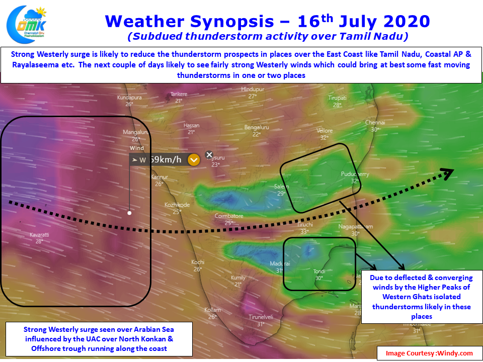
Wind charts though pretty much confirms the increasing strength of Westerlies with most parts of TN likely to come under 30 – 40 km/h low level westerly speeds. This is bound to not only keep thunderstorm development under check but also drag thunderstorms faster towards the coast making the hit & move rains as the order of the day.
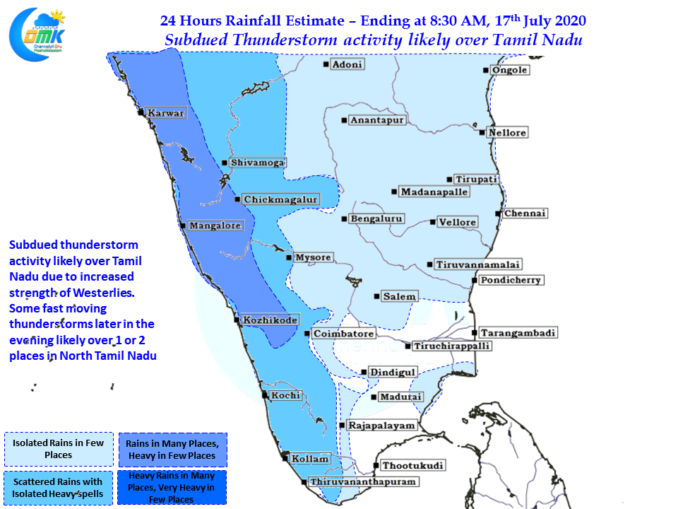
Overall though subdued thunderstorm activity is likely to be seen for the next couple of days as Monsoon surge brings heavy rains over Konkan & Coastal Karnataka. Isolated places are likely to see heavy to very heavy rains in the region. Kerala may see lesser monsoon surge compared to places further up North as the trough effect seems weaker over the southern parts of West Coast.
The stretch between Pondy & Chennai may see some thunderstorm activity today along with parts of South Delta & adjoining areas of Pudukottai dt. But overall it will be sharp spell of rains of high intensity rather than the stand and deliver type of rains that happened last week.