
The last couple of days things have slowed down on the thunderstorm front in Tamil Nadu with yesterday seeing mostly the rains restricted to North Tamil Nadu around 13 N with parts of Chennai enjoying some sharp spell of showers. While both the IMD observatories missed the rains the TN Government PWD weather station at Red Hills recorded about 35 mm rains bulk of which fell in a 15 minute spell.
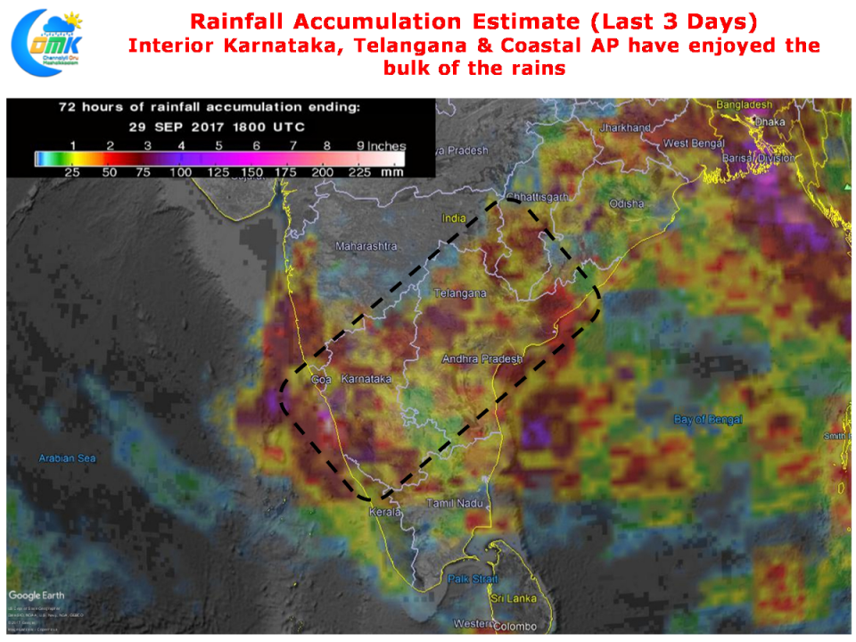
The precipitation accumulation chart for the last 3 days indicates the slowing down trend with bulk of the activity happening over Interior Karnataka, Telangana & Coastal Andhra Pradesh. The good rains which the west interior districts on Thursday possibly the best spell for TN along with parts of Delta districts.
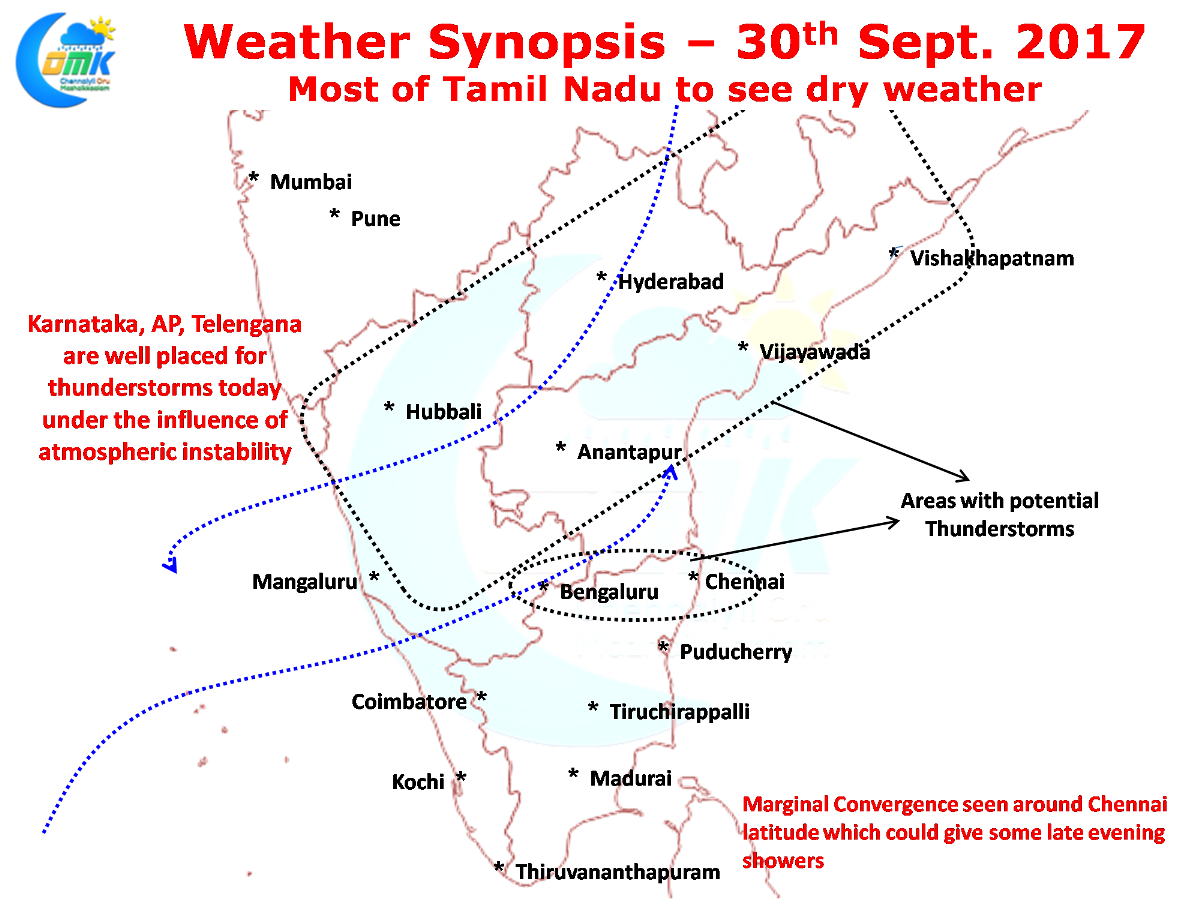
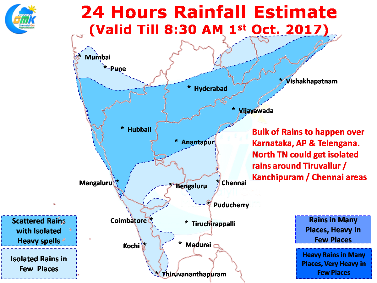
If one were to see the wind charts its quite obvious the convection band on account of the atmospheric instability is likely to shift further North. The convergence zone is around 14 N latitude now and the instability zone is likely to run along Odisha, Coastal AP, Telangana, North Interior Karnataka and parts of Maharashtra. Isolated places in this region is likely to see moderate to heavy rains.
There exists a marginal lower level convergence around 13N between Bangalore & Chennai which could possibly trigger some evening thunderstorms around this region. It could be similar to yesterday with some late evening thunderstorms aided by the sea breeze front as well and possibly providing some sharp spell of rains in a few places of Kanchipuram, Tiruvallur & Chennai region.
Rest of Tamil Nadu could see mostly subdued thunderstorm activity.