
Southwest Monsoon has been mostly subdued for the past couple of weeks over West Coast except for a spell or two of moderate rains in the ghat areas of Kerala & Karnataka. It is an irony the accumulated rainfall recorded at the Colaba station of IMD in Mumbai is 183.8 mm for the past 30 days which is even lesser than the 188.1 mm recorded by the IMD observatory at Nungambakkam in Chennai. This pretty much sums up the state of Southwest Monsoon for the past couple of weeks.
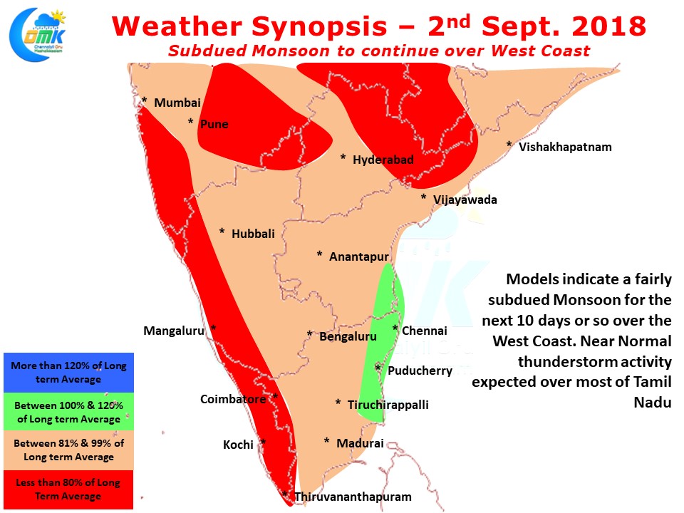
If one were to look at model outputs it appears similar conditions are likely to persist for the next week to 10 days with weak monsoon conditions seen. While this could mean good news to people of Kerala & Kodagu who are recovering from the devastating floods we will have to see how much of an impact this would have on the overall storage positions in dams as from now on under normal context the dams will not see heavy inflows and will have to have sufficient storage until early June next year to satisfy agricultural / power / drinking water needs.
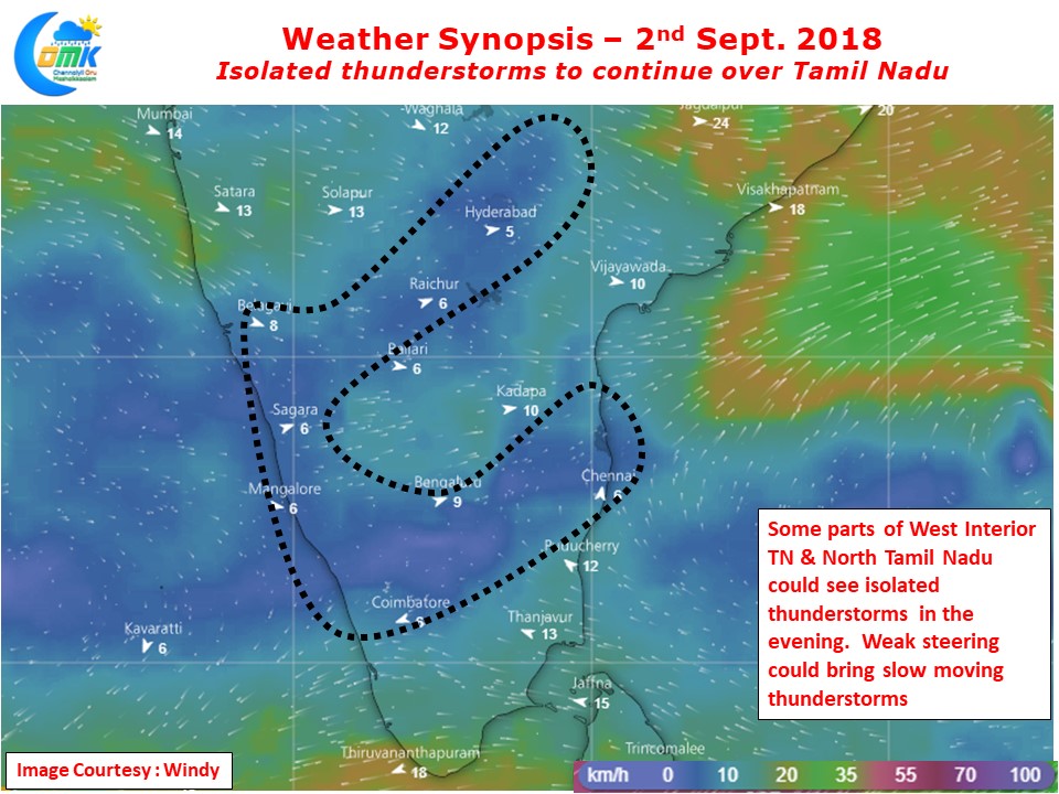
As far as today’s weather synopsis goes we could possibly see some isolated thunderstorm activity over parts of Tamil Nadu. Wind instability is seen at Mid Troposospheric levels over parts of West Interior & North TN which could see thunderstorm activity. With weak steering winds likely to play spoilsport some of these storms may not reach the coast at all. While on the overall scale things look good for thunderstorms in North TN it could be touch and go for Chennai due to the weak steering winds. Nevertheless the places that get lucky could see heavy spells of rains on account of slow moving thunderstorms.