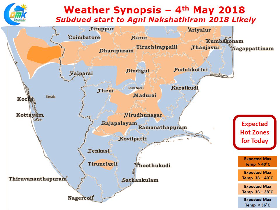
Today marks the beginning of Agni Nakshathiram period, the hottest period, as per traditional almanacs of India. Also called Kathiri Veyyil period in Tamil, typically a period of media frenzy as well with a lot of discussions on weather among the common public. The typical discussions center around how hot will the Kathiri period be and whether will it be hotter than last year.
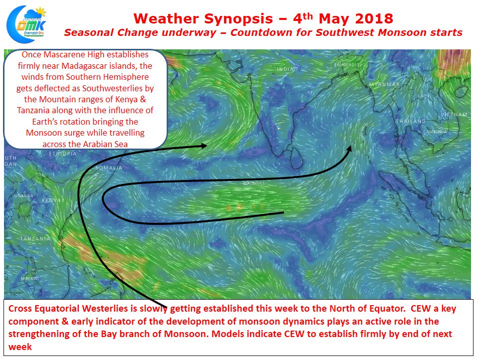
Chennai though normally sees some of its hottest days in the second half of Kathiri period or possibly just after the end when the Westerlies strengthen under the influence of monsoon dynamics. While staying on monsoon dynamics, wind charts indicate the advent of Cross Equatorial Westerlies one of the early indicators of the monsoon dynamics getting churned. As we progress into next week weather models indicate the cross equatorial winds are expected to strengthen improving the Bay branch of monsoon dynamics. While the Monsoon onset over Kerala is 1st of June lets not forget Southwest Monsoon in a normal year reaches the Indian shore on May 15th when it makes a grand touch down over the Southern parts of Andaman Islands.
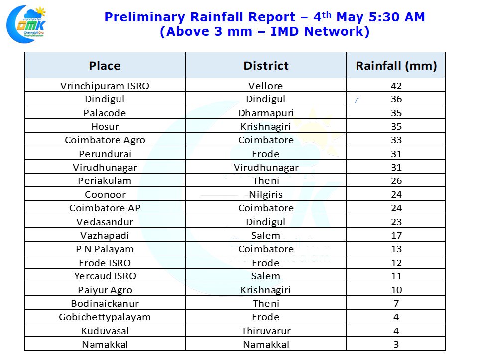
The thunderstorm story in the interiors is also an indicator of the Seasonal Cusp currently happening. Yesterday also saw parts of Erode, Dindigul, Coimbatore, Vellore & Krishnagiri districts record good rains from late evening thunderstorms. Travelling right across the Peninsular India starting from the Eastern Ghats around Tirupati in the evening the thunderstorms have crossed the Western Ghats into Kerala during the wee hours today. With Kathri Veyyil / Agni Nakshathiram dominating many a discussion among the commoners we thought it makes sense to give a brief inference on what can be expected.
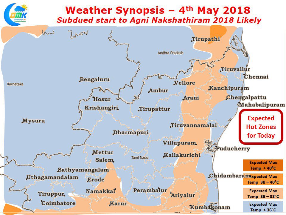
Models indicate a fairly subdued start to the Agni Nakshathiram period with temperatures likely to be closer to normal. As a matter of fact for the next few days models are indicating most of Tamil Nadu to see slightly below normal day time temperatures though in reality possibly they could be closer to normal.
Most parts of the state is likely to see temperature stay slightly below normal today due to partly cloudy skies during the early part of the day along with remnant thunderstorms retaining some moisture in the interiors. Also models are indicating the Easterlies to be fairly active keeping a check on temperatures as well.


