
As Southwest Monsoon gets ready to move into the final phase of its annual cycle the wind pattern over Peninsula India is scrambling up indicative of the upcoming withdrawal thunderstorm activity.
The Well Marked Low pressure off the coast of Gujarat is expected to intensify into a Depression by tomorrow and continue its journey in W/NW direction fading away from its influence over Indian Sub Continent.
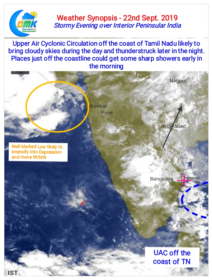
In the meanwhile another Upper Air Cyclonic Circulation over Bay of Bengal off the Tamil Nadu coast is likely to influence weather events over Peninsular India for the next couple of days.
With already Westerlies weakened by the Low Pressure up North the UAC has allowed pseudo Easterlies to intrude well into Peninsular India triggering a wind convergence zone over the interior parts of South India. In particular the areas where AP / TN & Karnataka borders meet is likely to see heavy wind instability which is likely to trigger violent thunderstorms over the region.
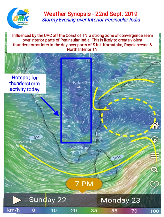
This strong convergence zone starting from 1.5 KM’s ASL altitude is likely to see highly unstable atmospheric conditions allowing thunderstorms to develop at many places over the districts of Kolar, Bengaluru Rural, Krishnagiri, Dharmapuri, Salem, Tiruvannamalai, Chittoor & parts of Vellore.
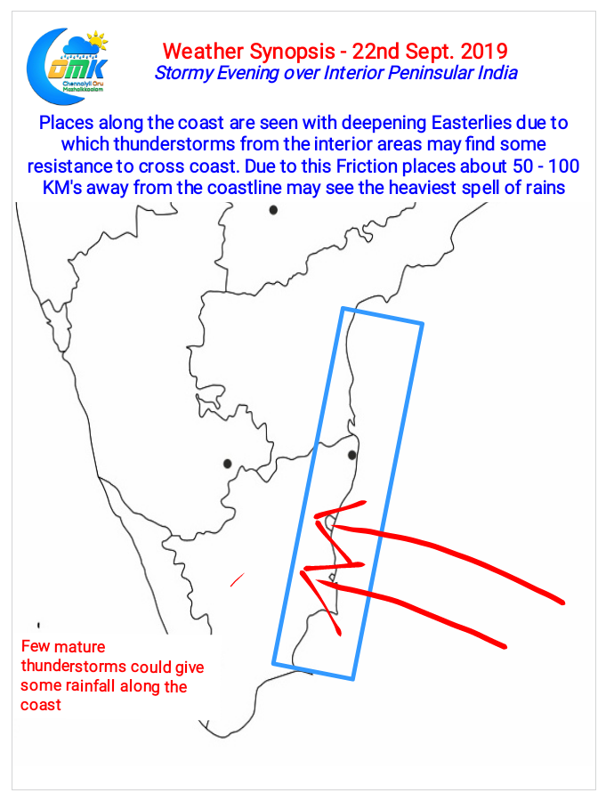
The deepening Easterlies mean coastal areas which were seeing interior thunderstorms move across comfortably last week will face see some resistance in the form of upper level winds. This friction could mean places about 100 KM’s to the west of the coastline will see heavy spells of rains through near stationary storms.
Coastal areas like Chennai though could benefit from some early morning showers due to pseudo NEM like conditions on account of the UAC