Former Chief Minister of Tamil Nadu, the late Arignar Anna once mentioned “வடக்கு வாழ்கிறது, தெற்கு தேய்கிறது” in the context of South India getting lesser share in Union Budgets compared to North India. If one was to use similar analogy for Peninsular India weather during Southwest Monsoon we could say “When West Sleeps the East gets active”.

The Well Marked Low that had given heavy rains to large parts of Central India is likely to give another day of heavy rains to Rajasthan & Gujarat before moving further West into Pakistan. Once it’s life cycle comes to an end we can look at possibly a break in Monsoon conditions increasing the Thunderstorms possibility for Tamil Nadu.

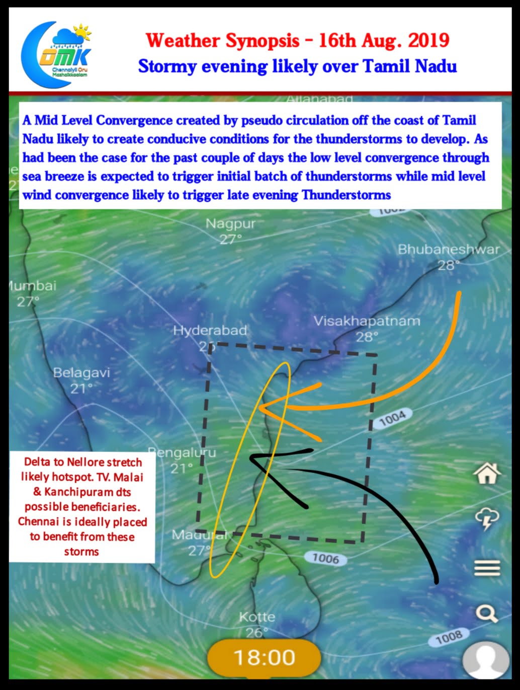
The last couple of days while Monsoon has not exactly been active in the Peninsular West Coast the thunderstorms over Tamil Nadu has picked up. One of the key reasons is ofcourse wind induced instability but one could never ignore the role the return of Sea breeze front plays in the development of these storms. In particular coastal places like Chennai should thank sea breeze not only during summer but also during the thunderstorm season. Today once again lower level convergence in the form of Sea Breeze is likely to benefit coastal Tamil Nadu.

But the more interesting factor to be looked out for today is possible role of Wind Convergence at Mid Level (5.5 kms ASL) triggered by a circulation off the South TN coast. This is likely to make atmospheric conditions ripe for thunderstorm activity over many places of Tamil Nadu. In particular the districts of Tiruvannamalai, Kanchipuram & parts of Vellore, Tiruvallur & Villupuram could benefit the most from this convergence. Chennai is ideally placed to get a decent spell of rains today from Thunderstorms developing in these districts. While North TN could benefit the most places in South TN around Madurai could get a spell or two of rains too.


