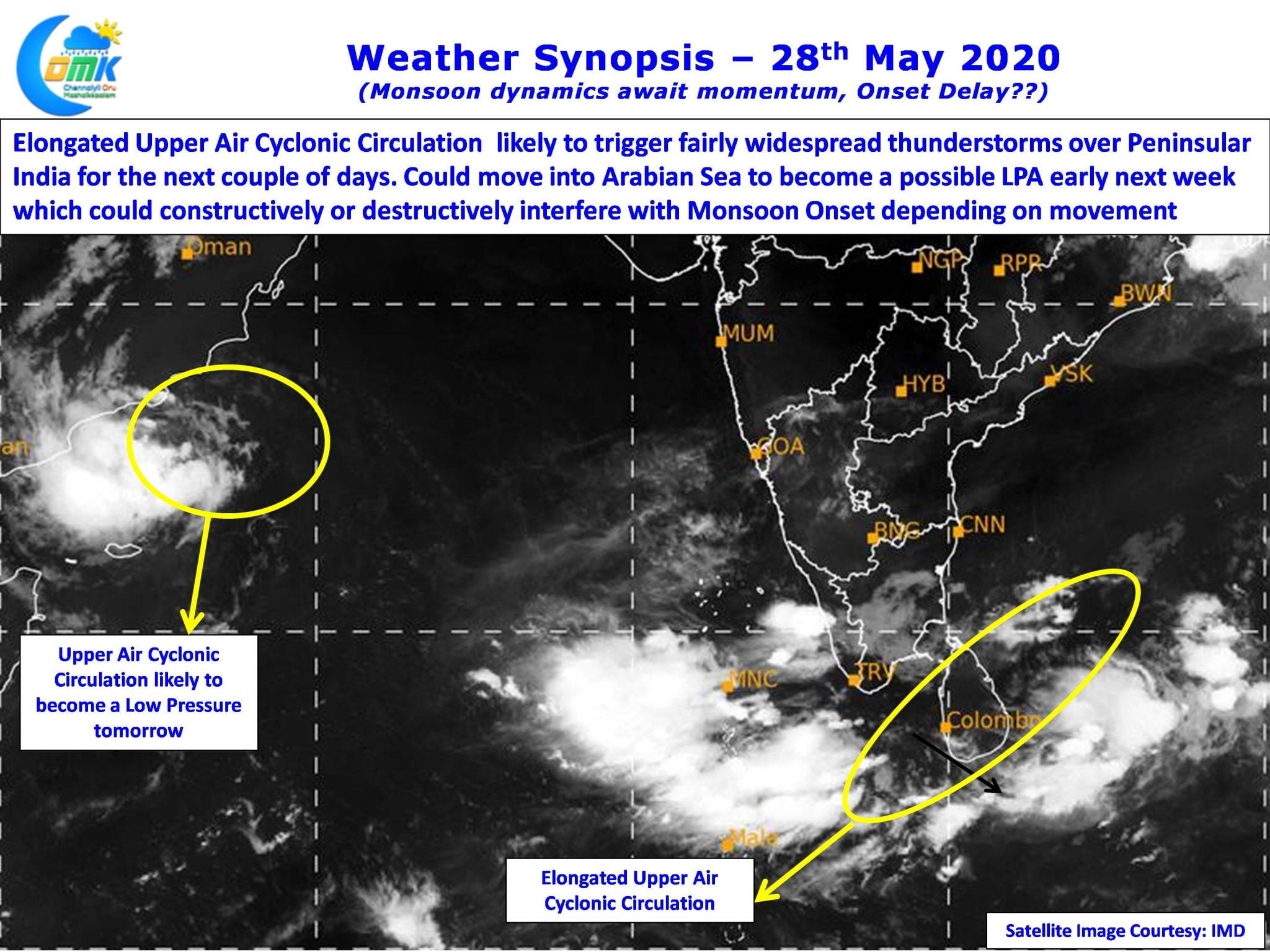
Yesterday saw a very active evening of thunderstorms with many parts of the state recording fairly intense thunderstorms. Hailstorms were reported over parts of Tirupathur, Tiruppur & Salem districts as wind induced instabilities created by the Upper Air Cyclonic Circulation off the TN coast aided the thunderstorms triggered by the convective process through day time heating.

In the meanwhile the wait for proper development of monsoon dynamics continues with a likely Low Pressure to develop off the Arabian Peninsular tomorrow. IMD expects this to strengthen into a depression. Slightly closer home the elongated circulation off the coast of TN is likely to become a joker in the pack as far as Monsoon Onset goes with models fairly consistent in expecting this pulse to move into Arabian Sea and possibly develop into an organized disturbance off the coast of Kerala. Depending on the movement it could interfere in the onset process constructive or destructively. It appears we could see some delay in the Monsoon Onset over Kerala which is traditionally on 1st June.

Coming back to current conditions the elongated upper air cyclonic circulation off Sri Lanka & TN coasts is likely to remain favorable for the next couple of days triggering thunderstorms over the interior areas through wind convergence with dry Northerlies creating wind instabilities over the southern parts of Peninsular India.

Today most parts of the state have a chance for possible thunderstorms except for those areas about 40 / 50 kms from the coast line between Chennai & Chidambaram which will fall under unfavorable wind pattern. Today once again we can see possible hailstorms over many places in the state with Tiruvannamalai, Vellore, Ariyalur, Perambalur, Madurai, Dindigul, Viruhdunagar dts remaining vulnerable for intense thunderstorms later in the evening.


