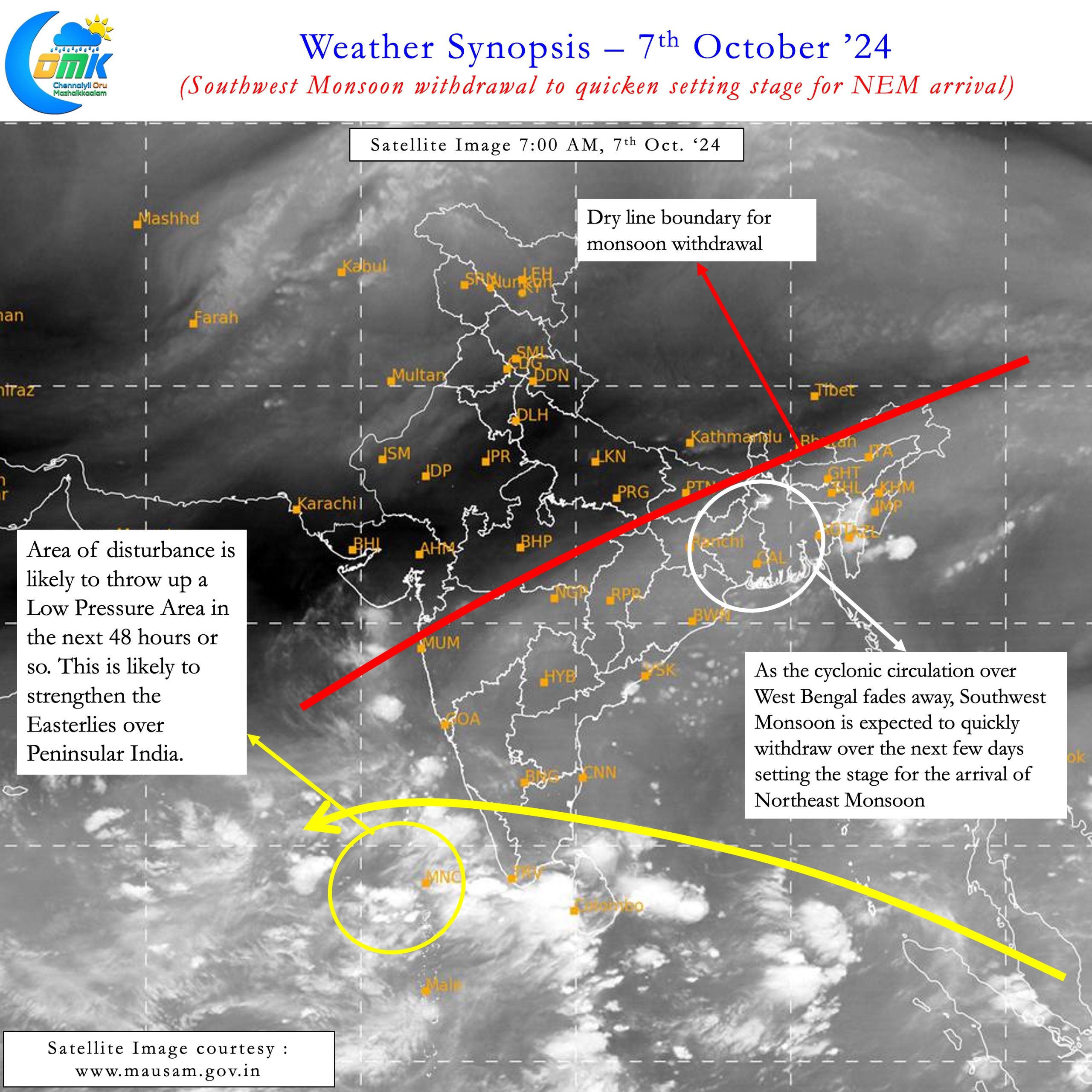
It is now nearly two weeks since Southwest Monsoon withdrawal started almost a week behind schedule this year. After withdrawing completely from NW India Southwest Monsoon withdrawal has now covered parts of MP, UP and most of Gujarat. By 5th October in a normal year Monsoon would have withdrawn from all of Gujarat most of MP and UP. The Low Pressure area over North Bay and adjoining Gangetic Plains had held back the withdrawal so far. Now with the remnant circulation from the LPA expected to weaken stage is set for Southwest Monsoon Withdrawal to quicken. This quick withdrawal over the next few days will also set the stage for the arrival of Northeast Monsoon
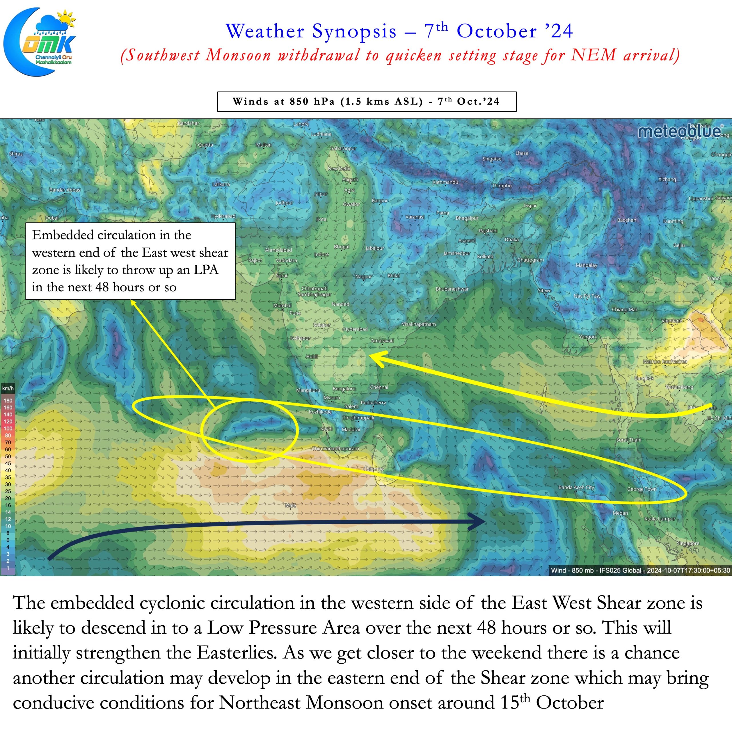
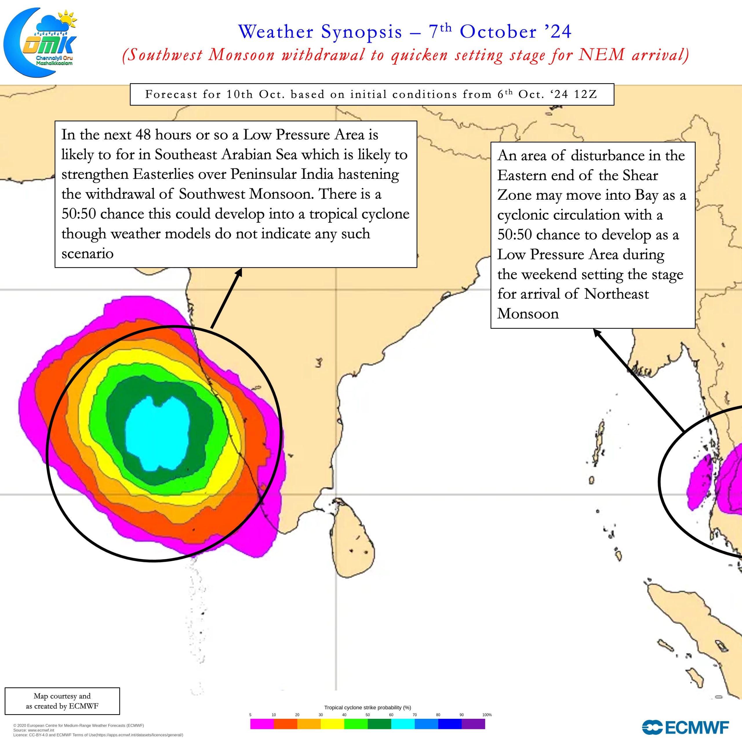
A developing circulation over South Arabian Sea is expected to become LPA in the next 48 hours. This embedded circulation in the East West Shear Zone will be a catalyst for Easterlies. This will strengthen Easterlies over South Bay and Peninsular India effectively ending the westerly regime. The satellite image indicate the dry line currently in sync with monsoon withdrawal charts. Weather models at the moment do not expect the LPA over Arabian sea to develop into a strong disturbance. But there is a 50:50 chance this could become a cyclone. Weather models in the past have underestimated cyclone potential over the Arabian Sea.


Meanwhile our eyes will have to look Far East for potentially the next circulation from the Shear Zone. Towards the end of next week a fresh cyclonic circulation is likely to move into South Bay. While the circulation by itself is likely to help for onset conditions. There is a good chance this could develop into an LPA over South Bay which could greatly enhance the Onset conditions for Northeast Monsoon. We will look into this circulation in detail as onset window gets closer. As things stand there is a very good chance for Northeast Monsoon to check in on or before 15th October.
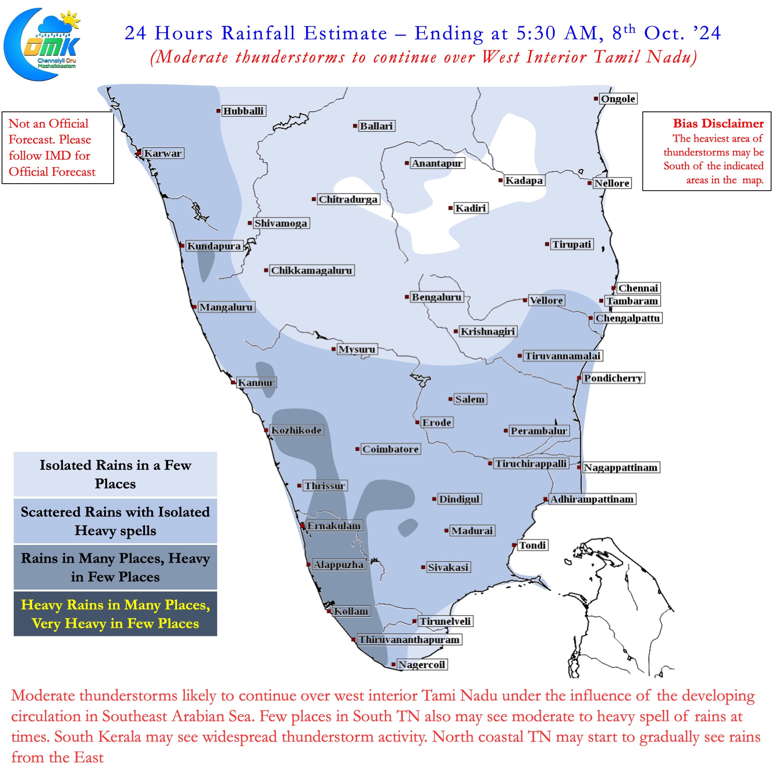
In the near time today there could be thunderstorms in many places over West Tamil Nadu. South TN may also see good rains in a few places. Kerala may see widespread rains under the influence of the cyclonic circulation. Over the next 24 to 36 hours we may start seeing butterflies in the sea to the East of Chennai heralding the first proper monsoon rains.

