“totter” : to walk with difficulty in a way that looks as if you are about to fall
Cambridge Dictionary
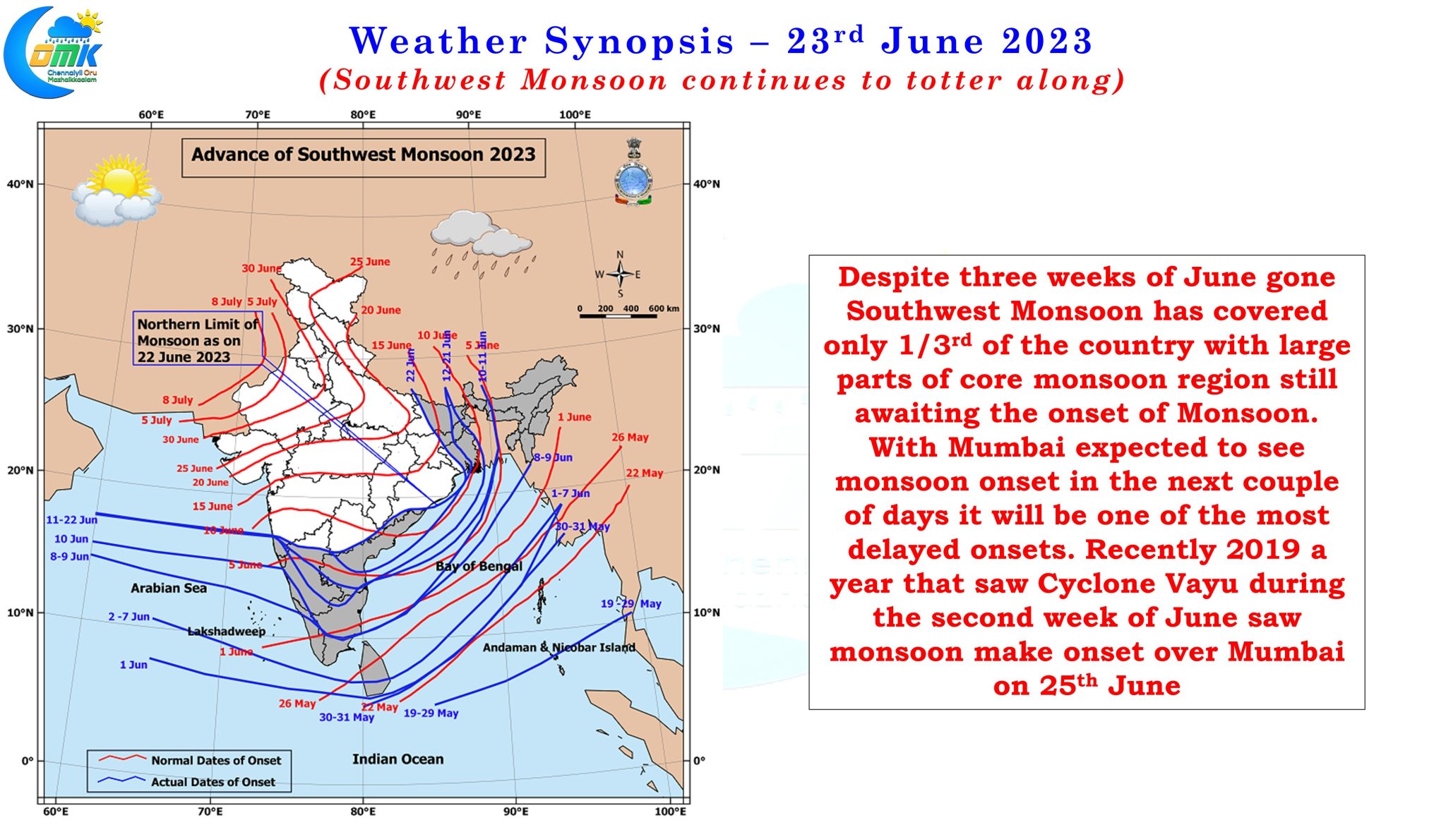
With three weeks of June gone it is not often one gets to see a Southwest Monsoon onset chart from IMD not covering the megapolis of Mumbai. In a way one can see a lot of similarities between 2019 and 2023. Chennai saw its hottest phase of that year’s summer during the 2nd and 3 week of June with Chennai AP recording 43°C on 9th June 2019. Just as Cyclone Biparjoy played spoilsport to monsoon dynamics we had Cyclone Vayu play spoilsport in an almost similar track like Biparjoy making a weak landfall over Gujarat coast. Just like 2019, which saw Southwest Monsoon check into Mumbai on 25th June, 2023 is likely to see a very delayed onset over Mumbai a potential delay of nearly 15 days compared to the traditional onset date of 10th / 11th June.
The erratic monsoon dynamics is visible in the overall seasonal precipitation accumulation for the year so far. -31% deficit for the country with Central India, where every sub division is in deficit, leading the table with -60% deficit while South Peninsular India is not far away with -55% deficit. Nothing else shows the state of monsoon dynamics more than the current seasonal tally of Coastal Karnataka along with Konkan and Goa, two traditional high rainfall monsoon zones. Konkan and Goa is at a deficit of -85% while Coastal Karnataka is staring a deficit of -74%. Interestingly Tamil Nadu and Pondicherry is above average with a positive 13% performance so far, ironically the three districts that are heavily dependent on Southwest Monsoon, Kanyakumari, Nilgiris and Coimbatore are all in deficit though.
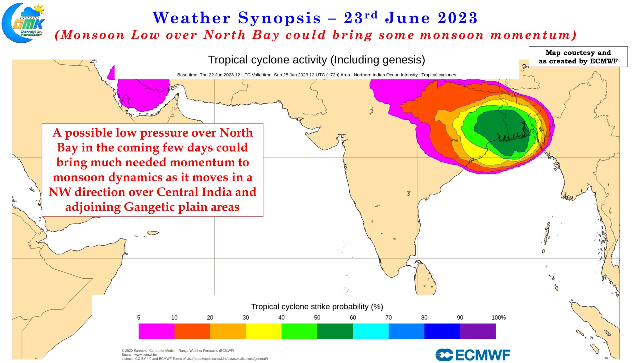
There appears light at the end of the tunnel though in the form of a possible Monsoon Low over North Bay. Often we have seen a well placed Monsoon Low over Bay of Bengal can create magic to the monsoon dynamics. Ensembles are fairly consistent about the current upper air cyclonic circulation off the coast of North AP / Odisha becoming a Low pressure by early next week strengthening the monsoon winds over Peninsular India along with it. This is likely to bring about the first active phase of Southwest Monsoon 2023 over the last week of June and first week of July as the Monsoon Low moves in a NW direction over parts of central India and adjoining areas of Gangetic Plains.
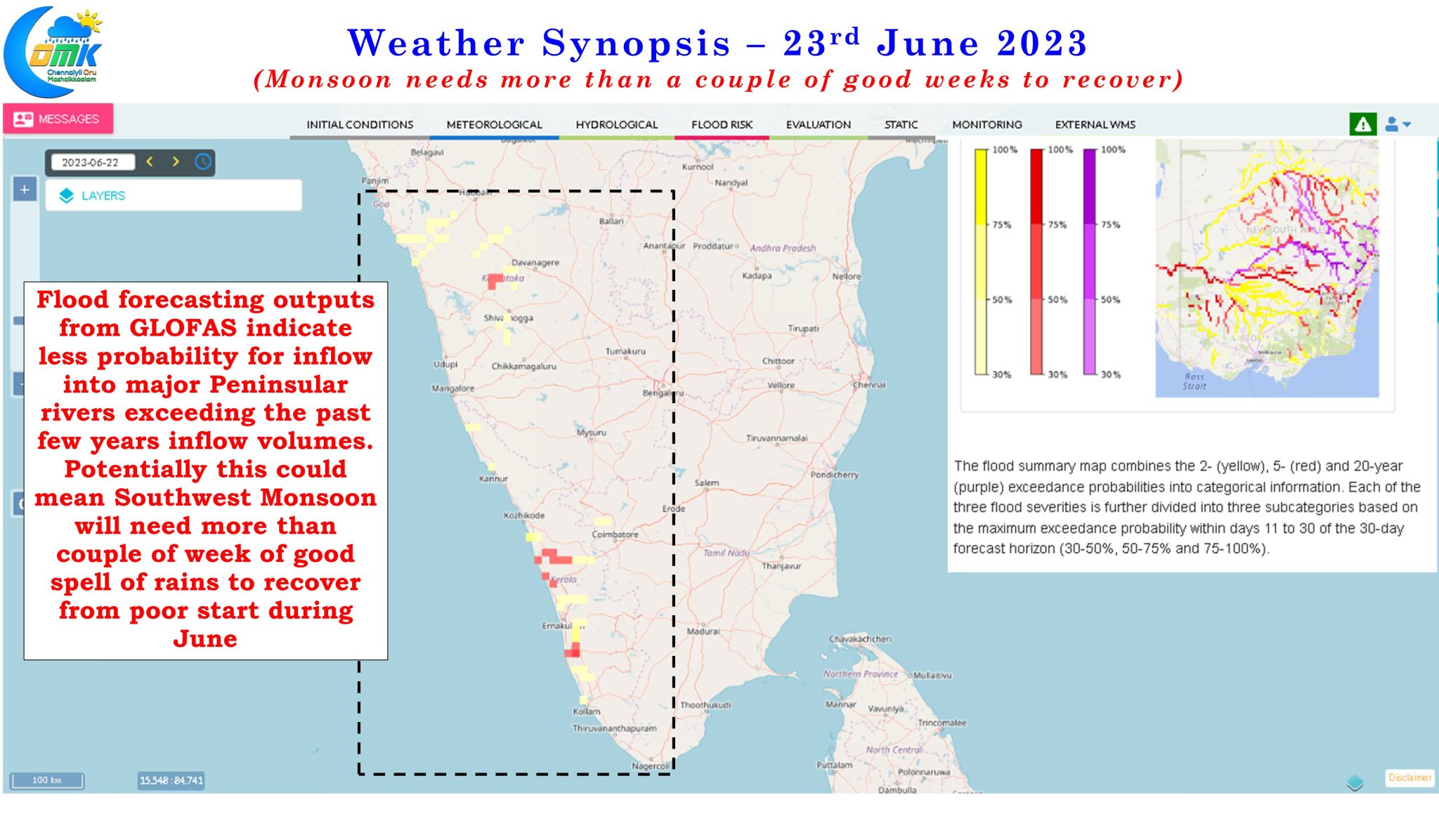
The question though is whether will a good couple of weeks be enough for Monsoon to get back on track. We have seen often Southwest Monsoon recovering from poor start during June on the back of good performance over the months of July and August. July and August are the peak monsoon months and poor performance during these months on most occasions lead to a poor year overall. Off late though for the past few years the late blooming of Monsoon during the month of September has become a safety net for subdued performance during July and August.


The key point is in the current year’s context it will require more than a couple of good weeks for Monsoon to get back on track. It becomes relevant to mention here 2019 Southwest Monsoon despite a very weak start, June saw a deficit of -32% nationally with every sub division in negative, ended the June – September Monsoon season with a 10% positive anomaly driven by the 16% excess in August and a massive 52% excess in September that continued well into the post Monsoon season with October also seeing a 45% excess overall for the country.
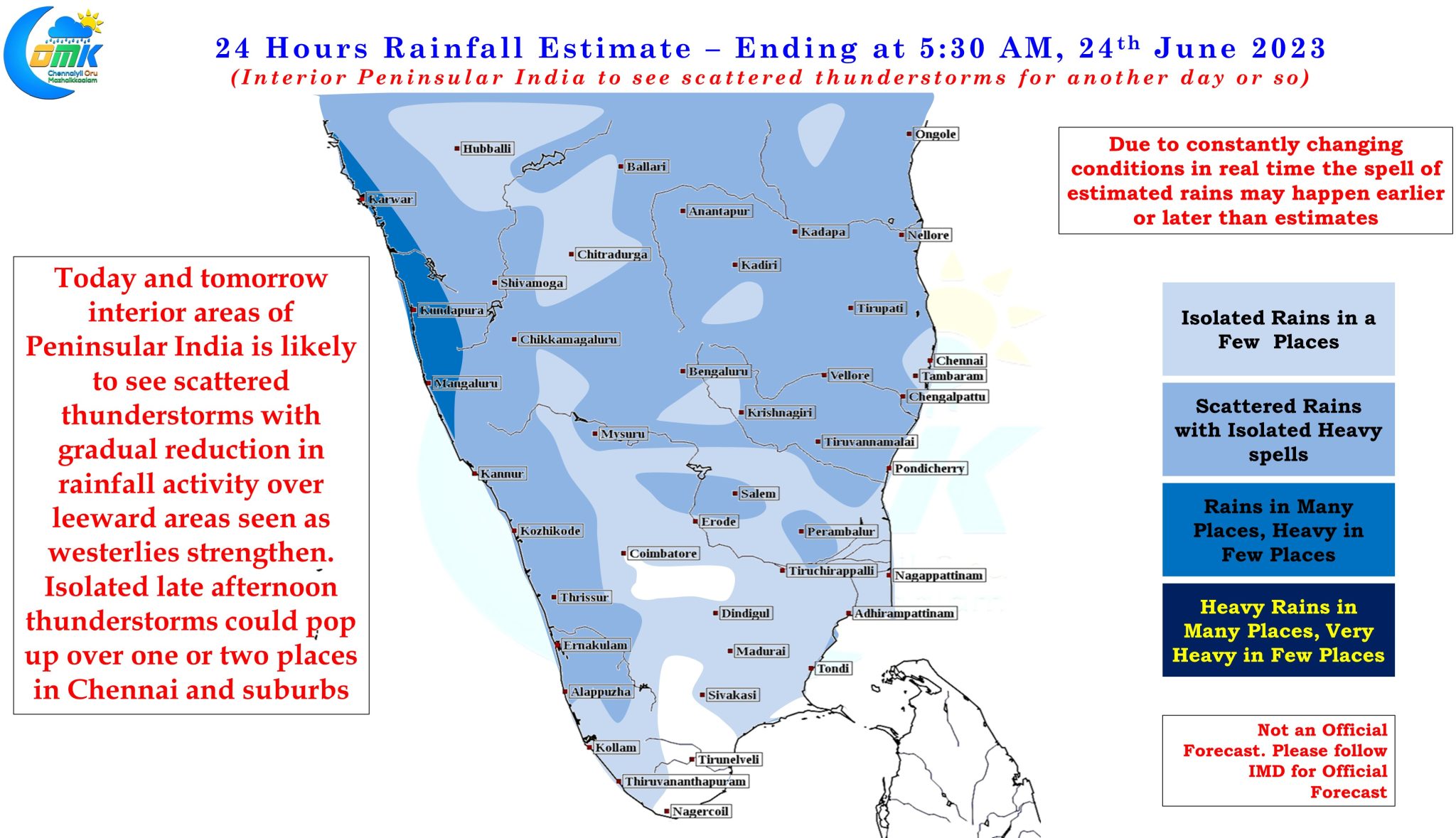
Closer home on the rainfall front for Tamil Nadu, thunderstorms will continue over the next couple of days before strengthening Westerlies will reduce the probability of Veppasalanam Rains. Chennai and suburbs may see isolated convective thunderstorms today and tomorrow though they are expected to be isolated and could last for about 30 minutes or so as large scale thunderstorm activity over leeward areas of Peninsular India looks unlikely from now on until possibly the next Break in Monsoon period.

