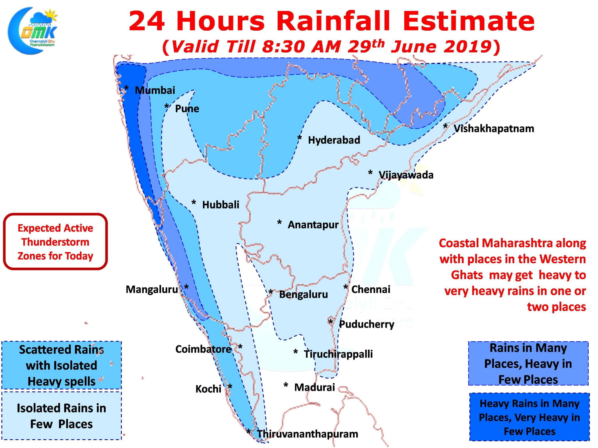
Southwest Monsoon, already running at a delayed pace, went into a pseudo break mode for the past few days as things slowed down completely on the Monsoon dynamics. This though gave a window of thunderstorms for Tamil Nadu including Chennai giving a few days of thunderstorms that came as a much needed relief to the citizens of TN’s capital City reeling under water scarcity.

Wind charts will clearly give an explanation to how things have been dynamically altered by the developing Low Pressure in Bay of Bengal. The westerly winds that had slowed down for the past few days are expected to pick up once again improving Monsoon prospects. As we explain often the thunderstorm opportunities for Chennai & most parts of Tamil Nadu opens up only when the westerly winds slowed down allowing for thunderstorms to develop rather than get sheared off by the strong Westerlies.

While Peninsular India may see a relatively weaker rainfall pattern for the next couple of days, Konkan coast & the Western Ghats of Maharashtra is likely to see the first active spell of Southwest Monsoon 2019 as Bay circulation creates the right moisture drag for these places to get a spell or two of heavy rains. With westerly winds streamlining and increasing in strength the thunderstorm possibilities slow down for places like Chennai though a spell or two of isolated light rains can not be ruled out for places in Chennai.


