One of the most anticipated weather events across the globe is the onset of Southwest Monsoon over the Indian Sub Continent. Not only it is closely watched by the farming community even a lot of businesses that hinge on a successful agricultural season look forward to a timely & strong onset of Southwest Monsoon.
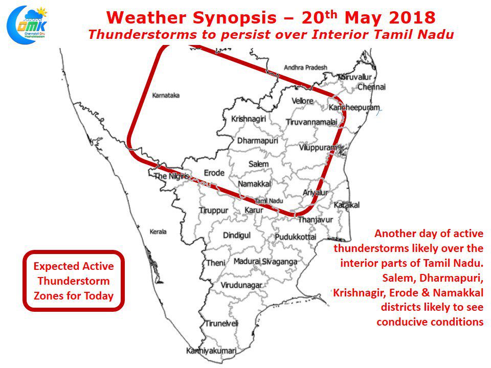
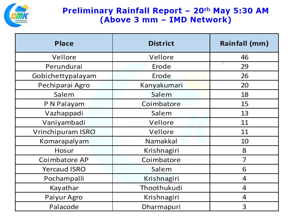
As mentioned in our post the first touchdown over Indian Sub Continent is Andaman Islands and we are now technically at the onset window. The most active phase of thunderstorms over the interiors are just as the monsoon dynamics get set for an onset. Some of the most intense thunderstorms are seen just before the onset of Southwest Monsoon & just as it starts retreating as well. Yesterday saw parts of Vellore, Salem, Dharmapuri, Erode & Krishnagiri districts come under intense evening thunderstorms along with adjoining parts of Rayalaseema & South Interior Karnataka.
The day after an active high intensity thunderstorm days is always tricky to estimate. Looking at the wind charts it appears once again today the hotspots for thunderstorms are likely to be the same areas of Interior Tamil Nadu with possibly some places in Tiruvannamalai, Villupuram, Ariyalur, Karur & Perambalur likely to see moderate thunderstorms in a few places. As we mentioned in the opening remarks of today’s post the Monsoon dynamics are slowly churning towards the onset phase.
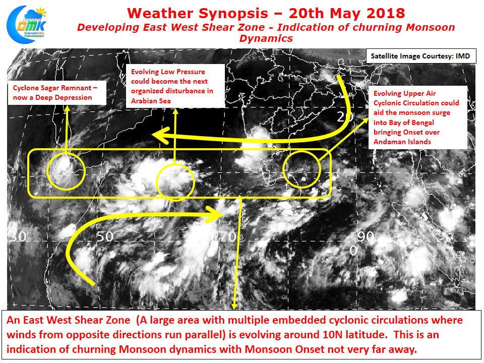
One indicator which possibly precedes the onset phase is the development of an East West Shear Zone with multiple embedded circulations. Looking at the wind charts & satellite images there is a clear inference on this development indicating the onset of Southwest Monsoon is not far away. At the far west is the remnant circulation of Cyclone Sagar, over the Central Arabian Sea we are seeing the evolving Low Pressure which some models expect to go on to become a cyclone and finally at the eastern end of the Shear Zone we are seeing an evolving Upper Air Cyclonic Circulation that could go onto become a possible Low Pressure Area triggering the bay onset.


