The last couple of years have seen a lot of progress in Ai/ML weather models which place a lot of emphasis on past events. Based on how events happened under similar conditions these Ai/ML models create forecasts with best probable scenarios. Numerical weather models which are based on differential equations place a lot of emphasis on the laws of physics. Based on how various atmospheric parameters are expected to behave the overall forecast is generated. In a way Ai/ML models work like how keen weather enthusiasts interpret events. The added advantage though is Ai/ML models may not have the personal bias bloggers are prone too. As these Ai/ML models continue to learn they will gradually start outperforming numerical weather models.
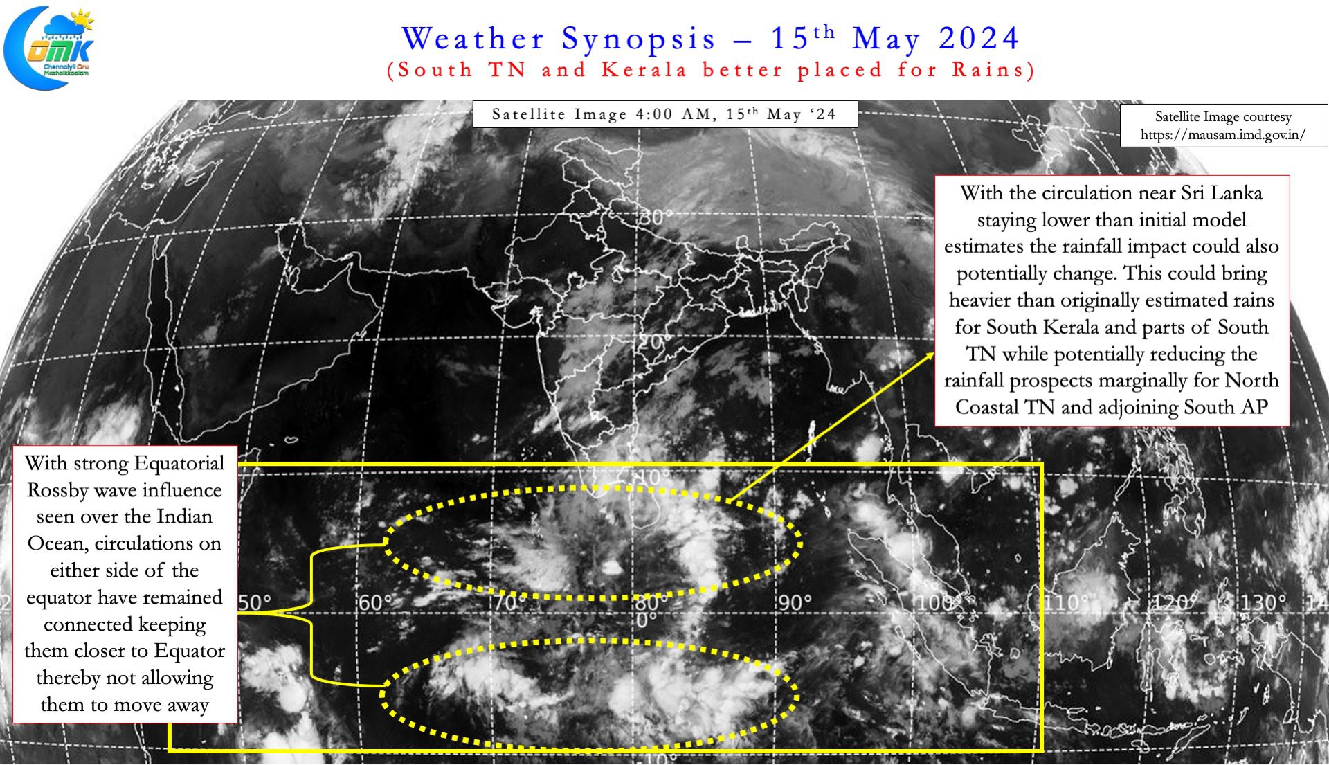
In tropical environment like the Indian subcontinent it is essential to keep a real time reference to model outputs. Over the past 36 hours real time satellite images indicate the cyclonic circulation is closer to Equator than model forecasts. In a way the strong influence of the Equatorial Rossby wave is the reason for this behaviour. Not only are we seeing a pair of circulations around Sri Lanka but also south of Equator as well. This is a typical signature of Equatorial Rossby wave. With these circulations staying connected to each other they have stuck closer to Equator. This in turn had led to convection staying slightly to the South of model estimates in the short term.


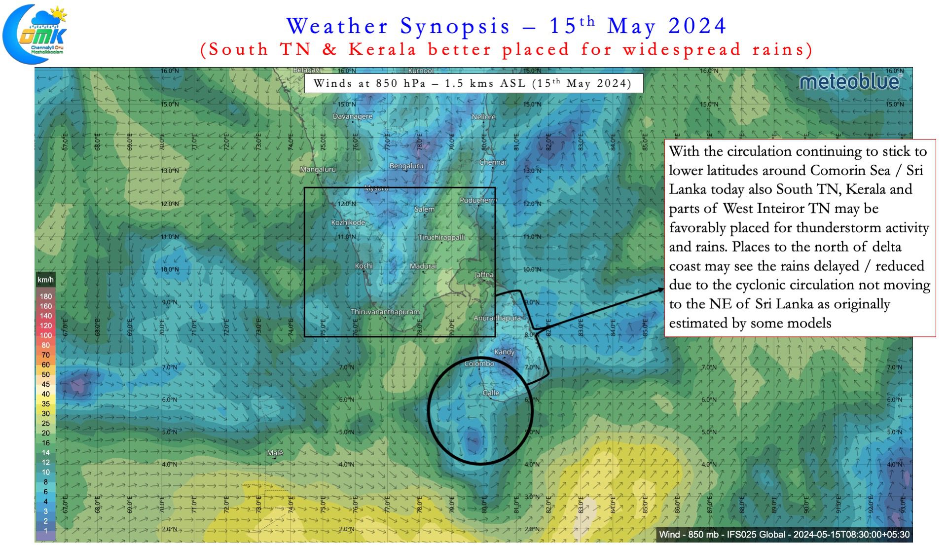
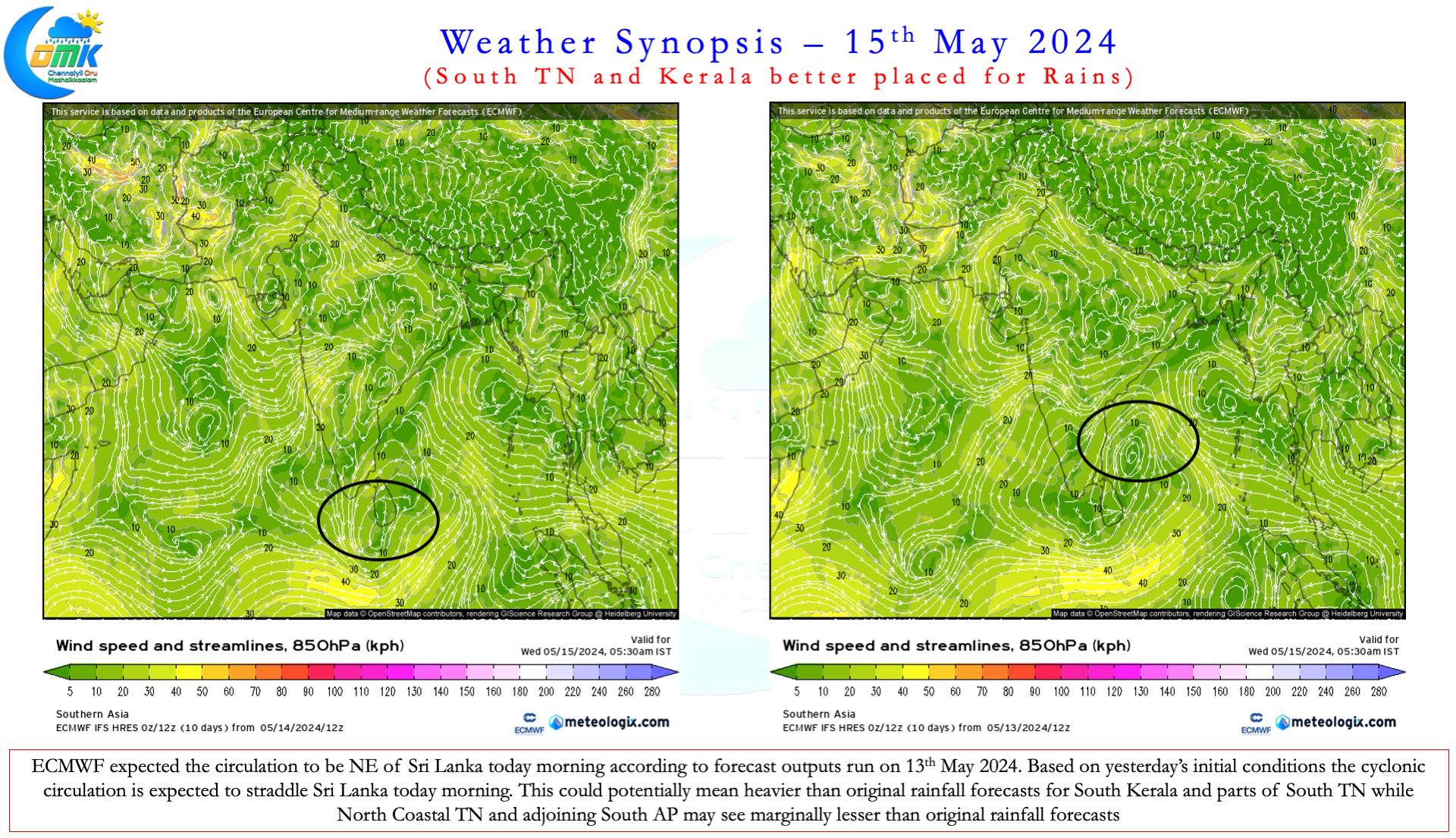
Based on 13th May initial conditions ECMWF expected the cyclonic circulation to be ENE of Sri Lanka on 15th morning. Based on yesterday’s initial conditions ECMWF expects the circulations to stay in the vicinity of Comorin Sea / Sri Lanka. It is essential to keep a track of these changes in model inferences along with real time observation of conditions. If the circulation had moved to NE of Sri Lanka North Coastal TN may have seen increased rainfall activity today. But with circulation staying around Comorin Sea parts of South TN and Kerala may see increased rains.
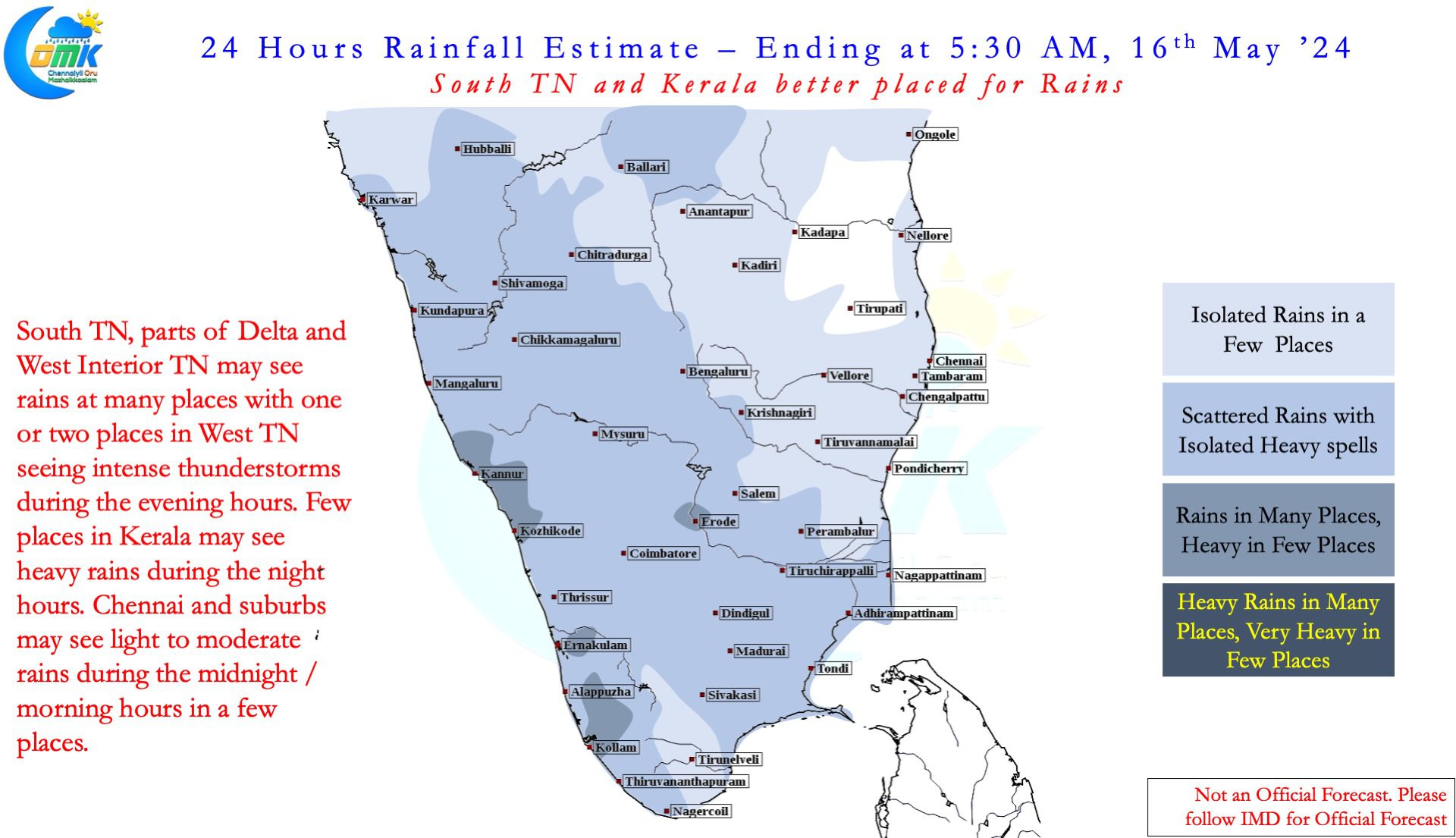
As the past couple of days indicate, things change dynamically as various factors interplay. It is very important during transition seasons not to look at forecasts beyond a day or two. Weather models continue to indicate the broad area of disturbance to persist over the next 36 to 48 hours. There is some back and forth forecasts on whether the disturbance would consolidate over Arabian sea or Bay of Bengal. Nevertheless as things stand South TN and Kerala may see widespread rains continue for the next few days. A few places in these areas may see heavy to very heavy rains between Friday and Sunday. Similarly West Interior TN is also in line to see thunderstorm activity continue over the next few days.
The change in how circulations have behaved has brought about a delay in rains for North Coastal TN. It is essential to be noted the rains may not be denied completely. But please keep in mind there is a high possibility the quantum of rains may be lesser than originally expected by weather models.

