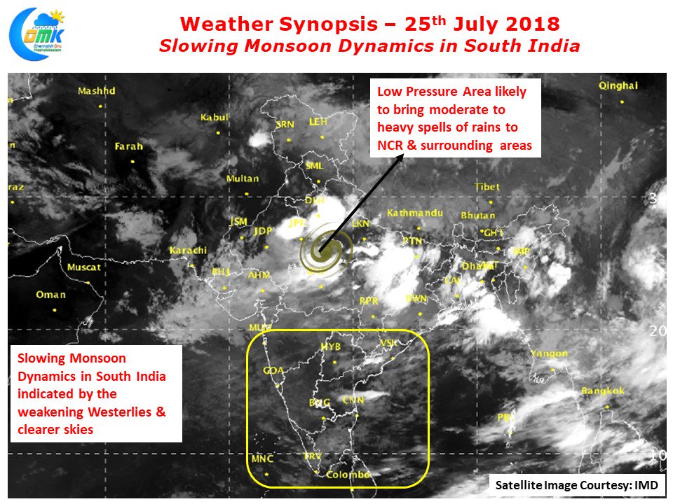
Southwest Monsoon continues to remain active and vigorous over parts of Central & North India under the influence of Low Pressure Area currently persisting over parts of Northwest Madhya Pradesh & South Uttar Pradesh. Down South though Monsoon has slowed down over the last couple of days with heavy rains restricted to isolated pockets in some of the Ghat areas alone.
Coastal areas have started seeing only light rains indicative of the slowing down dynamics. Not only has the rains slowed down along the West Coast the slowing Monsoon dynamics have brought clearer skies to the other side of the coast with temperatures notching up by a degree or two above normal on account of this.
Yesterday saw Tiruttani record 39.5°C while Nagappattinam, Puducherry, Madurai saw max temperatures cross 38°C. Both Chennai observatories saw temperatures in excess of 37°C which was 2 degrees above normal for this time of the year. With the weakening of Monsoon in Peninsular India the westerlies also have slowed down in the region bringing forth with it wind induced and convective thunderstorms for interior areas & coastal areas of Tamil Nadu.
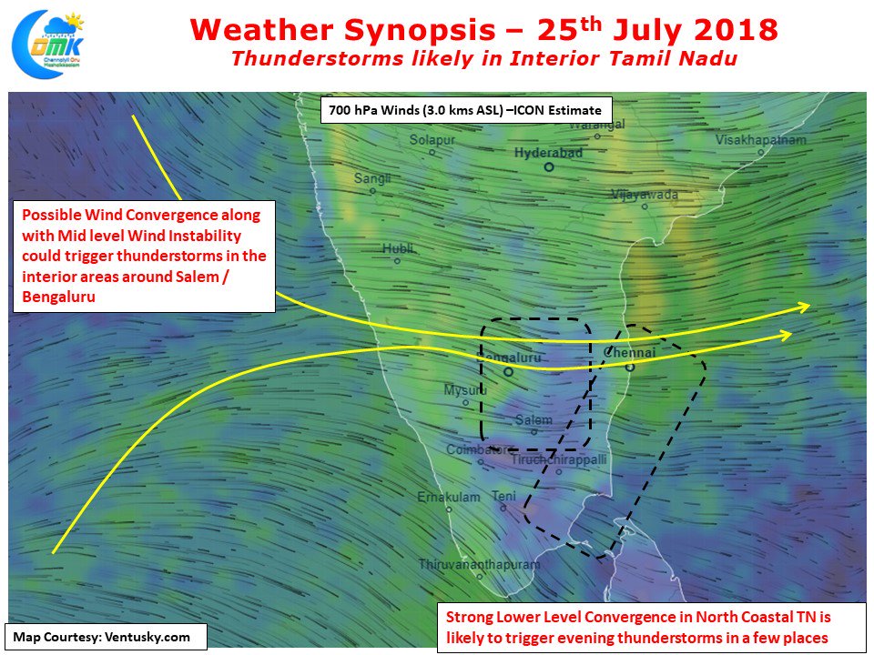
Yesterday saw Salem record 16 mm from evening thunderstorms while parts of Chennai & suburbs in the southern areas recorded sharp spell of rains. Things look good for thunderstorms over the interior parts of the state around Salem today as well under the influence of converging winds around 3 kms ASL and mid level wind instabilities. Parts of South TN around Pudukottai and North Coastal TN is likely to see low level wind convergence which could trigger some thunderstorms aided by Sea Breeze Front.


