
Ever since Kathiri started for the year 2017 heat was in the backburner for most of Tamil Nadu with thunderstorms and Veppa Salanam rains taking up the mind share among bloggers and media. For the first time possibly we will start seeing a spell of period where Heat will once again take up pole position as Agni Nakshathiram ups the ante in sync with the changing wind patterns.
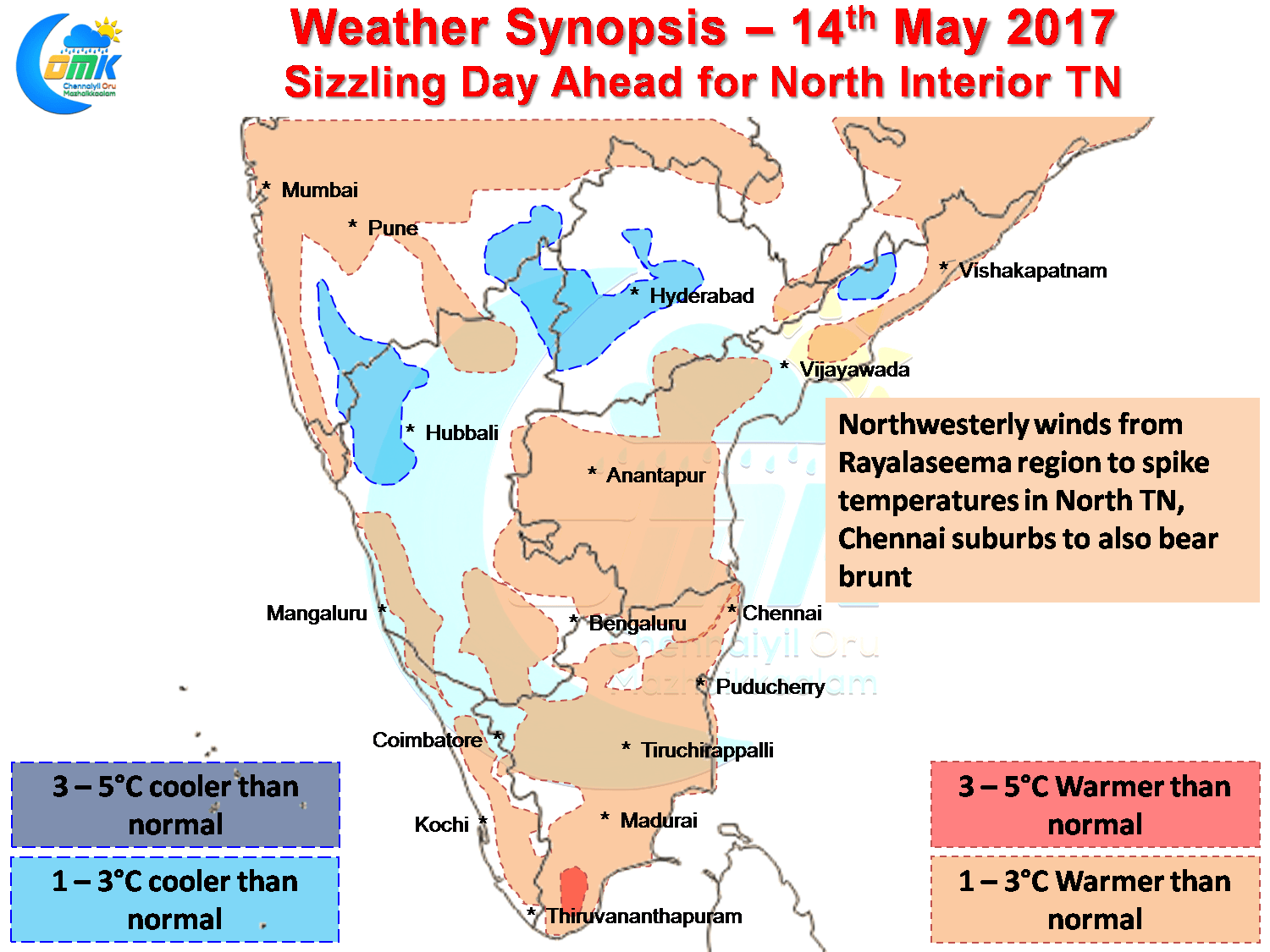
While the daily temperatures charts were showing many blues and white rows indicating the closer to normal conditions that was prevailing in large parts of the state so far. Today’s temperature anomaly chart though pretty much shows the change in pattern with large swathes of Tamil Nadu under the reds with day time maximum temperature expected to be a couple of degrees higher than normal with isolated pockets expected to see maximum temperatures almost 3 / 4 degrees above normal.
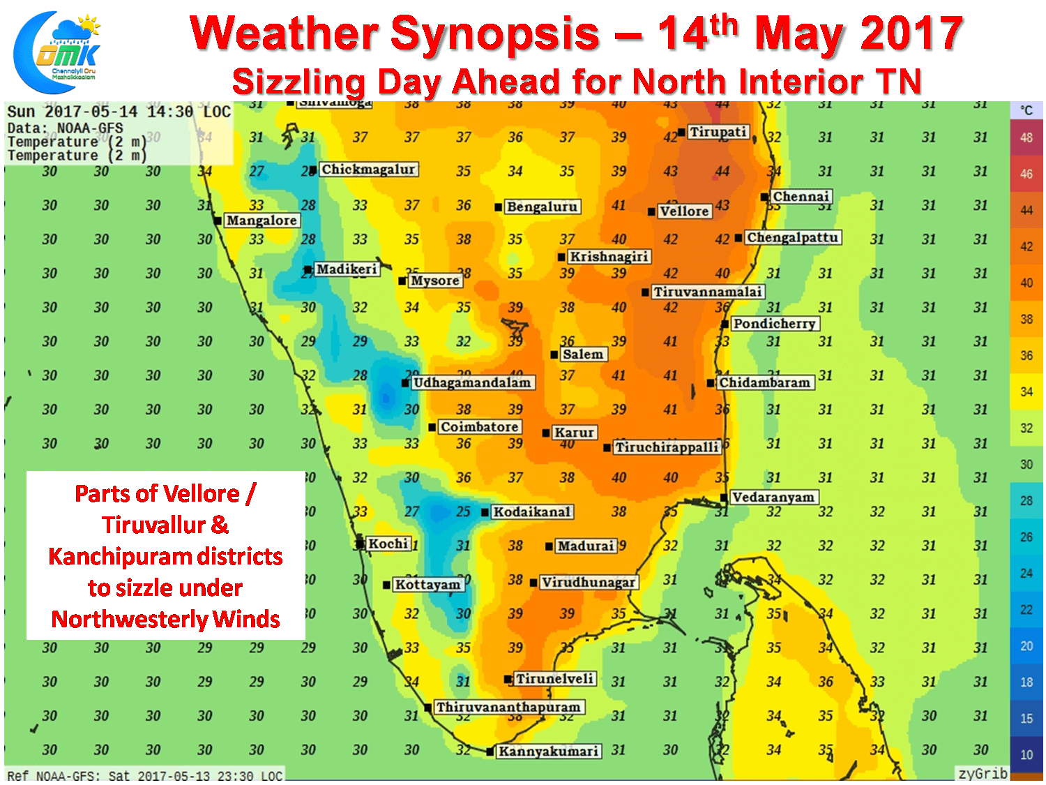
North Interior Tamil Nadu is likely to be the hottest region of the state under the influence of Westerly / Northwesterly winds from the Rayalaseema region. Numerical Models indicate we could possibly see isolated places in the districts of Vellore, Tiruvallur & Kanchipuram touch close to 42 / 43°C with the two usual suspects Vellore & Tiruttani well placed for this number.
Chennai is also likely to see the influence of this Westerly wind burst as the western and southern suburbs of Chennai is likely to see temperatures spike with a good possibility of Chennai Airport recording its first 40 in almost 4 weeks if the sea breeze does not manage to negate the Westerlies. Similarly City observatory also is well placed to record its first 100°F as well if things fall in place.
Powered by WPeMatico