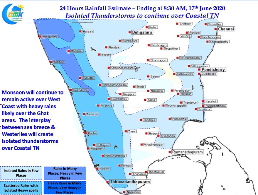
The last few days Southwest Monsoon has been covering the Indian Sub Continent making rapid progress reaching up to Western Madhya Pradesh & parts of East UP as well. On the West Monsoon has also reached parts of Gujarat as well with the Northern Limit of Monsoon passing over Kandla & Ahmedabad, Indore, Raisin, Khajuraho, Fathehpur & Bahraich. While the last Low Pressure in Central Bay gave the necessary impetus for the Monsoon to pick up pace after going through a Lull in the Post Cyclone Nisarga period another low Pressure is expected for form in a couple of days in North Bay that is likely to strengthen the Monsoon Trough.

In the meanwhile the last couple of days have also seen isolated thunderstorms develop over Coastal areas of Tamil Nadu though they have been fairly short sharp spells due to the strength of Westerlies under active monsoon conditions. One of the key components of this thunderstorm equation has always remained the intrusion of sea breeze front over the coastal areas. Particularly when the lower level winds in the form of sea breeze and upper level Westerlies interplay in a 90 degrees pattern the chance for thunderstorm increases. With current Westerlies coming in from the SW and models indicating the Sea Breeze intrusion to happen from SE once again we are likely to see the 90 degrees wind pattern or in other words the 7 pattern as many weather bloggers of Chennai would like to call it.

With Westerlies continuing to remain strong the thunderstorms will be fast paced carried across the coast by the strong Westerlies. The storms will remain isolated so it could be a case of your area not getting any rains while a couple of streets away your friend could enjoy a sudden burst of rains later in the afternoon / evening as the sea breeze intrudes across the coast of Chennai.


