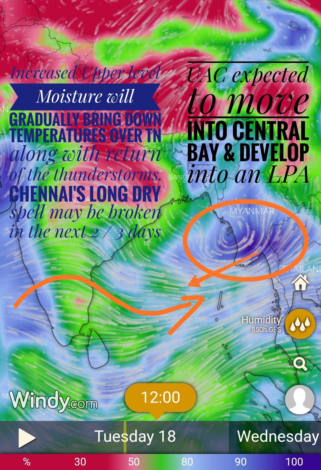
During the last couple of weeks Chennai has been seeing only hot hot weather. Nungambakkam has been recording above 40 degree Celsius since 8th June except for one day similar has been the case with Meenambakkam as well. With cyclone Vayu going through a long life cycle the moisture over Peninsular India reduced drastically playing spoilsport not only for the monsoon but increasing temperatures over North Tamilnadu as well.

Fortunately the the conditions are becoming conducive for the development of a low pressure area over the central Bay in the coming 2-3 days. This is likely to bring monsoon back on track to a great extent and simultaneously create possible opportunities for few thunderstorms over Tamilnadu.
Weather models indicate an increase in the moisture levels of the atmosphere thanks to the developing low pressure area in Bay of Bengal. This could mean partly cloudy skies keeping a check on temperatures during the afternoons and also possible thunderstorms in one or two places over South Tamilnadu today.

Things certainly look up from tomorrow as the upper air circulation descends down towards surface levels. By Thursday / Friday increased convergence of winds could favour a possible spell of thunderstorms over North Tamil Nadu bringing to an end the long drive spell Chennai and suburbs have been seeing for more than 6 months.


