
After a week or so of fairly active thunderstorm spell over Tamil Nadu, can sense a lot of disappointed weather bloggers from Chennai, the development of a Low Pressure Area over Central Bay region is likely to bring back monsoon dynamics over the West Coast. This Low Pressure Area is also likely to pull back the Monsoon Trough, currently lying closer to the foothills of Himalayas, to its normal position ending the Break in Monsoon period. Long term it remains to be seen if Monsoon withdrawal will start from extreme Northwest India as per the revised withdrawal schedule of 15th Sept.
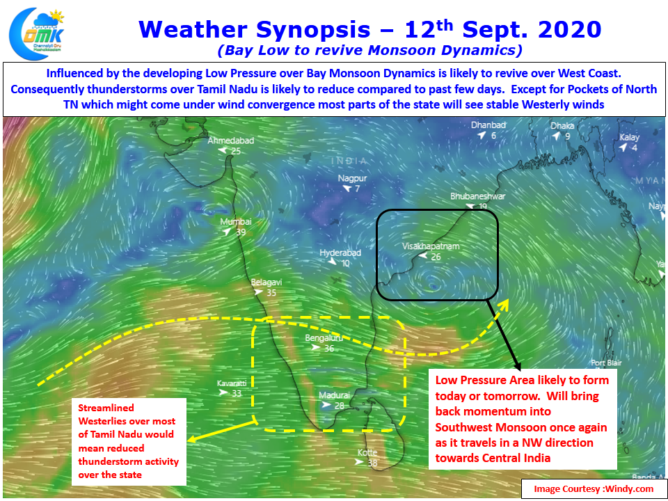
The developing low also has created more streamlined Westerlies across Peninsular India to the South of 15 N latitude. This streamlined westerlies pretty much eliminates the possibility of Unstable atmospheric conditions to trigger thunderstorm activity. Also the presence of Low Pressure in Bay would mean reduced sea breeze strength over the coastal areas removing one another key component of the Thunderstorm equation over the leeward areas of Tamil Nadu.
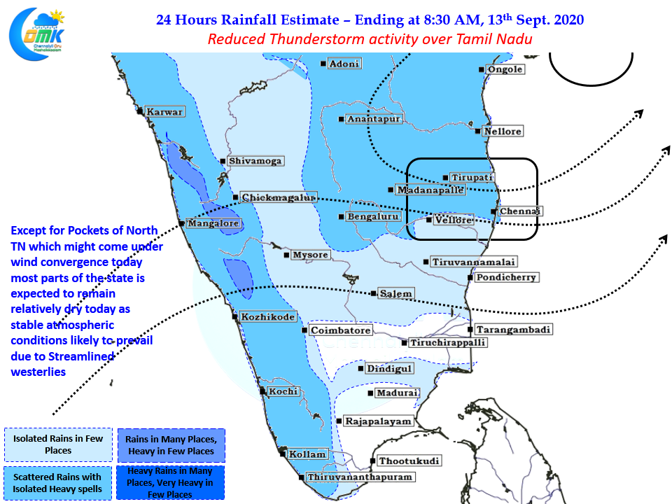
Over the next few days until the expected Bay Low completes its cycle it will be relatively quiet on the thunderstorm front over Tamil Nadu. Though there is one possibility for some pockets of North TN to catch up a spell or two of rains today from the Mid Level Wind Convergence happening over South AP & adjoining areas of North TN. It remains to be seen how much Chennai could benefit if these storms form in the interiors areas to the West of Chennai.