
After a blistering start Northeast Monsoon took it slightly easy for the last couple of days as temporary Westerlies took centre stage under the influence of the North Moving disturbance in Bay of Bengal. The next disturbance now churning over the Equatorial Waters is all set to bring back Easterlies over Tamil Nadu and along with the associated Rains too.
Over the Arabian Sea Cyclone Kyarr has intensified into a Severe cyclone as it starts to slowly make a Westward movement. Currently lying to the West of Ratnagiri it will still continue to give heavy rains along the coast until today evening before slowly the rains will ease. As of now there’s a firm consensus on Cyclone Kyarr intensifying and heading in a Westward direction over the immediate future. But there is a slight divergence in terms of intensity sustaining among models due to which some models continue to show a possible scenario of Cyclone Kyarr getting pushed towards Pakistan coast as a weak disturbance.
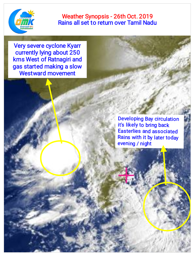
Down South the circulation in Bay of Bengal off Sri Lanka has been developing talking a slow NW drift. Over the course of next day or two there’s a fair chance of this circulation descending to surface level as a possible LPA. While models indicate the circulation to move across Sri Lanka into Arabian Sea it may be prudent to wait for a day or so as things will continue to evolve until the LPA forms.
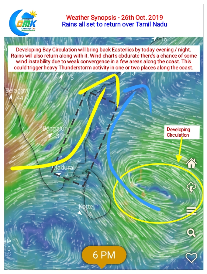
In the meanwhile from today evening we will see the return of Easterlies over Tamil Nadu. This would also mean the rains will slowly show up as well. The wind charts indicate few areas in the coastal areas could see a convergence of Westerlies and Easterlies. This could trigger heavy Thunderstorm activity in one or two areas along the coast.